

This journey was our return to Alaska. On our first visit, we explored the Panhandle, followed the historic Klondike trails and sailed up Endicott Arm to Dawes Glacier. We wrote about it in earlier blogs.
This time, our goal was to connect the destinations along the rugged, beautiful North Pacific coastline, combining the sheltered Inside Passage with the open waters of the Gulf of Alaska, then continuing by train and on foot.
Like our first visit, this trip took place in July. We traveled with an organized tour as far as Seward, then continued on our own, taking the train to Anchorage and exploring the city and its surroundings at our own pace. That final chapter is coming in our next blog.
Our route at a glance:
- Sitka: Tlingit heritage, Russian America and the 1867 transfer
- Icy Strait: gondolas, old-growth forest trails and whale watching
- Hubbard Glacier: North America’s largest tidewater glacier
- Seward to Anchorage: a scenic train ride past the Kenai and Chugach Mountains.

Sitka: Where Alaska’s Layered History Comes to Life
Sitka, Alaska, is the largest city in the United States by land area, covering 2,870 square miles of mountains, fjords and forests. That’s larger than Delaware and Rhode Island combined, yet only about 8,500 people call it home.
From the Bering Expedition to Russian America
In 1725, Peter the Great commissioned Vitus Bering, a Danish explorer serving in the Russian Navy, to find a passage to North America. Bering’s second attempt, the Great Northern Expedition, reached Alaska in 1741. Of the two ships that sailed from Kamchatka that May, one made landfall near Sitka that summer.
During the Russian period, Sitka, then known as Novo-Arkhangelsk, was the main administrative, commercial and cultural hub of Russian America until 1867.


Prince Dmitry P. Maksutov, an Imperial Russian Navy rear-admiral was the final Governor of Russian America (Alaska) from 1864 to 1867.

Between 1808 and 1867, it was also the seat of power for the Russian-American Company, a state-chartered fur-trading monopoly that governed the territory on behalf of the Russian Empire.
Under Alexander Baranov, the first governor of Russian America, and thanks to the abundance of sea otters around its protected deep-water harbor, the town grew into a global trade hub. It was here in Sitka, on October 18, 1867, that Alaska was transferred to the United States. Sitka remained the capital until 1912, when the territorial government moved to Juneau.

Of course, this story began long before Russian ships arrived. Sitka’s Tlingit name is Sheet’ká, and the town invites visitors to explore its whole timeline, from the first Tlingit settlements some 5,000 years ago to the present day.
Where to Begin: Harrigan Centennial Hall
Any exploration of Sitka naturally starts at Harrigan Centennial Hall. Here you’ll find maps, information resources and personalized advice on making the most of your time.

For us, the hall’s special attraction was the Sitka History Museum inside, the natural starting point for understanding this place before stepping out into the historic quarter.
Sitka National Historical Park: Totem Poles and Temperate Rainforest
From the museum, we headed to a true must-see: Sitka National Historical Park. Here, Tlingit heritage and the temperate rainforest come together, with a peaceful walk among towering trees and artifacts that tell Sitka’s story.
The park is home to one of the finest collections of totem poles in the Northwest, set along a 1-mile loop trail through the forest. Carved by Tlingit and Haida artists and donated by villages in southern Southeast Alaska, these poles have been part of Sitka’s story since 1901.

Stepping onto the trail, we felt an almost mystical atmosphere in the lush rainforest. Towering Sitka spruce and western hemlock line the path, their canopies sheltering some 150 bird species. The forest is also rich habitat for brown bears, river otters, mink and black-tailed deer. The trails are open daily from 6 a.m. to 5 p.m., mid-April through September.


Don’t miss the visitor center, which houses a collection of Tlingit artifacts and shows the film “The Voices of Sitka,” connecting the town’s stories past and present.
The Russian Bishop’s House
Our next stop was the Russian Bishop’s House, a log structure and one of the oldest surviving buildings of Russian America. Just a short walk from Harrigan Centennial Hall, it was once the home and office of the first Orthodox bishop to serve in Alaska. Today it is a National Park Service museum.

A free, self-guided exhibit area features tactile floor plans, stories of interaction between the local Tlingit and the Russians, and artifact displays.

The second floor, which we explored on a very informative free guided tour, houses living quarters restored to the 1853 period, formal reception rooms and the Annunciation Chapel with its imported Russian icons. Space is limited and demand is high, so it’s best to reserve ahead or check in early.

Walking through these rooms felt like stepping into a mid-19th-century home, with furniture imported from St. Petersburg, Russia, setting a refined, quietly elegant atmosphere.

St. Michael’s Cathedral
Closely connected in substance and again just a short walk away, St. Michael’s Cathedral was our next highlight. It was the first Orthodox cathedral in the Americas. The current building is an exact replica of the original, which was built in the 19th century and destroyed by fire in 1966. Today it has an active congregation and a collection of artifacts and icons, some believed to date back to the 17th century.

Inside are the original golden Royal Doors rescued from the fire, the Cathedra, and revered wonder-working icons such as the Sitka Madonna (Our Lady of Sitka), to which healing is attributed, and Christ the Judge.


Icy Strait: Gondolas, Old-Growth Forest and Whales
Icy Strait shifted our focus from history to the wonders of nature, on land and at sea. Set on a forested headland of Chichagof Island near Hoonah, a Huna Tlingit community, Icy Strait Point is owned by the Alaska Native Huna Totem Corporation. The surrounding landscape is full of pristine, wild beauty, and the best place to take it in is the summit of Hoonah Mountain.

Riding the Gondolas
To get there, take the Sky Peak Gondola (Red), which climbs more than 1,500 feet from its base, with panoramic vistas the whole way up.
At the top, you can linger over the view, set off on a walking trail, or ride the zipline back down. Riders go in groups of six, which is why it’s known as one of the largest.

A second system, the free Transporter Gondola (Green), links the ground-level Adventure Center with Wilderness Landing. The distance is only about 0.5 miles, and you may prefer to hike it, as we did, to enjoy a wonderful trail among old-growth trees.


Whale Watching in Icy Strait
In our experience, one of the best things to do in Icy Strait is take a boat out to watch humpback whales and orcas. The excursion lasts about 2.5 hours, and they are very well-spent hours!


Humpback whales travel to Icy Strait from warmer winter breeding grounds far to the south, such as Hawaii, Mexico and the Pacific coast, to feed through the summer.

We had plenty of chances to watch humpbacks, including pairs swimming in sync.
Seeing orcas breaching and hunting together in groups was priceless, and our videos captured some of these moments.
Hubbard Glacier: The Silence and Scale of Ice
From lively wildlife to the silence and immensity of ice, Hubbard Glacier was our next highlight. It added to our earlier visits to Dawes and Mendenhall glaciers and to the reflections on glaciers we shared in an earlier blogs.

Hubbard Glacier is North America’s largest tidewater glacier, approximately 76 miles long and over 6 miles wide at its face. Its visible ice face towers 300 to 400 feet above the waterline, comparable to a 30- to 40-story building, with hundreds more feet below the surface.

Sailing through Yakutat Bay and into Disenchantment Bay, a ship may bring you within half a mile of the glacier’s face, depending on the weather.

Nicknamed the “Galloping Glacier,” Hubbard is advancing rather than retreating, moving forward at roughly 80 feet per year.
The Coastal Classic Train: Seward to Anchorage by Rail
In Seward, we left the organized part of our trip behind and boarded the train to Anchorage, one of the most scenic routes.
The Coastal Classic, operated by the Alaska Railroad, proved a fantastic way to gather the best views of the Alaskan wilderness into one stunning memory album, all within a 4.5-hour ride. Large windows and glass ceiling domes give unobstructed views of mountains and glaciers on both sides of the tracks, while an onboard guide adds live narration along the way.

Glaciers Along the Railway
Near Moose Pass, behind the Kenai Mountains, Trail Glacier rises above the lake of the same name. Across the Placer River Valley, the dramatic Bartlett Glacier comes into view, and Spencer Glacier towers above Spencer Lake.

Throughout the journey, smaller alpine and hanging glaciers and cascading snowfields make the vistas all the more stunning.
Into the Roadless Wilderness
Much of the route passes through wilderness that can’t be reached by car. Waterfalls, lakes, creeks and more mountains, with steep canyons and high passes, glide past your window. With a little luck, you may spot a moose or a bear, and you’ll almost certainly see bald eagles.


Turnagain Arm and the Chugach Range
After Girdwood, the final stretch follows Turnagain Arm, with the steep mountains of the Chugach Range rising beside the tracks.


This journey through the wilderness made it almost hard to step off the train. But one more unforgettable Alaskan stop awaited us: Anchorage. We’ll share that story in our next blog. Until then, let curiosity be our guide!
Frequently Asked Questions
When did we travel?
Both of our Alaska trips took place in July, when humpback whales come to Icy Strait to feed.
Can you combine a tour with independent travel?
Yes. We joined organized travel as far as Seward, then continued on our own by train to Anchorage.
How long is the Coastal Classic train ride from Seward to Anchorage?
About 4.5 hours, with large windows, glass ceiling domes and live narration.
How close can ships get to Hubbard Glacier?
Depending on the weather, within about half a mile of its ice face.
What can you see in Sitka?
Highlights include the Sitka History Museum, Sitka National Historical Park with its totem poles and rainforest trail, the Russian Bishop’s House and St. Michael’s Cathedral.

After the hushed stone courtyards of Yogyakarta, arriving in Jakarta feels like stepping out of a whispered story and into a shout. This sprawling megacity anchors Greater Jakarta, one of the largest urban regions on the planet and home to more than 40 million people – and yet, inside all that bustle, we found some of the richest heritage travel and nature travel experiences of our entire journey through Java.
Jakarta wears its contrasts openly: traffic-choked avenues next to vast public squares, colonial stone facades wrapped in pockets of tropical green.


So where do you even begin in one of the world’s most populous megacities, especially with limited time? For us, the answer was always the same: start with history.
Kota Tua Jakarta: Stepping into Batavia’s Colonial Past
With Jakarta’s 500th anniversary on the horizon, the city practically hands you your starting point: Kota Tua Jakarta, or Old Batavia. This historic downtown pocket, spanning parts of North and West Jakarta, won’t take you as deep into the past as Borobudur or Prambanan – but it opens a very different chapter of history: Dutch colonial rule, from the 16th century all the way through to Indonesian independence in 1945.
Our first stop was the Jakarta History Museum (Museum Sejarah Jakarta), also known as the Fatahillah Museum or Batavia Museum. Opened in 1974 inside the former Stadhuis – Batavia’s city hall, built in 1710 – it traces the region’s story from before the founding of Jayakarta in 1527 through to independence.


Just across the square, don’t skip Wayang Puppetry Museum, one of Jakarta’s most fascinating cultural heritage stops. Wayang puppetry has never been mere entertainment in Indonesia: for more than a thousand years, it’s served as a spiritual, political, and moral compass, shaping how communities understand the world, teach values, preserve local history, and even mediate conflict. If you’re chasing living heritage rather than static exhibits, this small museum delivers it in spades.


For a break, slide into Cafe Batavia, tucked inside a 19th-century colonial landmark overlooking the square. Vintage furniture, Javanese wood accents, historic photographs on every wall, and a second-floor window seat looking out over Old Town – it’s the kind of slow-travel pause every heritage trip needs.

Then just walk. Let the square’s wide-open space, and the wind, carry you back a few centuries.

Merdeka Square and the National Monument (Monas)
Following the trail of history forward, we landed in the beating heart of modern Jakarta: Merdeka Square (Independence Square), a nearly 80-hectare public space anchored by the National Monument, or Monas.

It’s genuinely hard not to stop in your tracks here. The 433-foot (132-meter) obelisk, capped with a bronze frame and gold-leaf flame symbolizing the spirit of independence, dominates the skyline. Head down into the basement to see the original proclamation of independence, then ride the elevator up to the observation deck for a 360-degree view over the megacity.
Istiqlal Mosque and Jakarta Cathedral: A Living Symbol of Unity
Right next to Merdeka Square stands Istiqlal Mosque – the largest mosque in Southeast Asia and the ninth-largest mosque in the world by worshipper capacity.

Opened to the public in 1978 to commemorate Indonesian independence, “Istiqlal” is Arabic for “independence.” Its rectangular main prayer hall is refreshingly minimalist, ringed by twelve round, marble-clad columns, and topped by a 45-meter spherical dome representing 1945, the year of independence.


Across the street stands Jakarta Cathedral, linked to the mosque by a pedestrian “Tunnel of Friendship” – a quiet, powerful nod to Indonesia’s national motto, Bhinneka Tunggal Ika, “Unity in Diversity.”
The cathedral itself is a striking example of European Neo-Gothic architecture, adapted for the tropics: its spires and vaults rest on flexible teak wood beams engineered to bend rather than crack during earthquakes.


Inside, three altars and fourteen murals lead up to the Jakarta Cathedral Museum, home to historic vestments, colonial-era artifacts, and sacred art. Together, the mosque, the cathedral, and the tunnel between them make one of Jakarta’s most quietly moving heritage travel stops – proof that this city’s history isn’t only in its buildings, but in how it chooses to live side by side.


National Museum of Indonesia
Before leaving the Merdeka Square area, you may want to make time for the National Museum of Indonesia, on Jalan Medan Merdeka Barat.

Its ethnographic galleries hold treasures like the bedug, a large ceremonial drum once used for timekeeping and communal signaling.

A dedicated wing of Hindu-Buddhist stone sculpture felt like a direct callback to everything we’d just marveled at in Borobudur and Prambanan.

Taman Mini Indonesia Indah: Indonesia’s Culture in One Walkable Park
No heritage travel itinerary through Jakarta feels complete without Taman Mini Indonesia Indah (TMII), a 147-hectare cultural theme park in East Jakarta’s Cipayung district.

Opened in 1975, TMII compresses over 30 of Indonesia’s provinces, traditions, and architecture into walkable pavilions and several thematic zones, including a Houses of Worship complex.

With so much ground to cover, pick your focus: each provincial pavilion delivers traditional houses, regional artifacts, small museums, and live performance spaces.

Nature lovers shouldn’t miss Museum Komodo – Jagat Satwa Nusantara, dedicated to Indonesia’s reptile life,

and kids will be ecstatic over Istana Anak-Anak Indonesia, the fairy-tale “Children’s Palace” of spires and arched windows.

Jakarta’s Climate Challenge – and a New Capital
It’s easy to forget, wandering TMII’s peaceful gardens, that the megacity behind you is fighting for its future. Jakarta faces the usual megacity headaches – overcrowding, pollution, gridlocked transit – plus two distinctly Indonesian complications: earthquake risk from its place on the Ring of Fire, and a sinking, flooding coastline.
Land subsidence and rising seas mean as much as 90% of North Jakarta could be underwater by 2050, putting low-lying fishing communities at the sharpest edge of the crisis. Proposed fixes range from tighter groundwater regulation and a colossal 700-kilometer coastal seawall to nature-based solutions like mangrove restoration – though UN experts warn the seawall may only buy time, and at real environmental cost.
It’s one of the reasons Indonesia is relocating its political capital to Nusantara, on Borneo’s east coast in East Kalimantan – targeted to take over as the political capital by 2028, with the full master plan expected to be complete by 2045.
As we said goodbye to Jakarta – still, for now, the capital – full of impressions and new knowledge, we carried it all toward our last stop on Java: Bandung.
Bandung: Feeling the Ring of Fire Up Close
North of Jakarta, Bandung is where nature travel takes center stage. Sitting inside an ancient volcanic basin, the city offers an up-close encounter with the Pacific Ring of Fire – a must for anyone drawn to real geotourism.

The Ring of Fire is a roughly 40,000-kilometer horseshoe strung with more than 450 active and dormant volcanoes, formed where tectonic plates collide over Earth’s partly molten mantle. About 90% of the world’s earthquakes strike within it, and Indonesia – Java especially – lives with that reality daily. As we write this, news is still breaking about a fresh eruption on the volcanic island of Anak Krakatau in the Sunda Strait, which grounded flights at Jakarta’s Soekarno-Hatta International Airport – an unmistakable echo of the catastrophic 1883 Krakatoa eruption nearby, whose eruption sequence stretched across roughly five months and produced the loudest sound ever recorded in human history.
Standing that close to the planet’s raw power puts Bandung’s appeal into focus: this is what makes it such a compelling stop for volcano tourism and one of Java’s best answers for anyone craving true off-the-beaten-path nature travel.

Getting there is easier than ever, too. The Whoosh high-speed rail – an acronym for Waktu Hemat, Operasi Optimal, Sistem Hebat (“time-saving, optimal operation, great system”) – connects Jakarta and Bandung, and has run since October 2023. Reaching speeds up to 350 km/h, it cuts the journey to about 45 minutes, down from 3-plus hours by road or regular rail.
Bandung itself sits inside a massive ancient volcanic caldera ringed by dramatic, easily accessible geological sites. Stand at the edge of the Kawah Ratu crater and watch active steam vents and sulfur smoke rise straight out of the Earth.

Set against that majestic backdrop, don’t skip a hike through the surrounding lush tropical forest – it’s the kind of eco-adventure that rounds out any nature travel itinerary in Java.

Saying Goodbye to Java
Closing out our journey against Bandung’s striking volcanic landscape felt like the perfect finish to a trip that surprised us at every turn – from ancient kingdoms to the world’s most populous megacity, to the raw, live pulse of the Ring of Fire. Between the heritage travel packed into Jakarta’s museums and cultural landmarks and the nature travel waiting in Bandung’s craters and forests, Java gave us both halves of what makes this kind of trip unforgettable. We left already planning our return to Southeast Asia for more.

Some places hit you with numbers before they hit you with anything else, and Java is exactly that kind of place. This is the most populous island on Earth, home to more than 150 million people – roughly 56% of Indonesia’s entire population. It’s also the political and cultural engine of the world’s largest Muslim-majority nation, Indonesia. And then there’s Jakarta: Java’s capital, and, per a landmark 2025 UN report, now officially the largest city on the planet, with close to 42 million people calling it home – a title it just took from Tokyo. Wow.
We came to Java chasing three very different experiences across three stops – Yogyakarta, Jakarta, and Bandung – with hopes to stand in front of world-famous cultural heritage sites peeling back layers of history, feel the pulse of a genuine megacity, and get a sense of what it’s like to live squarely on the Pacific Ring of Fire. Java delivered on every count, and then some. This is the story of stop one.

Yogyakarta: Java’s Spiritual and Cultural Compass
Our first stop was Yogyakarta (locals just say Yogya), the beating heart of Javanese cultural tradition. It’s almost baffling how many travelers stream into overcrowded Bali each year while only a fraction detour here, home to what’s now known as the Cosmological Axis. Yogya has another nickname too: kota sepeda, “bicycle city,” a callback to an era before it filled up with scooters.

If you’re building a heritage travel bucket list, put this on it: in 2023, UNESCO inscribed the Cosmological Axis of Yogyakarta as a World Heritage Site, recognizing an entire philosophical landscape rather than a single monument. At its center sits the Kraton, or Royal Palace Complex, anchoring a six-kilometer line of sacred sites and historic landmarks that runs from Mount Merapi in the north to the Indian Ocean in the south.

So what exactly is this Cosmological Axis? In 1755, Sultan Mangkubumi – later Sultan Hamengku Buwono I – laid out the city according to Javanese cosmological principles, positioning his new capital as a microcosm of the universe, blending Hindu-Buddhist ideas about the physical, metaphysical, and spiritual realms.

More than 250 years later, the region remains governed both politically and spiritually by the reigning Sultan, and the palace complex still embodies that same syncretic layering of animist, Hindu, Buddhist, and Islamic belief that put Yogya at the center of the cosmos in the first place.

Walk up to the Kraton and you might be surprised by how understated it looks – a low, tree-shaded cluster of pavilions rather than a sprawling palace, currently home to the 10th Sultan of Yogyakarta and his court.

It’s a rare thing: a walled complex functioning simultaneously as a living museum open to the public and the seat of an active Indonesian monarchy. Wander the airy, elegant structures, and look up – on a clear day, sacred Mount Merapi rises on the horizon like it’s keeping watch over the whole city.
Borobudur: A Portal Into the Age of Early Kingdoms
As incredible as the Kraton is, our real reason for coming to Yogyakarta was history on an entirely different scale – a chance to step into what scholars call Southeast Asia’s “Age of Early Kingdoms.” There’s no better entry point into that chapter than Borobudur, the largest Buddhist temple on Earth.

Picture this: while Europe was deep in the Dark Ages, Southeast Asia was busy building its first great states. Indo-Buddhist kingdoms rose across the region, fusing Indian art and religious philosophy with local tradition into something entirely their own – a blend of Buddhism and Shaivite Hinduism unique to ancient Java. Borobudur, raised by the Shailendra Dynasty between roughly 780 and 850 CE, is the single greatest monument that era left behind. Ringed by 72 stupas and covered in more than 2,600 carved stone relief panels, it’s breathtaking in person – the kind of ancient wonder that photos never quite prepare you for.


Borobudur earned its UNESCO World Heritage status in 1991, following a massive international restoration campaign in the 1970s and ’80s. Structurally, it rises in three tiers: a pyramidal base of five square terraces, three circular platforms above that, and, crowning it all, a single monumental stupa.


Every element here is deliberate. The vertical progression from base to summit mirrors the Buddhist path through the stages of enlightenment toward Nirvana, and the latticed stupas ringing the upper terraces each once sheltered a statue of the Buddha, glimpsed through the perforated stone like a secret half-revealed. Stone guardian figures watch over the stairways and terraces of one of the most sacred pilgrimage sites in the Buddhist world.


And then there are the reliefs – thousands of them, an intricately carved narrative of Buddhist cosmology, spiritual teaching, and everyday 8th-century Javanese life, stretching for kilometers end to end. You could spend an entire day here and still not take it all in.


Prambanan: Java’s Hindu Masterpiece
A little over 50 kilometers from Borobudur sits Java’s other unmissable UNESCO World Heritage Site: Prambanan. It was our next stop, and it was just as unforgettable.

Prambanan rose in the 10th century, a few decades after Borobudur, and it’s Indonesia’s largest temple complex consisting of 240 temples.

Three soaring central towers carry an extraordinary sequence of carved panels retelling the Ramayana, and each is devoted to one member of the Hindu Trimurti: Shiva, Vishnu, and Brahma.


Each of the three main temples faces east and is paired with a smaller companion shrine honoring the sacred animal linked to its god: Nandi the bull for Shiva, Hamsa the swan for Brahma, and Garuda – Indonesia’s iconic mythical bird – for Vishnu.


Prambanan’s history has been anything but smooth. The complex was mysteriously abandoned less than a century after it was built, and the reasons remain debated among historians. Centuries of neglect, followed by a devastating 16th-century earthquake, left much of the site in ruins. Dutch colonial authorities launched reconstruction efforts starting in 1918, with formal restoration beginning in 1930 – work that has continued, in fits and starts, ever since.

Give yourself time to stroll the surrounding gardens once you’ve toured the temples – it’s one of the most peaceful spots to decompress after a morning of ancient history. Just 500 meters away, a lively local market sometimes hosts a decidedly less peaceful local tradition: cockfighting, still a popular pastime in the surrounding villages.
Beyond the Icons: Hidden Temples and Sacred Volcanoes
Before leaving the area, make time for the region’s “hidden temples” – more than 70 lesser-known 8th- and 9th-century archaeological sites scattered across the fertile Kedu Plain, or Cekungan Kedu. This is where heritage travel really rewards the curious: far fewer crowds, and just as much history.

On the drive back to Yogyakarta, through valleys quilted with rice paddies, consider a detour to the Dieng Plateau.

Bubbling hot springs and sulfur-scented pools here are a vivid reminder that this region sits in one of the most geologically active zones on the planet, fed by the geothermal power of Mount Merapi – one of the world’s most active stratovolcanoes, just north of the temple plains.


Back in Yogyakarta itself, save an afternoon for the city’s living traditions: batik workshops, silversmiths practicing centuries-old techniques, and contemporary art galleries showcasing a new generation of Indonesian artists.
With so much packed into one compact region, tour operators now offer highly personalized itineraries built around Yogyakarta’s temples and cultural sites. A few years ago, then-President Joko Widodo unveiled an ambitious plan – nicknamed “10 New Balis” – to spread tourism growth beyond Bali, which included a new international airport for Yogyakarta and eventually narrowed to five “super-priority” destinations, Borobudur among them. It hasn’t been without controversy, drawing criticism over fiscal overreach, disruption to local livelihoods, and environmental strain – a familiar tension for heritage destinations everywhere: how do you welcome the world without losing the very thing that makes a place worth visiting? Sustainable, community-led tourism isn’t a buzzword here; it’s the only real path forward.
Onward to the Megacity
Saying goodbye to Yogyakarta felt bittersweet, but we left buzzing with anticipation for what came next: Jakarta, the largest capital city on the planet, and a completely different side of Java altogether. That’s where Part Two picks up.

There’s something almost magical about the way nature helps you face your fears. We discovered this firsthand on a recent adventure through North Vancouver, where towering rainforests, dizzying canyons, and alpine peaks turned our fear of heights into pure exhilaration. It turns out that when you’re surrounded by breathtaking scenery, that rush of adrenaline doesn’t just help you push past your fears – it amplifies the beauty around you. Elevation of altitude and elevation of the senses, we learned, go hand in hand.

Our proving ground for this discovery: two of North Vancouver’s most iconic outdoor adventure destinations – Capilano Suspension Bridge Park and Grouse Mountain.
CAPILANO SUSPENSION BRIDGE PARK
Widely regarded as Vancouver’s number one attraction, the Capilano Suspension Bridge stretches 450 feet (137 meters) across and hangs 230 feet (70 meters) above the Capilano River – a dizzying, wobbly walk that’s been thrilling visitors since 1889. Nearly a century and a half later, it remains one of the great icons of experiential, nature-based travel in Canada.

The park is open year-round, with seasonal attractions that transform the experience with the calendar: Canyon Lights around Christmas, Love Lights for Valentine’s season, and Canyon Frights for Halloween, among others.

If you’re wondering just how much that swaying bridge can actually take, the engineering behind it is more reassuring than the wobble suggests. The steel cable system, upgraded from the original hemp-rope design, is built with a safety margin that far exceeds ordinary foot traffic even at the park’s busiest, most crowded moments. Wobbly, yes. But structurally, it’s not going anywhere.
Below the bridge runs the Capilano River canyon, the very feature that gives the bridge its name. Carved over thousands of years, this steep-walled canyon is part of what makes the crossing so spectacular and so vertigo-inducing. We visited it in summer, when the river’s water level drops and reveals patches of rocky riverbed below, adding a raw, sculptural quality to the view.

The vistas from the bridge are nothing short of breathtaking, and much of that is thanks to the surrounding old-growth rainforest. This is part of the Pacific temperate rainforest – one of the largest rainforest ecosystems on Earth, stretching from California all the way up to Alaska. Standing in the middle of it, suspended above a canyon, you feel genuinely small in the best possible way.

The dominant species here are western hemlock and western red cedar. The cedar, in particular, holds deep cultural significance: Indigenous communities relied on nearly every part of the tree – root, bark, wood, and leaves – to craft everything from canoes and musical instruments to baskets, blankets, and even baby diapers woven from cedar bark. It’s no wonder they called it the “Tree of Life”.

Towering above it all are old-growth Douglas-firs, some centuries old, which give the park’s Treetops Adventure boardwalk its iconic, cathedral-like atmosphere.
While the suspension bridge gets all the fame – and will absolutely make your heart pound – the park’s three elevated boardwalks are every bit as thrilling in their own right.

The whole high-altitude adventure begins the moment you step through the park entrance, greeted by a collection of totem poles.

As you wobble across the main bridge – and we’d recommend going first thing in the morning to beat the crowds – take a moment to simply pause and soak in the unmatched views of the forest canopy and canyon below.

But stepping off the bridge is just the beginning. Three more elevated pathways await, each offering its own unique way of communing with the treetops.
Treetops Adventure is a true canopy walk: seven suspension bridges strung between viewing platforms nestled high in the trees, reaching elevations of up to 110 feet (33 meters) above the forest floor. The path winds among 250-year-old Douglas-firs, and the entire structure is suspended using an ingenious, non-invasive collar system – no bolts, no nails – that’s loosened and adjusted every decade to let the trees keep growing freely.

Along the way, you may spot ongoing maintenance work on the wooden planking, a quiet reminder of just how much care goes into keeping this treetop world safe and sound.

Before or after your Treetops walk, we’d highly recommend joining one of the guided Nature Walk tours that run throughout the day. It’s an engaging, family-friendly way to learn more about the forest ecosystem, including quirky facts like the “coronet cut,” a specialized tree-surgery technique used on aging trees that accelerates natural decay and creates microhabitats for insects and birds, all while mimicking the look of storm damage.

Next up is Nature’s Edge Boardwalk, a scenic wooden loop on the canyon’s east side that winds around, over, and beneath the lush rainforest canopy. Don’t skip the Eagle’s Eye Lookout – just one of the park’s many jaw-dropping vantage points.

And finally, the one that got us the most: the Cliffwalk. Picture a 700-foot (213-meter) network of cantilevered walkways, suspended stairs, and glass platforms bolted directly into a granite cliff face. Nothing quite prepares you for looking straight down through glass at the canyon floor far below.


As you make your way along the Cliffwalk, look closely at the rock face – you’ll likely spot lichen, one of nature’s strangest life forms. It’s a partnership between fungus and algae that clings to rock, bark, and bare ground, and is often considered a kind of living fossil.

The Cliffwalk also happens to be one of the best spots to see the suspension bridge from a distance before you leave. From here, it looked dizzyingly high, framed by dense forest and – during our visit, in celebration of the FIFA World Cup – decorated with a colorful parade of flags and an oversized football. A memory we won’t soon forget.

GROUSE MOUNTAIN
If you’re craving more high-altitude adventure travel, don’t leave North Vancouver without visiting Grouse Mountain, one of the standout peaks of the North Shore Mountains. It’s just a 15–30-minute drive from downtown, or you can hop on a free shuttle from Canada Place.
Rising to 1,231 meters (4,100 feet) above sea level as part of the Pacific Ranges, Grouse Mountain, nicknamed “The Peak of Vancouver”, delivers sweeping views across British Columbia, along with a packed roster of activities for every kind of visitor.
One especially unforgettable event this year was a mountaintop watch party for the World Cup on June 27, 2026: fans rode the gondola up for a truly one-of-a-kind viewing experience. We missed that particular gathering, but joined the crowds instead on Canada Day, July 1st, choosing to celebrate surrounded by nature and panoramic views.

For those looking to lean into the height (or face it head-on, like us), Grouse offers two modes of uphill travel: base-to-peak gondolas that carry you from the valley floor up to the main alpine chalet, followed by scenic chairlifts that climb even higher toward the true summit. The panoramas from both are spectacular.

This year marks a special milestone: Grouse Mountain is celebrating its 100th anniversary as the “Peak of Vancouver.” Since its original alpine lodge first opened in 1926, the mountain has anchored a century of memories, and the celebration culminated in a 12-day Centennial Festival from July 23 to August 3, 2026, complete with nighttime drone shows, live entertainment, and new attractions. Even outside festival season, there’s plenty to keep you busy – paragliding from The Peak, the legendary Grouse Grind hiking trail, or North Shore’s only chairlift-accessed mountain bike park.

Don’t miss the Birds in Motion demonstration, featuring a vulture, an owl, and an eagle in flight.


We also highly recommend the Ranger Talks, where you can meet the mountain’s resident grizzly bears, Grinder and Coola, and learn more about local wildlife conservation. Keep your eyes on the slopes as you ride the chairlift, too – black-tailed deer are often grazing just below.


But for us, the real star of Grouse Mountain was simply the view from The Peak – an uninterrupted, sweeping panorama that made every wobbly step and every moment of vertigo completely worth it.

THE TAKEAWAY
Two days, two very different kinds of heights, and one shared lesson: fear and wonder often live closer together than we think. Whether it was the sway of a century-old suspension bridge or the quiet vastness of a mountaintop view, North Vancouver gave us the kind of slow, immersive nature travel experience that lingers long after the trip ends – the sort of off-the-beaten-path adventure that reminds you why getting a little outside your comfort zone is so often the whole point of travel. If you’re chasing that same blend of adrenaline, heritage, and jaw-dropping scenery, this corner of British Columbia should be firmly on your list.

Kazakhstan doesn’t often top the average traveler’s bucket list – yet. As the second-largest country to emerge from the former Soviet Union, with an economy that outpaced the rest of Central Asia combined, it’s quietly become one of the region’s most compelling cultural travel destinations. Perched at the crossroads of East and West, it’s a country that keeps proving it has far more to offer than geopolitics and oil. And nowhere makes that case better than Almaty.

Kazakhstan’s largest city, former capital, and undisputed cultural heart, Almaty has earned nicknames like the “city of gardens” and the “city of a thousand colors” – and once you’re standing on a street corner with snow-capped peaks rising behind the skyline, you’ll understand why. It’s no surprise Bloomberg named it one of the 25 places to visit in 2025, and local officials clocked nearly 2.5 million visitors last year alone.

For us, Almaty has that rare quality of feeling both familiar and completely new at once – a place where a morning spent wandering tree-lined boulevards and Soviet-era landmarks can end with an afternoon hike above the clouds. It’s this constant push and pull between city life and wild nature that makes Almaty such a rewarding destination for slow, curious travel.


Almaty traces its roots to the Silk Road, and its modern story began under a different name: Verny. Today, the city sits in the south of Kazakhstan, tucked right against the Zailiysky Alatau range – part of the mighty Tian Shan mountain system. That location gives Almaty a rare one-two punch: a mild climate and a jaw-dropping mountain backdrop visible from almost anywhere in the city.

A City Built in Layers
What keeps pulling us back to Almaty is how its architecture tells the story of the city in real time – historic wooden buildings, bold Soviet-era modernism, and sleek contemporary design all coexisting against the same mountain skyline.

Start with the Ascension Cathedral, or Voznesensky Sobor – the world’s second-tallest wooden building, built entirely from Tian Shan spruce without a single nail in its original construction. Over a century later, it’s still standing strong, a genuine feat of engineering as much as faith.

For a taste of Soviet-era grandeur, head to Hotel Kazakhstan on Abai Square – a 102-meter tower crowned with a gleaming gold accent that seems to catch the light from every angle in the city.

Blending Soviet modernism with brutalist lines, the building is also an engineering marvel: its sliding monolithic formwork was designed to withstand earthquakes up to magnitude 9.0 – no small detail in a city that still remembers the devastating 1911 Chon-Kemin earthquake, estimated at magnitude 8.0–8.2.
Just as striking is the former Government House of the Kazakh Soviet Socialist Republic, in service until 1980. With its grand neoclassical columns framing both entrances, this national historical monument (built 1938–1957) now houses Kazakh-British Technical University – proof that Almaty’s landmarks rarely retire; they simply find new purpose.

Round out your architecture tour with the former Parliament building, now Almaty’s City Administration (Akimat) – a late-Soviet modernist and brutalist statement piece from 1979.

Tradition Meets Today
During festivals, don’t be surprised to find these historic facades flanked by traditional Kazakh yurts – felt-and-wood structures that connect Kazakhstan’s nomadic past with its sustainable-living future.

Almaty also honors the people behind its cultural heritage. In Abai Square, in front of the Republic Palace on Dostyk Avenue, a 13-meter bronze-and-red-granite monument pays tribute to Abay Kunanbayev, the revered Kazakh poet and philosopher whose words still shape the country’s identity.

And the city keeps writing new chapters. Last year, the Almaty Museum of Arts opened as the first museum of its kind in the region – home to roughly 700 works and a growing platform for dialogue between Central Asian art and the global contemporary art scene.

Where the City Meets the Mountains
Almaty’s charm isn’t confined to its streets. Its greatest asset might be what surrounds it: the sweeping, snow-dusted Tian Shan range, with accessible peaks and valleys just a short trip from downtown.

A quick drive gets you to Medeo, one of the world’s highest ice rinks, or Shymbulak, Central Asia’s largest ski resort – both beloved by locals and visitors chasing alpine thrills in any season. It’s no wonder Almaty was chosen to host the 2029 Asian Winter Games.

Just 15.5 miles from the city, Shymbulak spans elevations from 2,260 to 3,200 meters against a genuinely spectacular Tian Shan backdrop. Once a Soviet Olympic training base, it’s now a modern alpine playground with over 12 miles of runs for every skill level.


Prefer your mountain time on foot? You’re in good company. Six miles south of the city, the Kok-Zhailau plateau – “Green Pasture” in Kazakh – sits between 1,450 and 1,740 meters and delivers panoramic views over Almaty and the peaks beyond, making it one of the most rewarding hiking trails near the city.

Another favorite: the trail along the Ili River, equally beloved by hikers and anglers. The cliffside views over the river valley are nothing short of breathtaking. The Ili itself is a serious river – 1,439 kilometers, flowing from China’s Xinjiang region all the way to Lake Balkhash – but its most scenic stretch near Almaty is only a 43–75-mile drive north. Cast a line here and you might land wels catfish, wild carp (sazan), asp, or pikeperch. Cast your eyes instead, and you’ll come away with views you won’t forget.


Charyn Canyon: Kazakhstan’s Answer to the Grand Canyon
With so many extraordinary nature spots around Almaty, picking a favorite feels almost unfair. But if we had to choose one, it’s Charyn Canyon – often compared to Arizona’s Grand Canyon, and every bit as awe-inspiring. Best of all, it’s only about 120 miles from the city, and explorable by vehicle or on foot.

Formed some 12 million years ago as an ancient lake receded, Charyn Canyon stretches roughly 95 miles (154 km), its sedimentary sandstone cliffs layered in colors that seem almost too vivid to be real. Dark ancient lava anchors the canyon floor, while bands of fiery red, orange, and yellow clay and sand rise above it – a geological color palette that took millions of years to paint.

The rock formations here shift dramatically as you move through the canyon: towering spires, sheer vertical walls, sharp crevices, and sweeping natural arches, as though nature was simply improvising. A 1.8-mile stretch known as the Valley of Castles, named for its uncanny resemblance to ancient fortress ruins, is an especially unmissable highlight for curious travelers.

Where to Next?
As your Almaty adventure winds down, you’ll likely already be plotting your return to Kazakhstan. Shymkent, Taraz, Turkistan, and Semey are all rising stars on the country’s tourism map, each with its own cultural treasures waiting to be discovered. And if you need one more reason to come back – Almaty will be hosting the 2029 Asian Winter Games, so the mountains will be calling again soon.

After a day spent tracing Gaudí’s fingerprints across Barcelona, we woke up ready for a completely different kind of adventure. Barcelona, it turns out, is a city of layers – Roman, medieval, Renaissance, modernist, and thoroughly modern – and today was about peeling back a few more of them.
Where Every Barcelona Story Begins
We started, as almost every visitor to Barcelona eventually does, in Plaça de Catalunya. It’s easy to see why this vast, fountain-dotted square functions as the city’s unofficial town center – nearly every major avenue seems to funnel into it, and both hop-on-hop-off bus lines use it as their starting point.

Standing there with our coffees, watching locals cut across on their way to work while tourists studied maps in six different languages, we understood immediately why this is where so many Barcelona days begin.
Into the Old City
From Plaça de Catalunya, we made our way toward Ciutat Vella – literally “Old City” in Catalan – the historic heart of Barcelona that holds the Gothic Quarter within it. Along the way, we passed the Palau de la Balmesiana, a striking neo-Gothic building with Art Nouveau touches that’s easy to miss if you’re not looking up.

Built in the early twentieth century by Joan Rubió i Bellver, one of Gaudí’s own disciples, it now houses a foundation devoted to Catalan culture and philosophy. Its stone façade and turreted silhouette make it feel much older than it actually is – a kind of architectural time-bend that we’d come to notice again and again in this city.
Deeper into the Old City, we stumbled into something genuinely ancient: remnants of Roman Barcelona. Fragments of the old aqueduct still stand, and Plaça Nova opens up right alongside two towering Roman gate towers that once flanked the entrance to the walled city of Barcino.


Nearby, we found a section of the original Roman wall, complete with an inscription bearing the city’s ancient name – a humbling reminder that people have been calling this patch of the Mediterranean coast home for well over two thousand years.

A few steps later, color returned to the scene in the form of the Picasso mural on the façade of the Col·legi d’Arquitectes building – a lively, almost childlike frieze the artist designed based on sketches of Catalan festival scenes, a nod from Barcelona’s most famous adopted son to the city’s folk traditions,

Saints, Kings, and a Very Dark Chapter
We arrived next to the square framing Barcelona’s Cathedral of the Holy Cross and Saint Eulalia, a Gothic masterpiece begun in the late 1200s, though its main façade wasn’t finished until the early 1900s. The cathedral honors Saint Eulalia, a young co-patron of the city said to have been martyred by the Romans in the fourth century for refusing to renounce her Christian faith – her relics still rest in the crypt below.

Just around the corner is one of the quarter’s most quietly powerful stops: the Royal Palace complex, anchored by the fifteenth-century Palace of the Kings of Aragon and the adjoining Plaça del Rei. This is where Catalonia’s medieval monarchs once lived and ruled, and where centuries of Moorish and Christian influence blended into the architecture you see today.


It’s also, more soberingly, where the Spanish Inquisition carried out its business -trials, sentencing, and executions took place right in this square. Fittingly (and a little eerily), the historic house of the city’s executioner still stands on the plaza, tucked into a corner for the executioner’s own protection.

This same square carries an entirely different kind of historical weight, too. It was here, in April 1492, that the Capitulations of Santa Fe were drawn up – the formal agreement between Queen Isabella I of Castile and King Ferdinand II of Aragon and Christopher Columbus, laying out the terms and privileges under which he would sail west. It’s considered the first written document to anticipate a European presence in the Americas, and a copy – preserved in the register of royal secretary Juan de Coloma – was added to UNESCO’s Memory of the World Register in 2009. Standing where that agreement was struck, knowing what it would set in motion, was one of those travel moments that’s hard to shake.

The Political Heart of Catalonia
From there, we walked to Plaça de Sant Jaume, the historic and political center of Barcelona, tucked right into the heart of the Gothic Quarter. Two government buildings face off across the square like old rivals: the Palau de la Generalitat, seat of the Catalan government, and Barcelona’s City Hall, the Casa de la Ciutat.
The Palau de la Generalitat is a remarkable fifteenth-century Gothic palace with a grand Renaissance façade and a statue of Sant Jordi (Saint George), Catalonia’s patron saint, watching over the exterior.

Directly across the square, the City Hall presents a bold Neoclassical face to the world – built in 1847 – while quietly preserving an older, fourteenth-century Gothic façade around its side, as if hedging its bets between two eras.

It’s worth pausing on what this square represents: Catalonia is one of Spain’s wealthiest and most dynamic regions, with its own distinct identity, language, and political voice, reflected in its recent regional elections and ongoing autonomy debates. Catalan is spoken alongside Spanish throughout the region, and you’ll hear both everywhere – in conversation, on street signs, in the news.
Modernist Grandeur on Passeig de Gràcia
Next we wandered up to Passeig de Gràcia, Barcelona’s grand boulevard, already familiar to us from the two Gaudí buildings we’d toured the day before. This time, our eyes were on two of its other UNESCO-listed showpieces: Casa Lleó Morera and Casa Amatller. Both are dazzling examples of Catalan Modernisme – the same broader movement that produced Gaudí’s work, but with its own distinct voices.
Casa Amatller, designed by Josep Puig i Cadafalch, borrows from Dutch Gothic gables and Moorish tilework, while Casa Lleó Morera, by Lluís Domènech i Montaner, is dressed in floral stone carving and stained glass. Together with their more famous Gaudí neighbors, they turn this one block into an open-air museum of the movement.


Speaking of Domènech i Montaner, no trip to modernist Barcelona is complete without the Recinte Modernista de Sant Pau. This sprawling complex – all soaring towers, red brick, and stained glass – looks more like a fantastical palace than what it actually was: a fully functioning public hospital. Built between 1901 and 1930, it’s now recognized as the largest Art Nouveau complex in the world and holds UNESCO World Heritage status. Today it operates as a museum and cultural center, and wandering its pavilions and gardens, it’s easy to forget you’re standing in what was once a working hospital rather than a royal estate.

We also made a stop at the Arc de Triomf, built in 1888 as the grand ceremonial gateway to that year’s Barcelona World’s Fair. Designed by Josep Vilaseca i Casanovas in a Neo-Mudéjar style, its red-brick façade is covered in sculpted reliefs celebrating the city welcoming the world – a fitting, if unintentional, preview of the tourism debate we’d find ourselves thinking about by the end of the day.

Home Base: Poblenou
Our home base for this leg of the trip was Poblenou, and it turned out to be one of our favorite parts of Barcelona. Once a gritty industrial district of old textile factories, Poblenou has spent the last couple of decades reinventing itself as one of the city’s most creative, up-and-coming neighborhoods – quiet, leafy blocks, handsome old buildings, and a relaxed pace that felt worlds away from the crowds of Las Ramblas.
The neighborhood’s social life centers on a lively pedestrian rambla lined with cafés and restaurants on both sides, where people of every age linger over coffee or a long dinner with family, friends, or coworkers.

It’s the kind of street that makes you want to slow down and do the same. One specialty of the Iberian Peninsula not to miss: Iberian ham, thinly shaved or piled onto a crusty sandwich – simple, and completely addictive.


Poblenou’s most eye-catching architectural landmark, though, is impossible to miss from almost anywhere in the district: Torre Glòries, the shimmering, bullet-shaped tower designed by French architect Jean Nouvel. Rising 144 meters, its curved glass-and-steel skin was inspired by the peaks of Montserrat and, fittingly, by Gaudí’s own organic forms.

Originally built as corporate headquarters, it now also houses a public observation deck near the top, offering sweeping views over the very city we’d just spent two days exploring on foot.
Leaving Barcelona – and Thinking About What Comes Next
Boarding our flight home, we found ourselves reflecting on just how much this short visit had added to our understanding of Spain’s history and culture – Roman ruins, Inquisition-era intrigue, a document that helped set the course of the Americas, and two entirely different architectural revolutions, modernist and contemporary, all within a few square miles.
But we also couldn’t ignore the more complicated side of a city this beloved. Barcelona has become a case study in overtourism, and residents have made their frustration visible, taking to the streets in recent years to protest overcrowding, pollution, unruly visitor behavior, and a housing market squeezed by short-term rentals.
To its credit, Barcelona has responded with some of the most pronounced tourism-management measures of any major destination: a ban on new hotel construction, a rising tourist tax, caps on group sizes in congested areas, and even the quiet removal of a tourist-favorite bus route from Google Maps. A ban on short-term vacation rentals is set to take full effect by the end of 2028.
At the same time, the city’s economy remains deeply tied to tourism, which accounts for roughly 14 percent of municipal revenue and directly employs some 150,000 people. It’s a genuine balancing act, without an easy resolution.
Walking away from Barcelona, we felt something we hadn’t quite expected: a responsibility, as travelers, to tread a little more thoughtfully. Cities like this one aren’t just backdrops for our photos – they’re living places with residents trying to hold onto their homes, their neighborhoods, and their culture even as the world keeps showing up at their door. The heritage we came to admire, from Roman walls to modernist masterpieces, only survives if the people who steward it can still afford to call the city home. That, more than any single building, might be the real lesson Barcelona has to teach.

When we started planning this trip, we didn’t expect our timing to align so perfectly with such a significant moment in art history. 2026 marks the centenary of the death of Antoni Gaudí, the Catalan architect, and Barcelona – the city influenced by his vision – is honoring him in a big way. So naturally, a Gaudí pilgrimage became the centerpiece of our visit. We started, as most people do, with his most famous (and still unfinished) work: the Sagrada Família, a breathtaking Basilica and part of a collection of Gaudí sites that together hold UNESCO World Heritage status.

We happened to be there just weeks before Pope Leo XIV held an evening Mass inside the Basilica to mark the completion of its central tower, the Tower of Jesus Christ. It is described as a masterpiece of “stones, colors, and light”, and standing beneath it, we could see exactly what this means. With this tower finished, the Sagrada Família now reaches roughly 172.5 meters, or about 566 feet, officially making it the tallest church in the world.


Topping the tower is a massive three-dimensional cross, 17 meters tall on its own. Yet for all this grandeur, there’s a surprising humility built into the design. Gaudí didn’t want his creation to surpass those of God’s natural world, so he designed the Basilica to be lower than a hill overlooking Barcelona.

Standing in front of it, it’s hard to imagine everything this building has lived through. Construction started all the way back in 1882, and over the decades it’s survived wars, economic crises, and pandemics, and it’s still not done. Current estimates put completion another decade or so away.
Pope Leo XIV’s visit carried the theme “Lift up your eyes,” and both outside and inside the Basilica, that’s basically impossible not to do. Every surface seems to pull your gaze upward, into a forest of columns that branch and twist like trees, circling shapes, spirals, curves.

Sunlight pouring through the stained glass turns the whole interior into something closer to an art installation than a church – colors shift across the floor and columns depending on where you stand and what time of day it is.


What struck us most is how Gaudí’s deeply personal Catholic faith shaped every inch of this place, yet somehow the experience feels open to everyone, regardless of belief. It’s easy to see why nearly 5 million people came through in 2025 alone, with Americans, Spaniards, and Chinese making up the largest groups.

Gaudí took an unconventional approach to construction, building the separate vertical sections first rather than expanding horizontally. He started with the Nativity façade, which, once completed, became the model for all the others that followed.

Each tower has its own stylized shape, topped by a sculptural pinnacle. Their outer surfaces feature vertical openings fitted with angled louvres known as abat-sons – a clever solution Gaudí devised to direct the sound of the bells downward. Elevated bridges connecting the towers are another key feature.

Almost everything we saw was shaped by hand – carved, laid, and pieced together by stonemasons, carpenters, and other specialized craftsmen.


After Gaudí’s sudden death in 1926 – at age 73, after being struck by a tram – other architects carried his life’s mission forward.
La Sagrada Família still isn’t complete, and construction will continue for years to come. He never intended for it to be finished in his lifetime. “My client is in no hurry,” he is said to have remarked, fully expecting future generations to carry on his masterpiece, much as had happened with the great European cathedrals before it.

The Sagrada Família might be Gaudí’s signature work, but it’s not his only one. Two more stops rounded out our day: two residential buildings and the sprawling Park Güell.
Gaudí only designed three residential buildings in his lifetime, and two of them – Casa Batlló and La Pedrera (Casa Milà) – sit along Passeig de Gràcia. This boulevard was once where Barcelona’s wealthiest families built their mansions, and it’s often likened to the Champs-Élysées. Over the years it shifted from a leisurely promenade for carriages to the city’s main car-friendly avenue.
Casa Batlló’s story starts before Gaudí, actually – it was originally built in 1877 by Emili Sala Cortés, one of his architecture professors. Decades later, in 1903, textile magnate Josep Batlló bought the building and brought in Gaudí to completely reimagine it; renovation took place between 1904 and 1906.

The Batlló family eventually sold the building in the 1950s, and it passed through a string of owners and businesses before the Bernat family took it over in the 1990s. They restored it carefully and opened it to visitors and events in 1995. It’s now a UNESCO World Heritage site and one of the most-visited buildings in Barcelona, drawing around a million people a year.
True to Gaudí’s signature style, the façade blends religious symbolism with elements of nature, embodying Catalan modernism at its finest. Its marine-inspired, curve-filled design is wonderfully open to interpretation – let your imagination run as you spot fish bones, a dragon’s back, climbing plants, and a flower in bloom.

A short walk away is La Pedrera, also called Casa Milà – another Gaudí icon and UNESCO site, built between 1906 and 1912 as a home for the well-off Milà family. Its rippling stone façade looks like a frozen wave, and the wrought-iron balconies twist and curl their way across the front. True to form, you won’t find a single straight line anywhere on it!


No Gaudí day in Barcelona would feel complete without Park Güell, so that’s where we headed next. The park began as an ambitious project from 1900, when industrialist Eusebi Güell asked Gaudí to help him build a private, garden-city-style community for Barcelona’s elite, modeled loosely on ideas popular in England at the time. The plan for housing never fully took off, and the city eventually bought the land, opening it to the public as a park in 1926.

Gaudí had free rein here, and it shows. He built winding paths, viaducts, and an entire water-collection system, all guided by his belief that nature simply doesn’t do straight lines – so why should he.


Walking through, you get the same whimsical, nature-meets-art feeling as everywhere else on this Gaudí trail, except here it’s on a much larger, more playful scale.

The most photographed spot might be the mosaic-covered fountain along the Dragon Stairway, though the rooftop spires on the Entrance Pavilions – shaped like little mushrooms – give it a run for its money.


Climb a bit higher and the park opens up into sweeping views over the city, all the way to the Mediterranean. From up there, you can pick out the Sagrada Família in the distance, framed against the sea.

Following one of the paths to the very top -182.3 meters above sea level – brings you to a spot called the Hill of the Three Crosses. The crosses represent Calvary, and they’re arranged to mark the cardinal directions: one points straight up, while the other two face out toward the compass points.

From here, the view stretches out across all of Barcelona, including magnificent Tibidabo mountain, and it’s the kind of spot where you just want to sit for a while before heading back down.

By the time we made our way down the hill, we’d spent an entire day immersed in Gaudí’s world, and we were already itching to see more of the city through fresh eyes. That’s exactly what we did the next day – more on that in our next post.

When we set out to explore Halifax, Nova Scotia, we knew we were in for a treat, but this vibrant coastal capital in Atlantic Canada far exceeded our expectations. Owing its existence largely to its position on one of the largest and deepest ice-free natural harbors in the world, Halifax played a massive role in maritime history that comes alive at every turn. Before the founding of Halifax, the Great Harbor (Kjipuktuk) had been home to the Mi’kmaq people who came here to fish and hunt. In 1749 Britain chose the location to build a strategic naval base – the birth year of Halifax.
Halifax Citadel National Historic Site
The natural starting point for our exploration of historic Halifax was the fortress atop Citadel Hill. This impressive star-shaped structure is the fourth fortification built on this strategic hilltop, commanding 360-degree views of Halifax and its historic harbor below — a crucial advantage in the age of naval warfare. The preceding third version of the Citadel had protected the naval base and the town of Halifax during the Napoleonic Wars and the War of 1812. After 1815, British authorities decided to replace the old wooden forts, including the Citadel, with permanent works of stone. Construction of the fourth Citadel took place from 1828 to 1856.


As you climb up the hill to the Citadel’s entrance, make a stop to enjoy the Old Town Clock, also known as the Halifax Town Clock – a historic clock tower built in 1803 under the direction of Prince Edward, Duke of Kent. The clock has been in operation ever since, stopping only once during the Halifax Explosion.

As you step through the gate of the Halifax Citadel, you find yourself traveling back in time to see what life was like inside the fortress when the structure was home to thousands of soldiers and their families. For over two hundred years the Citadel was an active military installation, first for the British Army and then the Canadian Army. And if you happen to visit around noon you may witness the noon gun firing ceremony – a tradition that has continued daily since at least 1856.


At the center of the spacious square, you will find the Cavalier Building (Barracks) that houses the Information Center and Army Museum where you can also watch the film A Harbor Worth Defending.


You can’t help but immediately notice how massive the two defensive walls are all around you – the inner wall (the Escarp Wall) and the outer wall (the Counterscarp Wall).

Between these two walls lies the Counterscarp Gallery – an interior gallery. Citadel defenders used this double-wall layout to trap an attacking force in a deadly, multi-tiered crossfire. No wonder the Citadel was never conquered.

Take the time to walk the pathway on the upper level (ramparts) of the Citadel to see the historic guns positioned along the outer walls, overlooking the city and the harbor.


To us, the most exciting part of the Citadel visit was seeing the period premises located inside the inner walls, such as the Engineer Store, Orderly Room, Tailor Shop and others. What a way to feel the breeze of history and to learn about it firsthand!


There you can see a collection of artifacts that span centuries and better understand Halifax’s crucial roles during both World War I and II. One such role was as the primary assembly point for convoys crossing the Atlantic during World War II. Thousands of ships gathered in Bedford Basin, visible from the Citadel ramparts, before making the perilous Atlantic crossing to Europe. These convoys carried troops, supplies, and equipment essential to the Allied victory, making Halifax one of the most strategically important ports in the entire war effort.
Two viewing platforms of the Citadel, South and North, allow you to enjoy the city’s most breathtaking views. From the Citadel’s ramparts you can also see where in the harbor the devastating Halifax Explosion occurred in 1917.

This catastrophic event – the largest man-made explosion before the atomic age – took place on December 6, 1917, when the French cargo ship Mont-Blanc, loaded with wartime explosives, collided with a Norwegian vessel in the harbor. The resulting blast killed approximately 2,000 people and injured 9,000 more, flattening the city’s north end. Seeing the vast geography of the impact from this elevated perspective helps to imagine the scope of the tragedy and the magnitude of the rebuilding efforts that followed.
Halifax Public Gardens: A Victorian Time Capsule
Our next step in the exploration of historic Halifax was the Halifax Public Gardens – a peaceful and beautiful counterpoint. This 16-acre Victorian garden has remained largely unchanged since 1867, making it one of the finest examples of Victorian garden design in North America. A few hurricanes – Juan in 2003, Dorian in 2019 and Fiona in 2022 – impacted the vegetation and required restoration efforts, in addition to the ongoing preservation efforts.
The ornate, wooden Victorian bandstand, dating from 1887, captured our imagination as the garden’s architectural centerpiece. The structure was commissioned by the City of Halifax as a civic memorial to honor Queen Victoria’s Golden Jubilee. It still hosts free Sunday afternoon concerts during summer months – something we’d love to experience on a future visit.

Ten years later, in 1897, the Victoria Jubilee Fountain was added to the Gardens to mark Queen Victoria’s Diamond Jubilee. This classical-style fountain features a Corinthian column supporting the nymph Egeria.

There are statues of Roman goddesses, decorative urns and two arched bridges on corner pedestals, all adding to the Gardens’ beauty.


The Gardens proudly feature carpet beds – a Victorian garden tradition. They are renowned for symmetric flower and plant arrangements with contrasting leaf colors, all carefully designed to depict a particular motif and consistently clipped throughout the season. Our visit took place just a few weeks before the start of the season, so we missed the flowers in full bloom but could already see the first colorful signs of what was to come!

You may want to take a moment to stop at the Horticultural Hall Plaza – the latest addition to the Gardens built in 2004 after Hurricane Juan. This plaza is a reminder that the Halifax Public Gardens were established by the amalgamation of the Nova Scotia Horticultural Society Gardens and an adjacent public park. The Society played a key role in choosing the best horticultural examples of trees and flowers. The Plaza is decorated with a fountain whose lower basin is supported by five swans. What a nice spot to enter the Halifax Public Gardens or to exit it, taking with you warm memories of natural beauty.

Architectural Heritage on the Streets of Halifax
Downtown Halifax, with its collection of historic architecture, is a highlight in and of itself. Halifax City Hall, located on Grand Parade Square, captures attention as one of the city’s most impressive architectural landmarks. Completed in 1890, this Second Empire-style building features a distinctive clock tower and elaborate stonework that exemplifies Victorian-era confidence and craftsmanship. Prominent features of the building are its ornate details – the carved stone flourishes, the mansard roof, and the commanding presence it maintains over the square.

It was interesting to learn that the clock on City Hall’s tower was stopped at the exact moment the Halifax Explosion occurred in 1917 – a permanent memorial to that devastating tragedy.

Visitors, us included, are told a curious story connected to City Hall. The story has it that in 1896, an aspiring escape artist Harry Houdini performed one of his famous escapes from this very building, specifically from the jail that it housed.
City Hall remains the seat of municipal government and is open for public tours. The interior features beautiful woodwork and period details that complement the exterior’s Victorian grandeur.
Throughout our walks in the downtown historic district, we admired beautifully preserved heritage buildings, elegant row houses with their distinctive Halifax character, and historic churches whose spires punctuate the skyline. Each building seemed to whisper stories of the merchants, sea captains, and families who built this prosperous maritime city.


Georges Island Lighthouse: A Harbor Sentinel
The final highlight of our short visit to historic Halifax was Georges Island, and especially its historic lighthouse. This small island, located in the middle of Halifax Harbour, has played an important defensive role throughout the city’s history. The island’s fortifications date back to the 1750s and formed part of Halifax’s comprehensive harbor defense system. The lighthouse, standing sentinel on the island, has guided countless vessels safely into port over the centuries.

During both World War I and II the island served as part of the examination anchorage where ships were inspected before entering the harbor. This seemingly small island contributed significantly to protecting those vital Atlantic convoys we learned about at the Citadel. While Georges Island isn’t regularly open to the public, occasional special heritage tours are offered through Parks Canada.

Waving good-bye to the Georges Island lighthouse and Halifax, we appreciated how accessible this city’s heritage is. The major historical sites are within close distance of each other, and information materials are abundant. Whether you’re interested in military history, architectural heritage, Victorian culture, or maritime traditions, Halifax offers authentic experiences that bring the past vividly to life. For history travel enthusiasts Halifax is an amazing place to visit. As part of the Canada Strong Pass Initiative, Parks Canada is waiving entry fees at all national historic sites and national parks for the summer season of 2026. And the Halifax Citadel – and over 40 other National Historic Sites are included!

New York’s Art Deco story doesn’t begin and end with the iconic skyscrapers. Our Art Deco architectural tour took us deeper into the city – to neighborhoods and buildings that embraced the style’s love of geometric patterns, stylized decoration, and soaring verticality during that short but gloriously fertile period of the 1920s and 1930s. These buildings didn’t just find their place in the skyline; they marked a genuine turning point, leaving behind the “revival” styles of earlier decades for something that felt as bold and alive as the Roaring Twenties themselves. Here are some of our favorite discoveries.
Salvation Army Headquarters
Straddling the border of Greenwich Village and Chelsea, the Salvation Army Headquarters (Ralph Walker, 1930) is one of those buildings that stops you in your tracks. Known for its fortress-like character, it opened in May 1930 to mark the golden jubilee of the Salvation Army’s work in the United States, serving as national headquarters until 1982. The massive Art Deco elements were deliberately chosen to convey the organization’s strength and unwavering sense of mission – and they do exactly that. The dramatic entrance arch, shaped like the rising layers of a theatrical curtain parting onto a stage, is particularly memorable. Landmarked in 2017 for its architectural and cultural significance, this is one of the hidden gems of Art Deco heritage travel in New York.

Skyscrapers of the Financial District
One Wall Street (Ralph Walker, 1929–1931) was originally designed for the Irving Trust Company and is listed on the New York State Register of Historic Places.

What makes it so special is the extraordinary attention to surface: its faceted limestone exterior was carved to mimic the soft texture of draped fabric, with fluted stonework lending an effortless elegance.


Then step inside. The lobby ceiling – a breathtaking mosaic of deep red and glittering gold tiles set within ornate metalwork – is among the finest Art Deco interiors in the city. A gem of architectural history that rewards every visitor who seeks it out.


Just along the street, 29 Broadway (Sloane and Robertson, 1929–1931) is another Art Deco gem well worth seeking out. Its elegant setbacks give the building a satisfying three-dimensionality, while alternating bands of windows create a lively play of light and shadow across the facade.


Inside, the lobby is a quiet showstopper: marble walls, a shimmering aluminum-leaf ceiling, and a vertically extended chandelier that draws the eye upward in exactly the way Art Deco intended.

Hebrew Tabernacle Congregation, Washington Heights
Originally built as the Fourth Church of Christ, Scientist, this Washington Heights landmark (Cherry & Matz, 1931) – now the Hebrew Tabernacle – is one of the rarest things in New York: an Art Deco house of worship. Its recently restored doors alone are worth the trip uptown. The metal grilles above the entrances weave geometric shapes together with abstract, fluid curves and spirals in a way that feels both rigorous and organic. Above them, the limestone façade blooms with Art Deco floral ornamentation – stylized leaves and grapes carved with real delicacy and care. A beautiful example, outside and inside, of how Art Deco touched every corner of the city’s cultural heritage.


NY Studio School of Drawing, Painting and Sculpture, Greenwich Village
Tucked into Greenwich Village, this handsome building (Auguste L. Noël, 1931) carries a rich double legacy. It served as the original home of the Whitney Museum of American Art before becoming the NY Studio School of Drawing, Painting and Sculpture – a fitting continuation of its artistic identity. Designated a National Historic Landmark in 1992, its Art Deco façade is a quiet pleasure on one of the neighborhood’s most characterful streets.

Former Hotel Carteret, Chelsea
The former Hotel Carteret on West 23rd Street (Emery Roth, 1930) is one of those only-in-New-York buildings. A significant Art Deco structure, it merged hotel living with what was known at the time as the “Skyscraper Church” concept – the Chelsea Presbyterian Church was physically incorporated into the building, creating an extraordinary union of ecclesiastical and residential architecture. The exterior is beautifully refined: polychromatic brickwork, limestone, and terra cotta combine in a composition that merges Art Deco verticality with bold, geometric ornament. A building that rewarded our curiosity handsomely.


Nelson Tower, the Garment District
Rising 560 feet above the Garment District, the Nelson Tower (H. Craig Severance, 1931) is a 46-story delight. Its distinctive “wedding cake” setback silhouette gives it an immediately recognizable profile, while polychrome brick spandrels and a gleaming white crown add color and character at every level. The building recently underwent a sensitive renovation of its lobby, corridors, and elevators – all carried out with care to preserve the original Art Deco marble and terrazzo details. It’s a fine example of how great Art Deco architecture can be both honored and renewed.

Residential and Commercial Buildings, Murray Hill
Murray Hill rewards the curious Art Deco traveler generously. 2 Park Avenue (Ely Jacques Kahn, 1928) is a landmarked 28-story skyscraper that announces itself with striking brickwork and brilliantly colorful geometric terra-cotta panels – bold, joyful, and unmistakably of its moment.


Within the opening at the ground floor is a large recess faced with marble walls and a multi-colored decorative mosaic ceiling leading to a bronze-framed entrance. Around the doors is an elaborate bronze enframement and the whole composition is capped by a semi-circular glass transom with a decorative pattern of individual lights.

At 10 Park Avenue (1930, Helmle, Corbett & Harrison), an Art Deco landmark 28-story co-op features a limestone base and beige masonry façade with distinctive setbacks. It stands as one of the finest surviving examples of pre-war luxury Art Deco residential design in Murray Hill’s Historic District.


Nearby, the Madison Belmont Building at 181 Madison Avenue is a showcase for Edgar Brandt’s extraordinary ironwork. Inspired by pieces he had studied in the Louvre, Brandt created a collection of iron works for the building – including the building’s historic geometric gate, which stands in its original position to this day. To see it is to feel the direct connection between the grand Parisian tradition of decorative arts and the Art Deco world of 1920s New York.

Edgar Brandt had been a star of the original 1925 Paris exhibition where Art Deco made its debut. Standing before his gate in New York City, a full hundred years later, felt like a perfect closing chord to our Art Deco walking tour. But there was one more wonderful discovery still to come: a memorable exhibition of Art Deco postcards at the Museum of the City of New York – itself a centennial celebration of the style.
The abstract, geometric, and streamlined Art Deco designs that transformed architecture in the 1920s and 1930s also found their way into one of the era’s most vibrant mass-media formats: the postcard. At the turn of the 20th century, postcards had been the cutting-edge communications technology of their day – the social media of the age, if you like. Billions circulated annually across the globe; countless more were lovingly collected in personal albums, bringing visual art into the middle-class home as never before. In the Art Deco era, postcards remained a thriving and fast-moving industry, spreading images and ideas with remarkable speed.
A wonderful selection from the Leonard A. Lauder Collection – spanning the 1920s and 1930s – was on display at the Museum of the City of New York as part of the Art Deco centennial, and it was a joy to see.


As leisure travel opened up to the middle classes – thanks to cheaper transportation, shorter working weeks, and the arrival of paid holidays – demand for affordable souvenirs soared. The postcard was the perfect answer: compact, beautiful, and inexpensive enough to send a dozen at once. And what better subject than the thrilling new Art Deco architecture rising across the city? The style’s vivid colors, bold geometry, and unmistakable glamour made for irresistible images.

Postcards were also powerful advertising tools. The grand new midtown hotels – many of them gateways to the Art Deco city – offered free cards at the front desk, and guests sent them home to share their experiences with friends and family. Inventive publishers produced colorful, mass-printed designs that captured the dazzling modernity of Art Deco New York in every brushstroke. In striking contrast to the economic hardship and political anxiety that defined the 1930s, these postcards sold the world an image of New York as a place of glamour, optimism, and unstoppable energy. The style’s power to inspire and uplift was, it seems, exactly what the times required.

Exploring Art Deco architecture on the streets of New York City, then discovering it again through the lens of those vivid, timeless postcards, gave us a rich double perspective on how the style found its distinctive voice in this city. Learning to spot and read its visual language — the geometric patterns, the stylized figuration, the vivid colors, the metallic finishes, the streamlined storefronts and exuberant public artworks — was a genuine joy. A century on, Art Deco still gives New York its allure, its energy, and that particular brand of elegance that feels like nowhere else on earth. And we couldn’t be more grateful that so much of it survives for us to see.

As stated by the Art Deco Society of New York City, “New York City is the Art Deco capital of the world! Of all the world’s great cities, none is so defined by its Art Deco buildings as is New York with its noble Art Deco skyscrapers, such as Rockefeller Center, Radio City Music Hall, the Empire State Building and the Chrysler Building, along with countless other apartment houses, public buildings, and theaters found throughout the five boroughs. Together these monuments of the 1920s and 1930s made New York the world’s most modern metropolis and tell a dramatic story of a long past era of glamor.”

Hard to argue with that. Art Deco didn’t just decorate New York – it announced it to the world as the ultimate cosmopolitan metropolis and vibrant cultural center. And for lovers of architectural history and heritage travel, there is simply nowhere quite like it.
Planning your own Art Deco walking tour of New York City has never been easier. The Art Deco Society of New York City and the Municipal Art Society (MAS) both offer superb expert-led tours and a wealth of published resources – including an impressive shelf of books on the subject – to help you navigate the city’s extraordinary architectural heritage.

Best of all, the buildings themselves are right there to be seen and savored. A great many of them survive thanks to the New York City Landmarks Preservation Law, now over fifty years old, and the tireless work of support organizations dedicated to protecting the city’s rich architectural past. Responsible tourism and thoughtful preservation, working hand in hand.

There is almost too much to take in. You could spend days exploring Art Deco skyscrapers in Murray Hill or the Financial District, apartment buildings in Washington Heights, the magnificent Grand Concourse in the Bronx, or Ocean Avenue in Brooklyn – and still only scratch the surface. You could equally choose to follow the works of a single architect across the boroughs. Our own focus was on the city’s great landmark buildings, explored through the fascinating lens of their “rediscovery” and preservation.
After its Paris debut in 1925, the style slipped from fashion – only to be joyfully “rediscovered” and named at a landmark Paris retrospective held from 3 March to 16 May 1966. New York soon followed: two Art Deco exhibitions arrived in the city in 1970–1971, and by 1978 the style had earned its first mention in the American Institute of Architects’ Guide to New York City. Even before that, in 1968, the Rainey Memorial Gates at the Bronx Zoo became the city’s very first officially designated Art Deco landmark.

Then came 1978 – a landmark year in every sense. The NYC Landmarks Preservation Commission designated two of the city’s most beloved spaces in a single stroke: Radio City Music Hall and the Chrysler Building lobby. Both have since become absolute must-see Art Deco destinations for anyone serious about architectural history and heritage tourism in New York.
Radio City Music Hall
Opened in December 1932, Radio City Music Hall remains the world’s largest indoor theatre, and it is every bit as breathtaking today as it must have been on opening night. The auditorium stretches 160 feet from the back of the house to the stage, beneath a ceiling soaring to 84 feet. Stand inside and you feel the full ambition of the era.

It is also one of the world’s most recognisable examples of Art Deco architecture – a building where clean lines and bold geometric ornamentation make every surface feel purposeful and alive. Painting, sculpture, and design are woven together seamlessly throughout, perhaps most beautifully in Hildreth Meière’s exquisite exterior medallions “Dance, Drama, and Song,” rendered in mixed metal and enamel with extraordinary craftsmanship.


Inside, the auditorium is dominated by massive, stepped arches fanning out in a radiating sunburst pattern – one of the most iconic motifs in all of Art Deco design, and here executed on a genuinely monumental scale.

In 1999, Radio City underwent a painstaking restoration – re-gilding the ceilings, restoring the murals, and updating the seating, lighting, and sound systems. Every step was subject to approval by the New York City Landmarks Commission, in keeping with the building’s Historic Landmark status. Most remarkably, conservators turned to archival records and microscopy to uncover and faithfully recreate the original colours and finishes. It’s a truly inspiring example of responsible cultural preservation, and a reminder of why Art Deco heritage tourism in New York City is so richly rewarding.
Chrysler Building
The Chrysler Building (William Van Alen, 1930) rises 1,046 feet and stands as one of the most thrilling skyscrapers ever built. Completed just as the Great Depression arrived to darken the mood, it is the ultimate embodiment of Jazz Age dynamism – a gleaming, streamlined celebration of speed, modern technology, and the irresistible allure of everything new.

Its terraced crown and magnificent sunburst-patterned stainless-steel spire are among the most iconic silhouettes in the New York City skyline. Look closely at the building’s facade and you’ll find a delight of automotive-inspired Art Deco ornamentation: gleaming Chrysler radiator caps used as gargoyles, and bold corner eagles gazing out over the city – equal parts sculpture and corporate swagger.
The landmarked lobby is renowned for its breathtaking red Moroccan marble walls, warm yellow-hued marble floors, and rich onyx accents. Step into the elevators and you’re surrounded by exquisite geometric wood inlay – a reminder that Art Deco considered every surface an opportunity for beauty.

Empire State Building
The Empire State Building (Shreve, Lamb & Harmon, 1931) has a wonderful backstory that perfectly captures the competitive spirit of the age. In autumn 1929, the plan called for 80 stories and 1,000 feet. Then the Chrysler Building peaked at 1,048 feet – and suddenly that wasn’t tall enough. A “penthouse” was added to push the Empire State to 1,050 feet, beating its rival by the slimmest of margins. Art Deco speaks boldly throughout: vertical chrome-nickel steel strips crowned with fan-like motifs, and cascading ribbons of windows and spandrels that seem to reach endlessly for the sky.

The building is of course a symbol of the city itself – but its lobby deserves a moment of your time that many visitors rush past. In 2006, Beyer Blinder Belle Architects & Planners led a meticulous restoration, bringing together architects, historians, artists, and artisans to return the space to its original Art Deco splendor. The result is magnificent: a restored ceiling mural glowing overhead, historic lighting fixtures and a chandelier catching the light, and marble stonework faithful in every detail to the original design. A hidden gem of immersive cultural travel, hiding in plain sight.


Rockefeller Center
If any single place captures the full ambition of Art Deco in New York, it is Rockefeller Center. Spanning 12 acres of midtown Manhattan, this finely planned “city within a city” is a complete world unto itself: office towers, shopping, dining, public recreation spaces, and of course the world-famous Radio City Music Hall. It is Art Deco not just as a style, but as a way of life.

Throughout the complex, the bold geometric language of Art Deco is beautifully balanced by grand walkways and an elegant symmetry that nods to more classical European traditions – modern and stately all at once.
It’s a pleasing irony that the complex’s lead architect, Raymond Hood, trained at the traditionalist École des Beaux-Arts in Paris – yet went on to play a defining role in New York’s emergence as the world’s leading center of modern design in the 1930s.

What makes Rockefeller Center so endlessly fascinating is its sheer richness: murals, sculptures, mosaics, metalwork, and wood veneer details at every turn. It is the multimedia character of Art Deco taken to its absolute zenith – a maximal expression of ambition, creativity, and the belief that beauty belongs in everyday public life.

The centerpiece at 1250 Avenue of the Americas was originally known as the RCA Building, named for the Radio Company of America – then the parent company of NBC and the building’s primary tenant. At 70 stories, it is a towering Art Deco sculptural form: a geometric slab whose setback levels create a dramatic jagged profile above a sweeping sunken plaza that, come winter, transforms into the beloved Rockefeller Center ice skating rink.

Today, as the Comcast Building – affectionately known as “30 Rock” – it houses the studios of Saturday Night Live and The Tonight Show. Art Deco glamour and American pop culture, perfectly combined.
The building is also home to the spectacular “Thought” mosaic – an astonishing work composed of over one million individual glass tiles (tesserae) in two hundred and fifty colors, every single one hand-cut and hand-set.

The mosaic tells a timeless story: the triumph of knowledge over ignorance. At its centre stands the figure of Thought – intelligence personified – presiding over the world. Flanking it are the two great forces of human communication: spoken words and written words. Other figures bring to life the themes of creativity, ideas, and intellectual endeavour. The message, as urgent today as it was in the 1930s, is that thought and knowledge together advance civilisation.
Presiding over the sunken plaza is Paul Manship’s magnificent Prometheus (1934) – an 18-foot, 8-ton gilded bronze figure that is among the finest examples of Art Deco sculpture anywhere. The geometric ring encircling him, blazoned with the signs of the zodiac, perfectly embodies the style’s love of combining bold graphic form with luxurious, gold-leaf finish. Glittering in the winter light above the skating rink, it is an unforgettable sight.

The main entrance to 45 Rockefeller Plaza – the International Building – is graced by one of the complex’s most extraordinary artworks: Lee Lawrie’s monumental limestone screen,The Story of Mankind (1930–1939). Fifteen allegorical “hieroglyphs” carved in stone depict the great themes of progress, trade, and knowledge. Together with the surrounding artworks, this magnificent screen defines the building’s 1935 Art Deco aesthetic – a fitting expression of Raymond Hood’s grand vision for the entire complex.

Just steps away, the entrance to the Associated Press Building at 50 Rockefeller Plaza features another masterwork: Isamu Noguchi’s stainless-steel bas-relief News (1940). Widely considered a major work of American Art Deco, it carries a modernist sensibility in its dramatic stylization and sleek industrial material yet integrates seamlessly into the surrounding Art Deco architecture — a reminder that the best of this style was never rigid, but always alive to the new.

Waldorf Astoria
When the Waldorf Astoria (Schultze & Weaver, 1931) reopened on Park Avenue in October 1931, it was the largest and tallest modern hotel in the world – a building dripping with Art Deco grandeur and designed to make every guest feel like royalty. Today it is rightly recognized as an architectural masterpiece and one of the most culturally and politically significant commercial buildings in New York City’s history.

The Landmarks Preservation Commission granted landmark status to the Waldorf’s façade in 1993 – but that protection stops at the front door. The equally remarkable interior spaces remain vulnerable, and the Art Deco Society of NYC is actively campaigning to change that. Full landmark status for the interiors would protect the murals, mosaics, decorative elements, and metalwork that make the Waldorf one of the great surviving examples of Art Deco interior design. It’s a cause well worth supporting.

The Art Deco architectural tour of New York City extends far beyond these iconic landmarks, of course. The style’s highlights are tucked into residential buildings, public spaces, and commercial streets across all five boroughs – waiting to be discovered by the curious traveler. We’ll take you to some of our favorites in our next blog.

2025 marked the centennial of Art Deco – a hundred years since the style burst onto the world stage at the 1925 Exposition internationale des arts décoratifs et industriels modernes in Paris. A century on, defining Art Deco can still spark lively debate – but there’s no argument that this iconic style transformed design across every industry and left its bold, glamorous mark on skylines around the world. In America, Art Deco found its own thrilling voice, drawing inspiration from the very technologies reshaping modern life: the soaring skyscraper, the powerful locomotive, the graceful ocean liner, the daring airplane.

The centennial felt like the perfect invitation to explore this enduring style up close. We couldn’t resist, so we set off on an Art Deco architectural tour through two cities whose very identities are interwoven with it: Miami and New York. This is the story of Part One – our immersive cultural travel experience through the sun-soaked streets of Miami Beach.

In both cities, our focus was the Art Deco architecture of the 1920s and 1930s – and what a joy it was to train the eye to recognize its distinctive vocabulary: bold geometric shapes, prominent vertical lines punctuated by setbacks, rich use of metal, glass and terra cotta, and that exuberant decorative ornamentation that makes every facade feel like a work of art.

Our Art Deco walking tour of Miami Beach was made infinitely richer by the wonderful materials and audio guides from the Miami Design Preservation League – a superb resource we’d heartily recommend to anyone planning their own heritage travel experience here.
The perfect starting point is the Art Deco Outdoor Exhibition Space – the Galeria on Ocean Drive – which offers a clear, engaging overview of the style and, in particular, its warm local expression known as tropical Art Deco. Think pastel colors, nautical touches, and a breezy Florida sensibility all filtered through that unmistakable geometric glamour.


From the Galeria, the route leads you into the heart of the Miami Beach Architectural Historic District – one of the largest and finest concentrations of Art Deco buildings anywhere in the world, and a UNESCO-recognized treasure of cultural heritage tourism.
Your first stop brings together three neighboring icons: the Leslie, the Carlyle, and the Cardozo hotels. All three were built during the Depression, designed to welcome middle-class holidaymakers seeking sunshine and escape. They share the hallmarks of the Art Deco style – horizontal banding, windows arranged in geometric bands, and angular sunshades projecting over the facade to keep out the fierce Florida midday glare.
Yet for all their shared DNA, each hotel has its own distinct personality. The Leslie (architect Albert Anis, 1937) is the purest of the trio – a beautifully composed rectilinear building, confident in its clean lines and precise angles.

The Carlyle (architects Kiehnel and Elliott, 1941) is a very different creature – rounded, exuberant, and full of energy. Where the Leslie goes straight, the Carlyle curves: its horizontal bands sweep around the corners in a fluid streamlining that captures the era’s obsession with speed and modern aerodynamic design. Look up and you’ll spot the famous “eyebrows” – cantilevered subtropical sunshades above each window, shading the interior while casting beautiful rhythmic shadows across the facade.

The Cardozo (architect Henry Hohauser, 1939) rounds things out – quite literally. Its smooth, curving form brings to mind the fenders of a vintage automobile, all graceful sweep and polished surface. The wrap-around front porch is a delight in itself, crafted from dyed keystone: a porous limestone formed millions of years ago beneath ancient seabeds, and a material deeply rooted in Florida’s architectural heritage.
There’s also a lovely piece of history attached to the Cardozo: it was here that the very first Art Deco Weekend was held in Miami Beach, back in 1977. That modest gathering has grown into one of the world’s great heritage celebrations, now drawing hundreds of thousands of visitors each January.

Just along the street, the Commodore Hotel (architect Henry Hohauser, 1936) tells its own Depression-era story. Built economically with modest materials, it nonetheless radiates Art Deco confidence: a beautifully curved corner facade, those trademark eyebrows over the banded windows, and four decorative round bosses adding a touch of sculptural flair. Proof that great design doesn’t require great budgets.

One of the most unexpected delights of the entire Art Deco district is the Miami Beach Post Office – a building that rewards the curious traveller handsomely. Its exterior wears the restrained, authoritative Art Deco of the 1930s government style, complete with those luminous hollow “glass bricks” framing the main entrance – an architectural innovation that was thoroughly modern in its day. But step inside and prepare to be transported.

The interior is a masterpiece of tropical Art Deco: sweeping wall murals across three panels, glorious ceiling paintings soaring up through the rotunda, gleaming marble stamp tables, banks of polished brass post boxes, and elegant fountains. It’s the kind of place that makes you wish you had a letter to post.

Don’t miss the wonderful Art Deco diner on the corner of 11th and Washington – a charming time capsule with a story. This gleaming classic travelled all the way from Wilkes-Barre, Pennsylvania, arriving on Miami Beach in 1992. Modelled on the sleek silhouette of a railroad dining car, it’s built entirely of aluminum, with rounded corners and glass brick insets that make it shimmer in the Florida sunshine. A thoroughly authentic slice of Art Deco culture travel.

The Sherbrooke Hotel is a love letter to the sea. With the sweeping profile of an ocean liner pulled into port, it’s one of the finest examples of nautical Art Deco you’ll find anywhere. Look closely and you’ll discover a whole vocabulary of maritime detail: portholes at street level, the ghost of anchor holes, shell-shaped tracery along the porch railing. Its Art Deco credentials are impeccable – rounded corners, wrap-around corner windows, and those characteristic horizontal eyebrows. Built in 1949, it stands as one of the style’s later and most elegant expressions.

Our walk culminates gloriously at the Tiffany Hotel (architect L. Murray Dixon, 1939), occupying a prominent corner site with all the confidence it deserves. L. Murray Dixon was one of the most prolific and gifted architects of the entire historic district: in under two decades, he designed 40 hotels and more than 80 apartment buildings here, each one a study in classical symmetry and refined elegance. Like the Sherbrooke, this building wears its Art Deco vocabulary proudly – eyebrows, rounded corners, corner windows, and portholes – but it’s the building’s crowning feature that makes it truly unforgettable. The Tiffany is lucky to still bear its original spire – a finial atop a rocket-like tower that rises from the two columns flanking the entrance all the way to its soaring pedestal tip. It’s pure 1930s Hollywood fantasy – the era’s optimistic dream of the future, frozen in plaster and steel.

The Tiffany Hotel made for a perfect final flourish as we completed our Art Deco walking tour through Miami Beach. This is a district that stays with you long after you’ve left – not just for the beauty of its colours and forms, but for what it represents: a style born a hundred years ago that still feels alive, still surprises, still delights. At its centennial, Art Deco’s legacy in Miami Beach is anything but faded. It’s dazzling as ever.

Our shift from the Classic Period Maya site of Nim Li Punit in Belize to the Post‑Classic city of Tulum in Mexico felt like more than a change in geography. We moved from the dense, shaded rainforest to the sunlit Caribbean coast – and forward in time by roughly 400 to 700 years.
Perched dramatically on cliffs above the Caribbean Sea in Quintana Roo, the Tulum Archaeological Zone – once part of a pre‑Hispanic port – is now one of Mexico’s most visited Maya sites. Dating back about 1,200–1,500 years, the city was originally called Zama, meaning sunrise. Just a few miles from modern Tulum, this striking settlement is believed to be the last great city built by the Maya. Its seaside location made it a vital religious and commercial hub, linking inland Cobá with maritime trade routes.


The name Tulum, meaning wall in Yucatec Maya, was introduced by the Spanish and refers to the fortifications that once enclosed the city on three sides, with the sea forming a natural barrier on the fourth. Unlike the more elaborate architecture of the Maya lowlands, buildings along the Eastern Coast tend to be more linear and modest in scale, yet still feature classic Maya elements – benches, walls, moldings, and the distinctive vaulted “Maya arch.”
As you approach the entrance, you may be greeted by energetic coatis darting across the road. Often nicknamed “hog‑nosed raccoons,” they’re active during the day, unlike their nocturnal cousins.

Tulum’s famous outer wall served not only as defense but also as a boundary for sacred space, a marker of communal life, and protection for fertile garden plots. Its height shifts with the contours of the land, and its five access points and two watchtowers once controlled movement into the city.


Inside, the main street – a sacbe, or white road – was lined with structures serving various civic and ceremonial functions. As in many Maya cities, Tulum’s buildings reflect an archeo‑astronomical design: their orientation aligns with solar events such as solstices and equinoxes, which signaled key agricultural cycles. Society here included nobles, craftsmen, and agricultural workers, all governed by a batab, or local leader, supported by a military force.

Highlights of the Site
- Temple of the Frescoes
The best‑preserved structure, it contains original 13th‑century murals, colorful stucco figures, corner masks, and the well‑known sculpture of the Descending God. The pigments – reds, blacks, blues, and greens – came from minerals, soils, and plants.

- El Castillo (The Castle)
The site’s most iconic building served as a landmark, watchtower, and even a lighthouse for Maya sailors navigating the reef. Once brightly painted and adorned with sculptures, it includes two small lower temples with altars for offerings and an upper temple used for major ceremonies.

- Temple of the Descending God
Named for the distinctive deity figure above its doorway, this temple reflects Tulum’s dedication to Venus, a celestial body closely tied to Maya cosmology and the symbolism of the setting sun.


- House of the Columns (Palace)
A multi‑room elite residence and ceremonial space supported by several columns.

- Temple of the God of the Wind
This temple (Templo del Dios del Viento) is a small, circular structure perched on a cliff edge, likely dedicated to the wind god. Like El Castillo, it may have guided ancient navigators. Some Mayan gods were represented in elements of nature, like rain, others in plants e.g. cotton silk tree and animals like jaguar. Mesoamericans worshipped the god of the wind, whose name was different in each language. In Maya it was known as Kukulcan.

- House of the Chultun
This building stands on a rectangular base with stairways on both sides. Its porch is decorated with two columns and leads to the interior with a small altar. The name comes from the nearby chultun, a bottle‑shaped underground chamber used for water storage.

- Temple of the Initial Series (Templo de la Estela)
This is a modest two‑room structure south of El Castillo, notable for the stela in front of it. The stela dates to 564 AD, predating Tulum’s main construction phase.

Throughout the site, you’ll find murals and stucco bas‑reliefs depicting rituals, daily life, nature, deities, and priests. And as you wander, you’ll likely be observed by the site’s quiet guardians – iguanas – who add to the place’s timeless atmosphere.


Just north of Tulum lies the Sian Ka’an (‘Origin of the Sky’) Biosphere Reserve, a UNESCO World Heritage Site and one of Mexico’s largest protected areas. Its tropical forests, mangroves, marshes, and extensive marine zone – including a barrier reef – support remarkably diverse flora and fauna.
Tulum, located only 80 km from Cancún, has become increasingly accessible. A new train line opened in late 2024 (still not fully operational), and Tulum International Airport welcomed its millionth passenger in November 2025. These developments, along with major infrastructure projects and global publicity, have transformed Tulum into a mainstream tourism hub with world‑class restaurants and international hotel chains, while also raising concerns about overdevelopment.
The Maya Train (El Tren Maya), one of Mexico’s most debated infrastructure projects, loops 966 miles around the Yucatán Peninsula, connecting five states and providing access to major Maya sites such as Chichén Itzá, Calakmul, and Palenque. In February 2026, however, a federal court suspended construction on the section between Playa del Carmen and Tulum due to environmental compliance issues. The ruling emphasized the need to protect cenotes, underground rivers, and caves, highlighting the region’s ecological fragility.

Whether you come to Tulum as part of a broader exploration of Maya sites, to enjoy the region’s extraordinary nature, or simply to relax on its beaches and snorkel in its clear waters, don’t miss the chance to experience this magnificent archaeological site perched above the sea. It remains one of the most evocative windows into the Maya world.

The ancient sites of the Maya civilization – one of the most sophisticated cultures to emerge in Mesoamerica, with roots reaching back to around 1000 B.C. – continue to captivate travelers from around the world. Naturally, we couldn’t resist their pull.
Our first journey into the heart of the Mayan World (El Mundo Maya) took place in the early 2000s, when we explored Mexico’s Yucatán Peninsula. One of the highlights was Chichén Itzá, a major archaeological center and a UNESCO World Heritage Site. Back then, visitors were still allowed to climb the iconic pyramid, and our old photos capture that.


It was impossible not to be awestruck by this ancient city, which flourished for centuries before the Spanish conquest. Rediscovered in the 19th century, Chichén Itzá has since become one of the most visited archaeological sites in the world. Its famed step-pyramid, El Castillo (now closed to climbers), the grand ball court – El Juego de Pelota – complete with a sacrificial altar, the Temple of the Warriors, the El Caracol observatory, and many smaller structures all offer a glimpse into a civilization whose achievements in mathematics, astronomy, and engineering were truly ahead of their time.

One of the most magical moments at Chichén Itzá occurs during the equinox, when sunlight casts a shadow that resembles a serpent slithering down the steps of El Castillo. In December 2012, the site drew global attention again as people gathered to mark the end of the 13th Baktun – a 394-year cycle in the Mayan calendar that began around 1618. For the estimated 800,000 Maya still living in Mexico, it was a moment of reflection and hope for a new era, following centuries marked by conquest, disease, and cultural upheaval.
And the discoveries haven’t stopped. Archaeologists recently revealed that the Kukulkan pyramid was built atop at least two earlier structures – like a Mesoamerican nesting doll. Even more recently, a scoreboard was unearthed, featuring Mayan hieroglyphs and two players beside a ball – evidence of the Pok Ta Pok game, where players used only their hips, knees, and elbows to propel a heavy rubber ball through a stone hoop.

With those vivid memories still fresh and knowing that the Mayan World extends into several Mexican states, all of Belize, and Guatemala’s Petén region, we felt it was time to return, two decades later. This time, our journey took us to the ruins of Nim Li Punit in Belize and the coastal stone city of Tulum in Mexico.

Nestled in southern Belize, Nim Li Punit was a thriving center during the Maya Classic Period, from around 400 to 850 AD. Its name, meaning “Big Hat” in the Q’eqchi Maya language, comes from a stela depicting a ruler wearing an elaborate feathered headdress.

One of the most striking monuments, known as the Wide Stela, features a central male figure – likely a ruler – flanked by a woman and a subordinate male. They appear to be performing a ritual, scattering copal resin into a brazier or offering blood-soaked paper strips into burning incense – a powerful bloodletting ceremony. This stela bears the longest hieroglyphic inscription found at Nim Li Punit and is the earliest monument carved at the site. In fact, it holds the record for the longest legible Maya inscription in all of Belize.
Discovered and named in 1976, Nim Li Punit has continued to reveal its secrets, with significant excavations taking place as recently as 2015. The site’s seven stelae are its most renowned features – stone monuments that serve as historical records, chronicling wars, dynasties, alliances, and ceremonial dates. To protect their delicate sandstone and limestone carvings, most of the stelae were moved to the on-site museum in 1998. One, the Mat Stela, still stands in its original place in the Plaza of the Stelae. This stela dated June 26, 741 AD, believed to depict another bloodletting ritual.

Also on display is the tallest stela in Belize, measuring an impressive 9.5 meters (31.2 feet). It’s the second tallest Maya stela ever discovered – second only to one at Quiriguá in Guatemala. Remarkably, it was found intact and unbroken, suggesting it may never have been erected or was carefully taken down.


The glyphs carved into these stelae have been instrumental in helping researchers piece together the history, language, and culture of ancient Maya. Thanks to these inscriptions, archaeologists now recognize Nim Li Punit as a dynastic hub in the region, particularly during the 8th century. Today, it’s considered one of the most important Classic Period settlements in southern Belize.
As you wander through the ruins, nestled in the foothills of the Maya Mountains, you’ll notice that the structures were built atop leveled hilltops.

The site is composed of three main residential groups, connected by public spaces and anchored by a ball court. This court, framed by two buildings with a central playing field, wasn’t just for sport – it also hosted musical performances and ceremonial festivals.

Another fascinating structure is the Royal Residence, excavated in 2012 and 2015. Built in two phases, the earliest platform dates back to before 400 AD and was used until around 800 AD. The final T-shaped platform, visible today, was constructed around 800 AD and occupied for only a short time.


Excavations of the Royal Residence revealed several tombs containing ceramic vessels – including the exquisite Wind God Vase – and other ceremonial artifacts.


Among the most extraordinary finds was the Nim Li Punit Wind Jewel, one of the largest jade artifacts ever unearthed in Belize. This T-shaped pendant, engraved with the Maya glyph Ik’ (wind), was worn by kings during incense rituals. It symbolized the breath of life and the life-giving winds that bring rain – an emblem of the king’s sacred role in sustaining his people.
Other discoveries include jadeite and hematite-inlaid human teeth, found in burial caches – markers of elite status and wealth in Maya society.


Nim Li Punit also showcases the Maya’s brilliance in astronomy, mathematics, and architecture. One of its most intriguing features is the E-Group – a cluster of buildings aligned to track the movements of the sun, moon, and stars. First identified at Uaxactun in Guatemala, these alignments were used to mark solstices and equinoxes, reflecting the Maya’s deep connection to cosmic cycles.

As you explore the site, you’ll also be enchanted by the surrounding nature: towering mahogany trees (a national symbol of Belize), gumbo limbo tree with its medicinal resins and bark, soursop (guanábana) known for vitamin-rich fruit, and the versatile jipi japa palm, used in everyday life for weaving and crafts.


Surrounded by this lush, living landscape, we concluded our visit to the evocative ruins of Nim Li Punit. From here, we journeyed on to a very different kind of Mayan site – Tulum, perched dramatically above the Caribbean Sea. We can’t wait to share that story with you in our next post. Stay tuned!

When planning a trip to Seattle, it’s hard not to recall that famous line from Sleepless in Seattle: “It rains nine months of the year in Seattle.” But if you’re lucky enough to catch a stretch of sunshine, even a short visit becomes an absolute delight. Having a clear idea of what you’d like to explore helps too. For us, the goal was simple and rewarding: enjoy the renowned waterfront and discover the nearby art-filled gems. And what a wonderful choice that turned out to be.

Seattle’s waterfront stretches for two scenic miles along the Puget Sound, hugging the western edge of downtown. It runs from the historic Pioneer Square in the south to the Smith Cove docks in the north. If you’re coming from a southern neighborhood like Georgetown – with its blend of industrial grit and blossoming art scene – Pioneer Square makes for a perfect first stop. This neighborhood, Seattle’s original downtown, was founded in 1852 and still showcases a striking mix of old and new architecture.


One standout is the elegant King Street Station, which opened in 1906 to serve Northern Pacific and Great Northern railway passengers. Its 242-foot clock tower, with four 14-foot-wide clock faces, remains a beloved city landmark.

While you’re in the area, consider visiting the Seattle unit of the Klondike Gold Rush National Historical Park – especially if Alaska is on your itinerary. Housed in a former hotel that once welcomed fortune-seekers bound for the Yukon, the museum tells the story of Seattle’s pivotal role as the “Gateway to the Gold Fields.”

In the late 1890s, nearly 100,000 hopefuls passed through the city, stocking up on supplies – from tents and warm clothing to food and gear – before heading north. Their presence helped transform Seattle into a thriving hub.
From there, we made our way to the waterfront. Whether you’re gazing out across the shimmering Puget Sound or turning back to admire the city skyline, it’s easy to reflect on Seattle’s remarkable evolution.


Since the 1980s, the city has grown into a global tech powerhouse. Its port has become a major center for container shipping and grain exports, and by the early 2000s, it was also a key departure point for Alaska-bound cruise ships. Today, with a population of over 790,000 and a metro area of nearly 4 million, Seattle continues to thrive.
At the northern end of the central waterfront lies Pier 66, home to the historic Port of Seattle – Washington State’s first public port, established in 1911.


Here you’ll find Bell Harbor Marina, the only downtown marina in the city. It’s a lively spot, often dotted with cruise ships from Norwegian and Oceania lines, as well as sailboats and classic yachts.


If you happen to visit in late July or early August, you’re in for a treat: Seafair Fleet Week brings the waterfront to life. This year’s festivities kicked off with the Parade of Ships on July 29, featuring vessels from the U.S. Coast Guard, U.S. Navy, and Seattle Fire Department.
Demonstrations at Pier 62 and ship tours at Pier 46 made for a memorable celebration. Since its start in 1950, Fleet Week has grown to include live music, meet-and-greets with sailors and guardsmen, and plenty of family-friendly fun.


As you stroll along the Promenade – the spine of the 20-acre Waterfront Park stretching from Belltown to Pioneer Square – you’ll find inviting public spaces with chairs, benches, playgrounds, bike lanes, and native plant gardens.

Don’t miss the vibrant garden beds and winding boardwalks, or the Overlook Walk, a stunning pedestrian bridge that links Pike Place Market directly to the waterfront.


Speaking of Pike Place, no visit to Seattle is complete without stepping into this iconic market. Open since 1907, it’s a bustling haven of fresh produce, bakeries, fishmongers, butchers, and specialty food shops. The energy is infectious, and the flavors unforgettable.

Just off the Waterfront Park, Belltown greets you with a burst of color and creativity. Start with the “Welcome to Belltown” mural by Brady Black and Myron Curry, then follow the Belltown Art Walk to discover more murals and street art tucked into alleyways and building walls.


From the waterfront, it’s an easy walk up the Harbor Steps to the Seattle Art Museum (SAM). You’ll spot it by the towering 48-foot Hammering Man sculpture by Jonathan Borofsky, whose rhythmic motion pays tribute to workers everywhere.


Inside, SAM offers world-class collections – and in 2025, it hosted a very interesting exhibition: Ai, Rebel: The Art and Activism of Ai Weiwei.

This landmark retrospective, the artist’s first in the U.S. in over a decade, featured more than 130 works spanning photography, sculpture, video, and installation. Ai’s bold, thought-provoking pieces challenge artistic norms and political boundaries. We were especially struck by his Lego mosaics, like Illumination (2019), with their pixelated textures echoing the digital age.

Other unforgettable works included Circle of Animals/Zodiac Heads, which explores authenticity and cultural heritage, and Sunflower Seeds (2010), a sea of hand-crafted porcelain seeds that speaks to collective labor and individuality.


Another favorite at SAM was the Porcelain Room, a dazzling gallery of over a thousand European and Asian pieces, curated to tell a story of global trade, artistry, and cultural exchange.


Just a 20-minute walk from Pier 66 brings you to another artistic treasure: the Chihuly Garden and Glass Museum. You’ll know you’re close when you spot the soaring 605-foot Space Needle and the vibrant red Olympic Iliad sculpture by Alexander Liberman.


Dale Chihuly, a pioneer of the contemporary glass art movement, began working with glass in the 1960s. His fantastical forms – seashell-like swirls, luminous chandeliers, and immersive installations – are mesmerizing. His work graces gardens, hotels, and even the Chihuly Sanctuary at the Buffett Cancer Center in Omaha.


At the Seattle museum, his vision to “create unexpected experiences” comes to life in every room.


The museum shares its home with the Seattle Center, a lively cultural campus that hosts festivals and public events. We happened upon the exuberant Bite of Seattle, a food and music festival featuring 65 bands, 250 food vendors, cooking demos, and festive wine and beer gardens. The bites were delicious, and the atmosphere electric.

Though our time in Seattle was brief, the sunshine, art, and community spirit left a lasting impression. We left with full hearts, inspired minds, and a promise to return – and next time, maybe we’ll even welcome a little rain.

As you step off the train crossing the Öresund Bridge from Sweden into Denmark, you arrive in Copenhagen – a city that, in 2025, claimed the top spot on the list of the world’s happiest cities. The Institute for the Quality of Life evaluated 82 indicators across six key categories: Citizens, Governance, Environment, Economy, Health, and Mobility. For those familiar with Copenhagen’s charm, this recognition feels more like a confirmation than a surprise.


Copenhagen shines especially brightly in the Environment category. Its commitment to sustainability is evident everywhere – from its lush green spaces to its widespread use of bicycles as a safe and eco-friendly mode of transport. Nearly a third of the population cycles daily, supported by an extensive network of bike lanes. It’s not uncommon to see bicycles parked beside medieval castles or tucked near sculptures in serene parks.


One such gem is the picturesque Amorparken, established in 1910. Here stands “Towards the Light,” a sculpture created in 1904 by Danish artist Rudolph Tegner. It honors Nobel laureate Niels Finsen, whose pioneering work explored the healing power of light.

Just a short stroll away lies Rosenborg Castle, a 400-year-old Renaissance treasure surrounded by tranquil gardens. Inside, centuries of Danish royal history and artistry await.

No visit is complete without a walk along the iconic Langelinie Promenade. Here, you’ll meet The Little Mermaid, unveiled in 1913 and inspired by Hans Christian Andersen’s beloved fairy tale – a gentle nod to Denmark’s literary legacy.

Nearby, the Gefion Fountain captivates with its dramatic depiction of the Norse goddess Gefion driving a group of oxen. Gifted by the Carlsberg Foundation in 1897, it celebrates the brewery’s 50th anniversary and adds mythic grandeur to the harborfront.

Copenhagen also ranks high in the Citizens category, which includes access to cultural resources like museums and libraries. It’s no wonder the city was named the World Capital of Architecture by UNESCO and the International Union of Architects, a title it holds from 2023 to 2026. This honor highlights Copenhagen’s leadership in sustainable urban development and thoughtful city planning.
The city’s architecture is a living testament to its heritage. Christiansborg Palace, once the residence of Danish royalty, now houses the Parliament, Supreme Court, and Ministry of State. It’s a striking example of how historic buildings are repurposed for modern civic life.

Another such transformation is the Sølvgade Barracks, a former military facility from 1771, now converted into student housing – a beautiful blend of past and present

Copenhagen’s churches offer quiet grandeur. Trinity Church, dating to the 17th century, and the Apostle Church, built in 1901, are both worth a visit.


But perhaps the most breathtaking is the Church of Our Saviour in Christianshavn. Built in the 1680s, it’s famed for its 95-meter spiral tower. Climbing its 400 steps rewards you with one of the highest – and most exhilarating – views in the city.

Copenhagen’s architectural harmony is striking, blending old soul with smart living.


To enjoy the views even more, hop aboard a waterbus and glide through its scenic canals. The city’s dynamic rhythm comes alive from this vantage point, where old and new buildings welcome you along the waterfront.

The National Gallery of Denmark is a must-see, showcasing Danish and international art from the 14th century to today.

Another unforgettable landmark is Børsen – the Old Stock Exchange. This 400-year-old red-brick building, with its copper roof and iconic spire shaped like intertwined dragon tails, is a beloved symbol of the city. We were fortunate to see it before the devastating fire in April 2024. Reconstruction is underway, with plans to complete it by 2029 using materials that were available in 17th century – a testament to Copenhagen’s dedication to authenticity. It may take 60–80 years for the new copper roof to develop its signature turquoise patina!

In 2025, Copenhagen also earned the title of the world’s most liveable city, surpassing Vienna after three consecutive years at the top. Perfect scores in stability, education, and infrastructure reflect the city’s deep commitment to quality of life – something you can feel in every corner, especially along its historic waterfront.
Take a moment to unwind on Slotsholmen, where you’ll find Christian IV’s Brewhouse, dating back to 1608.

Or wander through Christianshavn, a lively neighborhood founded in the 17th century as a merchant town. Today, it’s known for its canals and the alternative community of Freetown Christiania.


And of course, don’t miss Nyhavn – New Harbor – a vibrant entertainment district lined with 17th- and 18th-century townhouses and colorful houseboats, and buzzing with life.


Copenhagen continues to lead with innovation. The Nordhavn district’s “five-minute city” concept is Scandinavia’s most ambitious urban development project. Designed so that everything – from daily errands to special outings – is within walking or biking distance, it’s the only new urban area in the world to receive a gold sustainability certification from the DGNB (German Sustainable Building Council, the largest network for sustainable building in Europe).
Sustainability is woven into the city’s tourism strategy as well. The newly launched CopenPay initiative encourages visitors to make greener choices – like biking or walking – in exchange for perks such as discounts or complimentary coffee. It’s a refreshing contrast to the challenges of mass tourism faced by other European cities.

Leaving Copenhagen, you carry with you not just beautiful memories, but also a deeper appreciation for thoughtful living, cultural richness, and the quiet joy of a city that truly cares. Goodbye for now, Copenhagen – Indtil vi ses igen.

Second Stop: Lund
Just a short 12-minute train ride from Malmö brings you to Lund – a city that predates the very idea of Sweden as a nation. Nestled in the southern tip of the country, Lund is one of Sweden’s oldest cities, with over a thousand years of history and a population of around 94,000. It’s part of the vibrant Öresund Region, home to more than 4.2 million people.

Located in Skåne County, Lund is often celebrated as a city of culture and knowledge. On its northeastern edge, where a $2 billion state-of-the-art microscope now helps European scientists explore atomic structures, archaeologists have uncovered traces of Iron Age communities – an extraordinary meeting point of ancient and modern discovery.
At the heart of Lund stands its iconic Cathedral, its soot-darkened façade whispering stories from centuries past. Built between 1090 and 1145, it’s the oldest cathedral in Scandinavia and was originally constructed as a Romanesque basilica. Though it suffered damage from a fire, it was partially restored in the early 1500s and fully renovated in the 19th century.


Step inside and you’ll find the awe-inspiring astronomical clock, a technical marvel crafted around 1425. Only three such clocks exist in all of Europe. Towering several meters high, it not only tells time on a 24-hour dial but also displays moon phases, zodiac signs, and a calendar that spans 200 years.


The crypt is one of Northern Europe’s most remarkable examples of preserved medieval architecture. Its ceiling features 41 cross vaults, supported by multiple stone pillars. Here rests the sarcophagus of Birger Gunnarsen, the last Catholic Archbishop of Lund.

On the eastern side of the crypt stands the main altar, consecrated in 1123. Above it, the apse dome glows with a vibrant glass mosaic depicting the resurrection of Christ, created in the 1920s. Nearby, 78 intricately carved choir chairs from the 14th century and a grand wooden altarpiece – measuring 7.5 meters long and 2 meters high – dating back to 1398, add to the Cathedral’s layered beauty.

Among the Cathedral’s most exquisite treasures is the pulpit, crafted in 1592 by German sculptor Johannes Ganssog. Made from sandstone, limestone, black and white marble, and alabaster, it’s considered one of the finest works of the Nordic Renaissance.

Lund’s medieval charm is beautifully complemented by the youthful energy of Lund University, just across the serene park known as Lundagård. Founded in 1666, the university welcomes around 45,000 students each term from across Sweden and around the world.

Lundagård is also home to Kungshuset, or the “King’s House,” built between 1578 and 1584 by Danish King Frederick II. It served as the university’s main building until 1882.

The historic Lund Observatory was originally housed within Kungshuset before moving to its own building. Recognized by the Astronomical Heritage Network, the observatory has made pioneering contributions to celestial mechanics, stellar motion studies, and detailed mapping of the Milky Way.
Nearby, you’ll find AF-Borgen, the Academic Society’s grand house built in 1848. Its great hall has hosted concerts by legendary artists like Depeche Mode and Uriah Heep.


Just steps from the Cathedral, the Historical Museum at Lund University offers another window into the past.

It showcases discoveries from Uppåkra – the richest Iron Age settlement in the Nordic region – and houses the largest collection of archaeological artifacts, coins, and medieval church art in southern Sweden.
No visit to Lund is complete without wandering through Kulturen, a sprawling open-air museum featuring historic buildings from the Middle Ages to the 1930s. Here, you can admire half-timbered houses with timber frames and infill panels of brick or wattle-and-daub – hallmarks of Lund’s medieval landscape.


Cobblestone streets and lush gardens surround these buildings, while the museum’s pavilions host up to twenty different exhibitions. It’s a vibrant celebration of art, design, culture, and history.
What a perfect place to bid farewell to enchanting Lund before crossing back over the Öresund Bridge – this time heading west toward the lively streets of Copenhagen.

If you find yourself exploring Northern Europe and hoping to see more in less time, make sure to take note of the Öresund Bridge (Öresundsbron). This remarkable structure, which links Sweden and Denmark, celebrated its 25th anniversary in July 2025. One of Europe’s most renown bridges, it carries both road and rail traffic between Copenhagen, the Danish capital, and Malmö, Sweden’s third-largest city.

When the governments of Sweden and Denmark agreed to build a permanent connection across the Öresund Strait, their vision was clear: faster travel, stronger regional ties, and a boost to economic growth. The result of $4.3 billion investment was the longest road and rail bridge in the European Union, spanning 16 kilometers, including a tunnel section.
A one-way train ticket from central Copenhagen to Malmö costs around $17, and the 40-minute journey offers sweeping views of the water and a close-up look at the bridge’s striking metal pylons. The Öresund Bridge even inspired one of Scandinavia’s most successful TV series – the cross-border crime drama The Bridge, which captivated global audiences in the 2010s.

Naturally, we couldn’t pass up the chance to cross this engineering marvel and explore the Swedish cities of Malmö and Lund to the east, with Copenhagen waiting on the western shore.
First Stop: Malmö
When Malmö was chosen to host the 2024 Eurovision Song Contest, Euronews invited visitors to discover the city’s medieval roots, vibrant LGBTQ+ scene, and eco-conscious spirit. We found all that – and more.

What struck us most was Malmö’s seamless blend of old and new. The city’s laid-back charm dances in rhythm with its modern, metropolitan energy – especially since the bridge’s construction, which brought a wave of Swedish and Danish companies to set up offices here.
Malmö has recently been ranked by the OECD as the world’s fourth most inventive city (after Eindhoven in The Netherlands, San Diego and San Francisco in the US) thanks to the large number of patent applications per capita. Many of Malmö’s other thriving industries are striving to make a positive impact on the planet. These include green energy, digital healthcare and sustainable tourism.
We began our visit at Posthusplatsen, an open plaza nestled between Malmö’s historic post office and the inner harbor that reaches deep into the city’s northern edge.

In this “city meets the sea” setting, you’ll find the striking sculpture Utblick/Insikt (“Outlook/Insight”) by Gothenburg artist Pål Svensson.

Nearby lies Fisktorget, the former fish market square built in 1894.

Together with Posthusplatsen and Stortorget (“Big Square”), these spaces form the beating heart of Malmö’s city center.

Stortorget, just north of Posthusplatsen, is the oldest and largest square in the city. It’s part of Gamla Staden (“Old Town”), a historic district known for its medieval architecture, 16th-century buildings, and a lively mix of shops, boutiques, and restaurants.

But Old Town isn’t just about the past – it’s also home to modern landmarks like the Malmö Live complex, completed in 2015. This cultural and conference venue on the waterfront showcases a sleek, cubic design that contrasts beautifully with its surroundings.

Just a block northeast of Posthusplatsen stands Malmö’s oldest building: the Gothic Saint Peter’s Church (St. Petri Kyrka), dating back to the 14th century.

Not far away is the elegant St. Paul’s Church, built between 1879 and 1882. With its hexagonal shape, yellow brick façade, and central tower flanked by 12 turrets, it’s a true architectural gem.

Malmö’s signature is its harmony between history and innovation, with leafy parks woven throughout. One of the city’s most iconic modern structures is the Turning Torso – a neo-futurist residential skyscraper in the Western Harbor. Completed in 2005, this 190-meter tower is made of steel, glass, and concrete, and composed of nine rotating cubes. It held the title of tallest building in the Nordic region until 2022, when Gothenburg’s Karlatornet surpassed it.

Another standout is Glasvasen (“The Glass Vase”), an office building near Malmö Central Station. Its shimmering green glass façade and curved shape create a natural flow for pedestrians and cyclists alike.

Of course, no visit to Malmö is complete without stepping into Malmö Castle (Malmöhus Slott). Built between 1537 and 1542 atop the ruins of an older fort, it’s the oldest preserved Renaissance castle in Scandinavia.


Within its walls, the Malmö Art Museum houses a rich collection of Scandinavian art, including wistful Nordic landscapes by Carl Frederik Hill, as well as a compelling selection of early 20th-century Russian works.


Surrounding the castle is a peaceful park, complete with an old windmill and wooded walking paths – a lovely place to linger.

We ended our Malmö journey at Pildammsparken (“Willowpond Park”), a 45-hectare green haven designed in a neoclassical style. Towering European beech trees line its paths, and the park’s origins trace back to the Baltic Exhibition of 1914. Today, it serves as both a neighborhood retreat and a venue for cultural events, especially in its amphitheater.


Adding to the charm is the historic Pildammstornet, a brick water tower built in 1903 that still watches over the park.

It was the perfect spot to bid farewell to Malmö and continue on to our next destination – Lund, a city with a different rhythm and a complementary spirit all its own.

There are places where time lingers – where the landscape still echoes the stories of long-gone eras. Skagway, Alaska, is one such place – a gate to a fascinating journey in the footsteps of Gold Rush miners through breathtaking wilderness and legendary trails.

Nestled within the Klondike Gold Rush National Historical Park, Skagway offers more than just scenic charm. The town’s historic district preserves twenty-five original buildings, while the park itself includes portions of the legendary Chilkoot and White Pass Trails – once vital routes to the Canadian gold fields during the Klondike Gold Rush of 1897–98.

In 1898, Skagway was Alaska’s largest city. Today, it feels like a portal to another century. Long believed to mean “windy place” or “where the north wind blows” in the Tlingit language, recent linguistic studies suggest the name actually refers to “a place with solid core trees.”

As you stroll through town, you’ll notice wooden “buckboard” sidewalks and historic buildings that seem to whisper tales from over a century ago, when hopeful stampeders flooded the region in search of fortune.

At the height of the Gold Rush, some 20,000 miners crowded into this small town. Today, Skagway is home to around 1,200 residents, yet its compact layout – just 4 blocks by 23 blocks – still showcases 19th-century architecture. Notable landmarks include the McCabe College building (Alaska’s first institution of higher education, later the Skagway Museum and City Hall), the Captain William Moore Cabin, and the Gold Rush Cemetery. These landmarks offer glimpses into the lives of those who shaped the town’s destiny.

In 1887, Captain William Moore arrived in the valley known to the local Tlingit people as “Shghagwei.” Sensing the coming wave of prospectors, he and his son Ben homesteaded 160 acres and built a log cabin, still standing today as Skagway’s oldest structure. Their foresight marked the beginning of the White Pass Trail, a route that would soon carry thousands toward the promise of gold.
After exploring Skagway, your journey continues toward Fraser, British Columbia, retracing the historic White Pass route once taken by Gold Rush prospectors.
Fraser itself was the site of an earlier gold rush in 1858, when approximately 30,000 seekers descended upon the banks of the Fraser River. Though the rush faded by the mid-1860s, it played a pivotal role in the founding of British Columbia as a colony.
The route between Skagway and Fraser, known as the White Pass Trail, became a vital artery during the Klondike Gold Rush. Thousands of prospectors braved this rugged path, which later evolved into the White Pass & Yukon Route railway and the Klondike Highway. Today, this route is preserved as part of the Klondike Gold Rush National Historical Park, honoring the legacy of those who undertook the perilous journey.

As you travel this storied route, you’ll be surrounded by soaring mountains and the breathtaking wilderness of Alaska’s northernmost Inside Passage. This region is part of the Tongass National Forest – the largest national forest in the United States, spanning over 17 million acres.
These mountains, part of the Coast Range, were formidable obstacles for prospectors heading toward Canada’s Yukon Territory. The natural beauty here – glacier lakes, cascading waterfalls, and towering mountains – is truly awe-inspiring.

As you ascend, you’ll witness dramatic ecological transitions – from temperate rainforest to subalpine tundra and finally to taiga.

Along the way, you’ll cross a bridge named in honor of Captain Moore.

For those curious about the daily lives of miners, the Liarsville Gold Rush Trail Camp offers a hands-on experience, including gold panning demonstrations. Located just two miles north of Skagway, near a picturesque waterfall at the foot of White Pass, it’s a delightful stop.
One of the region’s most striking landscapes is the Tormented Valley.

Buffeted by strong winds, its tundra terrain features weather-worn rock formations and lakes framed by dwarfed trees. The name reflects the hardships faced by prospectors who crossed this rugged expanse.

Another scenic highlight are Summit Creek and Lake. A small cirque lake carved by a vanished alpine glacier offers a tranquil counterpoint. Its glacial origins are etched into the surrounding terrain, creating a dramatic and serene setting.

The turnaround point of your roundtrip is Bernard Lake in Fraser, British Columbia, where sweeping views of forest and water greet you.

This region’s subalpine terrain, often described as a “moonscape”, is fragile and exposed to extreme weather. With an average snowfall of 721 centimeters (24 feet!) annually, it’s a landscape that demands care. Visitors are encouraged to tread lightly: follow existing trails in single file or walk across gravelly lakeshores and creek beds to minimize impact. These guidelines help ensure tourism remains sustainable and respectful of the environment.

On your return journey to Skagway, you’ll pass the magnificent Pitchfork Falls and a glacier lake shimmering in aquamarine hues.


Throughout your journey, the changing flora reflects the shifting elevations: cottonwood, spruce, hemlock and fir in the lower forests, stunted firs at higher altitudes, and wildflowers bursting in summer with vibrant purples, reds, whites, and yellows.


Reaching the White Pass summit at 3,293 feet takes about 1.5 to 2 hours. You can travel aboard a restored vintage railcar from the White Pass & Yukon Route Railroad, built in 1898 – or drive the Klondike Highway, if you’re up for a winding road to dizzying heights.


Whether you choose rail or road, this journey through Alaska’s Gold Rush legacy offers more than scenic beauty – it’s a passage through time, a tribute to resilience, and a reminder of the enduring spirit of those who once dared to chase gold through these wild northern lands.

When we think of glaciers, it’s often facts and figures that come to mind first. Historically, Earth was a planet shaped by ice. Scientific research reveals that our planet has experienced several frozen epochs – periods when runaway climate effects led to global or near-global ice cover. The last of these so-called “Snowball Earth” glaciations ended around 635 million years ago, just as complex life was beginning to emerge.
Today, there are over 200,000 glaciers across the globe, not counting the massive ice sheets of Greenland and Antarctica. Together, glaciers and ice sheets hold nearly 70% of the world’s freshwater and cover about 10% of Earth’s land surface – roughly 15 million square kilometers. What an extraordinary natural treasure.

But alongside this awe comes a sobering reality: the loss of glacial ice. Glaciers are retreating and calving at an accelerating pace, a phenomenon happening worldwide. This urgency has given rise to what’s often called “last-chance tourism” – a desire to witness fragile wonders like glaciers, coral reefs, and remote archipelagos before they disappear. A study at six glacier sites in Europe found that nearly half of the visitors were motivated by the wish to see the ice before it melts.
Of course, “last-chance tourism” sparks debate. Critics point out that the carbon footprint of traveling to these remote destinations may hasten their decline. Yet advocates argue that, when done responsibly, such experiences can inspire travelers to become protectors of the very places they visit. As David Attenborough wisely said, “People won’t protect what they don’t know.”

These reflections felt especially poignant after a recent glacial outburst flood at Alaska’s Mendenhall Glacier – just three weeks after our visit. On August 14th, floodwaters burst through a dam of glacial ice and surged down the Mendenhall River, prompting evacuation warnings in parts of Juneau. The water breached flood barriers and entered several neighborhoods. Climate shifts are reshaping landscapes in real time; in mid-June, temperatures in parts of Alaska reached 85°F (29°C) – remarkably high for that time of year.
Our visit to Mendenhall Glacier, just a short drive from Juneau, left us with unforgettable impressions of natural beauty. Part of the expansive Juneau Icefield, the glacier begins high in the mountains and flows down through valleys.

At its base lies Mendenhall Lake, surrounded by the lush temperate forest of the Tongass National Forest.

The area offers several scenic trails, including the Trail of Time, East Glacier Loop Trail, and Moraine Ecology Trail, winding through groves of Sitka spruce, western hemlock, cottonwood, and willow.
A gentle one-mile walk leads to Nugget Falls – a dramatic 377-foot cascade fed by Nugget Glacier. Locals call it “A Waterfall That Moved,” as Nugget Creek once flowed beneath the glacier, emerging through its face to form an ice cave. Over time, the water carved a path over the rocky ridge, leaving its mark in stone.

Our next stop was Dawes Glacier – a striking contrast to Mendenhall. Dawes is a tidewater glacier, flowing directly into the ocean and ending in a fjord.

Sailing through the 30-mile-long Endicott Arm fjord offered breathtaking views of granite cliffs, cascading waterfalls, distant snowcaps, and more of the majestic Tongass Forest.

Spruce and hemlock trees cling to the steep mountainsides, reaching elevations of up to 1,500 feet.


As you approach Dawes Glacier, you begin to see small icebergs – some no larger than a suitcase, others more substantial.


These “growlers” and “bergie bits” glow with a brilliant blue hue, a result of centuries of compression that squeezed out air bubbles, leaving behind extremely dense, ancient ice.

And then, there it is – Dawes Glacier in all its grandeur.

Known for dramatic calving events, it begins at the Stikine Icefield, 5,200 feet (1,585 meters) above sea level. Its ice flows slowly into the fjord, fed by numerous tributary glaciers.

The glacier’s towering ice cliffs rise 600 feet (183 meters) and stretch half a mile across.

As we sailed away, the views were nothing short of soul-stirring. Quoting Robert Rabensteiner, “The ultimate luxury in life remains nature.” Alaska’s glaciers are a testament to that truth.
In recognition of the importance of glaciers, the United Nations General Assembly has declared 2025 the International Year of Glaciers’ Preservation. The initiative aims to raise awareness about the critical role glaciers, snow, and ice play in regulating the climate and water cycles – and the profound consequences of their rapid decline.
Glaciers are among the most visible indicators of climate change, yet their remoteness can make their loss feel distant. For instance, glaciers in the Alps and Pyrenees have lost about 40% of their mass since 2000. In Austria, one-third of the glaciers are expected to vanish within five years. According to UNESCO report, glaciers in a third of UN World Heritage sites will melt within three decades.

So how can “last-chance tourism” become part of the solution? While there’s no universal blueprint for sustainable travel just yet, promising efforts are underway. To make tourism within the Arctic Circle more sustainable, Norway empowered local councils in high-tourism areas to introduce visitor taxes – helping fund infrastructure and encouraging hikers to stay on designated paths.
For those venturing to Antarctica, experts recommend choosing tour operators that prioritize environmental stewardship and integrate education and science into the experience. And before setting out, travelers are encouraged to ask themselves three questions: Am I traveling in an eco-friendly way? Will my activities preserve the landscape I’m visiting? What conservation actions can I take once I return home?

Our journey through Alaska made these questions feel deeply personal. And that sense of connection only deepened at our next stop – Klondike with its wild beauty. We’ll share more about that in our next blog.
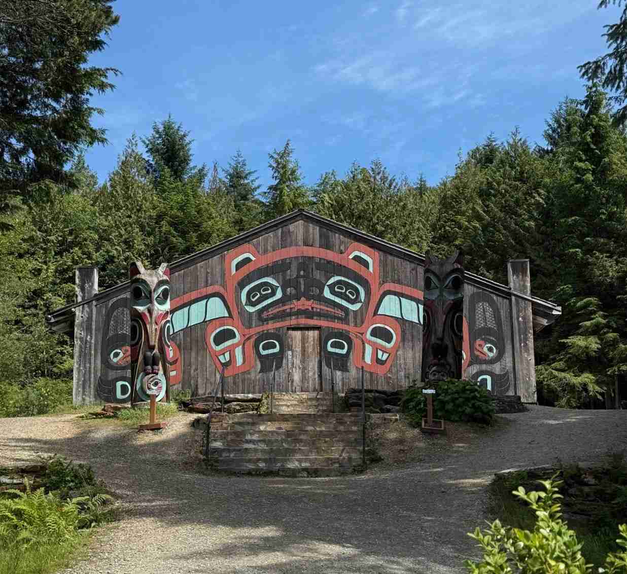
If you ever find yourself at the National Museum of the American Indian in New York City, don’t miss the exhibition titled Infinity of Nations. Among its many layers of meaning, one stood out to us: the enduring legacy of Native art and material culture. These traditions, passed down through generations, continue to preserve history, imagination, and identity. With this reflection in mind, we began our journey in Ketchikan – a must-visit gem in Southeast Alaska known for its large collection of standing totem poles.
Nestled within the Tongass National Forest, Ketchikan is surrounded by glacier-carved wilderness, snowcapped peaks, cascading waterfalls, and salmon-rich streams. Its downtown is a designated National Historic District, and the moment you arrive, you’re greeted by the striking Kootéeyaa (totem pole) of Chief Johnson. Originally commissioned by Chief George Johnson of the Tlingit Raven moiety in the early 1900s to honor his mother, the pole has since been recreated and restored by Tlingit carvers from later generations.
The Tlingit social structure includes two moieties – Raven and Eagle – each with multiple clans and houses. Clan membership is matrilineal, passed from mothers to their children.

Totem poles are carved to honor ancestors, commemorate significant events, and to proclaim the lineage of a clan, and not as religious objects. At the pole’s top we see the fabled Kadjuk, the Chief’s house crest, and at the base – a Fog Woman, creator of all salmon.
Nearby you will find Creek Street: for 7 thousand years salmon was coming up this creek, with eagles flying over just like you see it today.

Only 2.5 miles south of town, Saxman Native Village offers an up-close look at a remarkable collection of totem poles. Established in 1938 by the Civilian Conservation Corps (CCC), Saxman Totem Park was shaped by the skilled hands of Tlingit carvers.
The Proud Raven (Lincoln) Pole commemorates the Gaanax.adi Raven clan’s first sighting of a white man, whose likeness reminded them of Abraham Lincoln.

Grizzly Bear Pole tells the legend of Kats, a hunter who lived with a bear wife and had bear children. The opening at the base symbolizes both a house entrance and a bear’s den – bridging the human and animal worlds. The pole was about one hundred years old when brought to Saxman in 1939 to become part of the totem park.

William Seward Pole reflects the Tlingit people’s disappointment after Seward, the US Secretary of State at the time, failed to reciprocate gifts following a potlatch ceremony in 1869.

The poles of the totem park, like the Eagle Beaver and Owl poles, and other poles and posts in Ketchikan, showcase the deep connection between Native art and the natural world.


Each animal carries symbolic meaning – Eagle for prestige and peacekeeping, Beaver for industriousness, Whale for longevity, Thunderbird for power, and Sun for energy. Some of the totem poles trace a mythological story or lineage; other – reflect a descent of supernatural beings.



Totem poles are traditionally carved from Western red cedar and painted with natural pigments – red, black, and turquoise – mixed with a binder made from crushed salmon eggs and water. The process requires not only artistic skill but also spiritual responsibility.

As you admire the totem poles against the stunning backdrop of pristine nature, you are likely to see a bold eagle soaring above.

Traditional skills of woodcarving are passed down from generation to generation and further honed by modern artists. Renowned artist David Boxley and his son exemplify this tradition. They carved a 22-foot Tsimshian totem pole for the Smithsonian’s National Museum of the American Indian in Washington, D.C., bringing myth to life through wood.
Our Ketchikan journey sparked a deeper interest in the art and culture of Northwest Coast Native Peoples. Both the National Museum of the American Indian and the American Museum of Natural History (AMNH) in New York City offer rich exhibits that celebrate Indigenous heritage. While their online collections are impressive, nothing compares to seeing these exhibits in person.
The AMNH has an amazing collection of totem poles, especially those created by the Tlingit, Haida, and Tsimshian peoples – visual chronicles of ancestral memory and cultural identity. Among them are heraldic, memorial, and house front poles, like the Haida frontal pole that once stood at the entrance to a house, interior pole, and memorial pole.

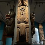

Exhibits of ceremonial dress include garments like tunics and robes adorned with traditional Chilkat weaving, worn during rites of passage and celebrations.

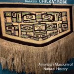
Tlingit Ceremonial Drum on display at AMNH was crafted by steaming and bending wood into a circle, covering it with animal skin, and painting with clan symbols.

In the Northwest Coast Hall of the National Museum of the American Indian, you can see wonderful examples of ceremonial accessories, such as a Haida feast dish carved from bentwood. The designs on its sides represent family crests, and the dish was used at initiations, marriages, and other events that included dancing, oratory, and feasting.

Sustainability is becoming a key principle in tourism, and Haida Gwaii – an archipelago off British Columbia’s northern coast – is showcasing its take on it. In 2024, landmark agreements between the Haida Nation – one of more than 200 distinct First Nations in British Columbia – and the Canadian government marked a shift toward Haida-led governance rooted in ancestral laws and stewardship. Gwaii Haanas park now requires advance reservations, controlled visitor numbers, and orientation sessions to protect its sacred lands and waters.
Exploring the art and traditions of the Tlingit and other Northwest Coast Nations was a deeply enriching experience. As we said goodbye, we offered our thanks—Gunalchéesh! Next up in our Alaska journey: the awe-inspiring glaciers. Stay tuned for Part Two!

Ubud is widely regarded as the spiritual and cultural heart of Bali, and it’s truly a place you won’t want to miss. Here, centuries-old Balinese artistic traditions are not only preserved but also continue to evolve.
At the center of it all is Vanara Vana Street – often affectionately called Monkey Forest Street. It leads directly to the sacred Monkey Forest Sanctuary, where lush nature, ancient temples, and playful long-tailed macaques come together in a harmonious celebration of Balinese values. This sanctuary beautifully embodies the Tri Hita Karana doctrine, which teaches that well-being comes from maintaining harmony with God, fellow humans, and nature. Daily offerings, ceremonies, and reverence for the forest show this philosophy in practice.

Dating back to the 14th century, the Ubud Monkey Forest actually predates the founding of Indonesia. True to its name, the forest is home to several groups of Balinese long-tailed macaques. These monkeys tend to keep to their own territories – though on occasion, playful scuffles arise when their paths cross.


Adult males typically weigh between 8–10 kg and are easily spotted by their broad shoulders and facial hair resembling a mustache. Females are smaller, ranging from 4–8 kg, with delicate beards. Interestingly, macaque society revolves around matrilines – groups of related females who play a central role in maintaining social cohesion. Males migrate between groups and try to integrate, though both sexes form shifting dominance hierarchies that are fluid and not clearly defined.


As Bali shifts its focus toward sustainable tourism, the growing primate population has sparked thoughtful conversations. Feeding monkeys has conditioned them to expect human food, which can lead to challenges when they wander beyond temple grounds into local farmland. Yet, the deep-rooted relationship between humans and primates in Balinese culture makes untangling this connection a complex task – one that local leaders and conservationists continue to explore.
The sanctuary also features three sacred Hindu temples dating back to the Pejeng dynasty: Pura Dalem Agung Padangtegal, Pura Beji, and Pura Prajapati. If you head to the forest’s northwest corner, you’ll discover a set of stone stairs that descend into a serene gorge with a spring, ancient trees draped in lianas, and mystical stone carvings – a setting that feels straight out of an Indiana Jones film.

Nestled beside the spring is Pura Beji, also known as the Holy Bathing Temple. It’s designed with three courtyards called mandalas, each housing a pool used for spiritual and physical purification.

To the southwest is Pura Dalem Agung, the sanctuary’s main temple. Visitors are asked to wear a sarong as a sign of respect.

On the eastern edge, Pura Prajapati temple serves as a ceremonial space for cremation and burial rites. In July 2008, it hosted a historic cremation for Tjokorda Gde Agung Suyasa, the revered head of Ubud’s royal family. The entire event – likely the largest of its kind on the island – brought together villagers from over 70 communities to honor the prince, whose guiding philosophy was Bakti Asih (faith and compassion): “the palace could not be a palace without the community.” That day, processions filled the streets with offerings, a massive bull effigy, and a dragon known as Naga Banda.
Exploring Ubud’s cultural depth wouldn’t be complete without experiencing its traditional dance, drama, and music. Among these, the elegant Legong dance stands out as one of Bali’s most iconic. More than performance, Balinese arts are woven into daily life – beginning with the creation of offerings and culminating in vivid stories told through dance. Legong, approximating a court dance style, tells tales of romance or rivalry through graceful, expressive movements and intense visual contrasts.

Another gem of Indonesia’s cultural heritage is batik – a traditional textile art form that has earned a place on UNESCO’s Intangible Cultural Heritage of Humanity list. The word “batik” is believed to derive from “amba” (to write) and “titik” (dot) in Javanese, perfectly capturing its intricate beauty.

Batik patterns are renowned for their rich colors and complex motifs. Using a wax-resist dyeing technique, artisans create durable, fade-resistant designs on cotton or silk. A framed batik piece makes for a lovely and meaningful souvenir.


Designs vary by region and influence – drawing from Japanese, Indian, Chinese, and Dutch aesthetics. Some common patterns include Kawung (intersecting circles), Ceplok (geometric shapes), Parang (knife-inspired motifs), and Prada cloth, which is adorned with gold leaf or dust. Balinese batik frequently showcases dragons, fire, and nautical scenes.
And speaking of dragons, you’ll also spot these mythical creatures in Balinese wind chimes – another charming memento to bring home and remember your time here.

As we said goodbye to Bali, we felt deeply thankful for the memories and cultural experiences it offered. With our hearts full, we’re already looking forward to the next adventure – this time in Yogyakarta and Jakarta, where we’ll continue our journey of discovering Indonesia in future blogs.

As I sit down to write this, protests are unfolding across Italy, Portugal, and Spain – activists armed with water pistols and the clamor of rolling suitcases are rallying against mass tourism. These protests reflect growing concerns about rising housing costs and environmental damage, with organizers pointing to overtourism as the culprit.
It brings to mind destinations where tourism is embraced thoughtfully, and cultural heritage is respected. Remarkably, such places still exist – even in the most popular corners of the world. Take Bali, for instance. Rather than flock to the buzzing Kuta Beach, we chose to explore Sanur and Ubud – and what a rewarding decision it was.

In recent years, Bali too has seen instances of unruly behavior from party-driven tourists. Fortunately, the local government has responded with firm but respectful measures – distributing etiquette cards at the airport and, in some cases, deporting those who show disregard. To support infrastructure, protect the environment, and preserve cultural sites, a one-time tourist levy of $10 was introduced for international visitors last year.
So, why does Bali remain so beloved? Most travelers have heard of its golden beaches and tropical gardens, but those drawn to culture find something even deeper – Bali’s rich spiritual traditions behind its unique, timeless atmosphere.

While around 88% of Indonesians identify as Muslim, Bali is a striking exception: nearly 87% of its 4.4 million residents practice Hinduism. This faith arrived with Indian traders and gained a strong foothold during the Majapahit Empire in the 14th century. As Islam spread throughout the archipelago, Hinduism endured in Bali, evolving into a unique blend of ancient animism, Buddhism, and Javanese influences – now known as Balinese Hinduism.
One of its most notable expressions is the island’s animist belief that all things in nature have a soul. This worldview is woven into everyday life through intricate rituals. A powerful example is Tumpek Kandang, the “Holy Day for Animals,” held every 210 days, during which animals receive blessings and offerings. Witnessing this devotion in person offers an experience no book or blog could capture.

Where to Visit in Bali? It Depends on What You’re Looking For
If you’re after sun, surf, and sand, you’ll find plenty of options. Kuta Beach remains the heartbeat of Bali’s surf culture. Back in 2006, it earned global fame when 53 people rode a wave together at its “Halfway” break – setting a world record.
For wave-chasers, Nusa Dua on the eastern coast is another favorite. Despite its name – meaning “two islands” – Nusa Dua refers to two raised headlands. With year-round right-hand reef breaks and larger swells during the wet season, it’s a magnet for surfers. Today, the area is home to luxury resorts, but even years ago, when we visited during the early stages of development, it already offered fantastic diving and watersports.


But if you crave serenity, a deeper connection to nature, and immersion in culture, then Sanur and Ubud are ideal.
Sanur: The Gentle Rhythm of the Sea
This peaceful coastal town moves to the gentle rhythm of the tides. Along Sanur’s iconic seaside promenade, every step offers sweeping views of the reef-touched ocean, where waves break in the distance like a hushed applause.

Cafés along the shore invite you to linger over lunch or a cool fruit juice beneath the shade of banyan trees. The menus are beautifully varied: fresh seafood, classic Indonesian dishes, crisp salads, hearty steaks – you name it. And if you’re in need of true relaxation, there’s nothing like a beachside massage with the ocean breeze as your soundtrack.

Sanur also offers a feast for the curious palate. Try nasi goreng, Indonesia’s famous fried rice dish, or the crispy, savory ayam goreng (deep-fried chicken). And don’t miss gado-gado, a vibrant salad of vegetables, tofu, and eggs with rich peanut sauce.

In the afternoon, low tide reveals a stretch of reef – 300 to 400 meters wide – waiting to be explored. Corals of all shapes, starfish, tiny crabs hiding beneath pebbles, and even glimpses of Mount Batur across the water make for a dreamlike scene. Just mind those coral edges – they’re beautiful but sharp.

When it comes to lodging, Sanur caters to all tastes. While boutique hotels now dot the landscape, it was also home to Bali’s very first large hotel: the Inna Grand Bali Beach. We stayed in one of its garden bungalows, nestled in a lush sprawl of blooming trees. That peaceful setting, where tropical gardens met the sea, remains a favorite memory.


While walking through Sanur, you’re sure to notice stone statues dressed in the striking black-and-white checkered fabric called Poleng. These cloths – complete with a sarong, headgear, and a belt saput – are much more than decoration. They reflect a philosophy at the heart of Balinese Hinduism: Rwa Bhineda, the belief in balance between opposing forces.

Poleng represents coexistence of the opposites – light and dark, good and evil, joy and sorrow. Sometimes you’ll even see gray squares added in, symbolizing transitions between those dualities. Whether wrapped around a tree, worn by temple guards, or placed on sacred statues, Poleng emphasizes that harmony comes from recognizing both sides of life.
Each color in Balinese Hinduism carries meaning: white for the east, red for the south, black or blue for the north, and yellow for the west. Together, the Tridatu – red, white, and black—symbolize the Hindu trinity: Brahma the creator, Vishnu the preserver, and Shiva the transformer. These threads of meaning are woven into temple ceremonies, offerings and prayers.
Let’s pause here, at this meeting place of sea, spirit, and silence. In our next post, we’ll wander north to the heart of the island – into the jungled mystery of Ubud’s Sacred Monkey Forest. I hope you’ll join us there.

The activities we saved for last turned out to be the perfect farewell to Vietnam – celebrating both its breathtaking natural wonders and its rich cultural heritage.
Our first stop was the magnificent Ha Long Bay – Cat Ba Archipelago. Located in the northeast of Vietnam, about 100 miles from Hanoi, this sprawling archipelago covers 65,650 hectares and is home to 1,133 islands and islets. Here, towering limestone formations rise dramatically from the sea, shaped over millennia into diverse forms.

According to UNESCO, Ha Long Bay is one of the most extensive and well-known examples of fengcong (clusters of conical peaks) and fenglin (isolated tower features) karst landscapes. It’s no surprise that this spectacular seascape, sculpted by nature, was chosen as a filming location for Kong: Skull Island in 2017.

What makes Ha Long Bay even more special is the opportunity to experience its beauty up close – kayaking around the towering peaks, gliding through Luon Grotto, and exploring its mesmerizing caves. Naturally, we couldn’t pass up the chance!

Stepping into these caves felt like entering another world. The intricate formations of stalactites and stalagmites, illuminated by a mix of natural and artificial light, created an almost surreal atmosphere.


Last year, Ha Long Bay and the adjoining Cat Ba Archipelago celebrated the 30th anniversary of their inclusion on the UNESCO World Heritage list. This designation has helped transform the site into a globally recognized travel destination, drawing millions of visitors and significantly boosting Vietnam’s tourism industry. However, UNESCO has also raised concerns about ongoing development projects along Ha Long City’s coastline, prompting the plans to evaluate their impact on the site’s preservation.
For our final stop in Vietnam, we had the pleasure of experiencing one of the country’s most treasured cultural traditions: a water puppet show.
At the renowned Thang Long Water Puppet Theatre in Hanoi, we were treated to an enchanting performance, complete with a live Vietnamese orchestra playing traditional songs. Dating back thousands of years, water puppetry has long been a way for Vietnamese storytellers to share myths and legends. Watching these beautifully crafted puppets glide across the water brought history to life in a truly magical way.


As our journey through Vietnam came to an end, we felt deeply grateful for the unforgettable wonders – natural, cultural, historical, and artistic – that we had the privilege of witnessing.
Since the COVID-19 pandemic, Vietnam’s tourism industry has bounced back impressively, now serving as a key driver of the country’s rapid economic growth. In 2024, more than 17.5 million foreign tourists visited the country, nearly reaching the pre-pandemic record of 18 million in 2019. Looking ahead to 2025, Vietnam has set an ambitious goal – welcoming 23 million international visitors.
This renewed emphasis on tourism aligns with the country’s broader strategy to diversify its economy, create jobs, foster cultural exchange, and encourage sustainable development. Alongside other major Southeast Asian destinations like Thailand and Indonesia, Vietnam is investing in infrastructure upgrades to enhance the travel experience and simplifying visa requirements to make entry more accessible.
Interestingly, Thailand is spearheading a proposal for a Schengen-style visa that would streamline travel across Southeast Asia. If implemented, neighboring countries like Cambodia, Malaysia, Myanmar, Vietnam, and Laos could become significantly more accessible to international travelers. This would be a good reason to come back to this wonderful region. Meantime, goodbye Vietnam – Tam Biet!

We arrived in Hanoi in early January – a time of year that, while not as ideal as autumn, still has its charms. The slightly chilly weather was more than offset by the relaxed atmosphere, as the sites were delightfully uncrowded, allowing us to explore at a leisurely pace.
Hanoi, the capital of Vietnam and, with a population of around 8.5 million, its second-most populous city after Ho Chi Minh City, is steeped in the nation’s rich and often dramatic history. This sentiment resonated deeply throughout our visit.
April 2025 marks the 50th anniversary of the Saigon government’s surrender to North Vietnamese forces, bringing an end to the decades-long Vietnam War. Today, the country takes pride in showcasing its natural beauty, architectural wonders, and vibrant culture to the world. Since welcoming international tourists in 1997, Vietnam has become one of Southeast Asia’s most popular destinations, drawing millions of visitors each year.
Hanoi has served as a capital in various forms throughout its history. Founded in 1009 AD as the imperial city of the Ly Dynasty – the first of Vietnam’s three great dynasties – it became the capital of the unified Vietnam in 1010 under the name Thang Long. The centralized form of government enabled the ruler to establish universal military service, which kept Chinese and Champa troops at bay.
According to legend, the city’s endurance is due to its sacred protectors. In one famous tale, King Ly Thai To (974–1028) dreamt of a divine white horse that led him to the ideal location for building a citadel. Despite earlier attempts that collapsed, the citadel constructed following the horse’s footsteps stood firm. This legend has cemented the horse’s significance in Vietnamese art, as seen in ornate statues displayed in temples and museums, like the ones we were fortunate to admire during our visit.


Hanoi’s role as the capital of French-controlled Vietnam began in 1873, a period that influenced the city’s diverse architecture. This blend is particularly evident in the Old Quarter, where traditional Vietnamese structures coexist with French colonial designs.
One highlight of the Old Quarter for us was Saint Joseph Cathedral, affectionately known locally as “The Big Church.” Built in a Neo-Gothic style in the late 19th century, this striking cathedral is the seat of the Roman Catholic Archdiocese of Hanoi, serving over 4 million Catholics in Vietnam. We visited it shortly after Christmas, when the square outside the cathedral was still adorned with a charming Nativity scene.

Another must-see site is the Temple of Literature, a historic complex dedicated to Confucius and Vietnam’s first scholars. Once home to the country’s first university, the temple features stone steles, carried on the backs of turtle sculptures, engraved with the names of graduates – a fascinating tradition that has endured for centuries!

Tran Quoc Pagoda was another unforgettable stop. This serene sanctuary of Buddhism, situated on a small island in Hanoi’s West Lake, is the city’s oldest Buddhist temple, dating back to the 6th century. Its stunning 11-story stupa, standing at 15 meters tall, is a sight to behold.


As admirers of traditional crafts, we couldn’t miss the opportunity to explore Vietnam’s lacquerware. With a history spanning over 1,000 years, this art form involves layering natural resin from lacquer trees onto wood, bamboo, or pottery. The Vietnam National Museum of History showcases exceptional examples of lacquer craft, including an intricately adorned altar we admired during our visit.


If you are interested to learn more about the customs of the country’s many ethnic groups, then Vietnam Museum of Ethnology is also a must-visit place. The country of over 80 million, Vietnam has 54 ethnic groups: the Vietnamese (the Kinh) and 53 ethnic minorities. There you will find galleries displaying artwork from across the nation as well as woodblock prints, ceramics, weaving and traditional dress. For example, a Rong house in an outdoor section is a traditional communal house of several ethnic groups in the Central Highlands of the country.

Delving into more recent history, we visited the Hanoi Flag Tower, built between 1805 and 1812 during the Nguyen Dynasty. This iconic site marks the location of the national flag-raising ceremony on October 10, 1954, celebrating the liberation of Hanoi from French colonial rule.


Today, the Flag Tower forms part of the Vietnam Military History Museum, which recently moved to a more spacious location in western Hanoi. Earlier it was in central Hanoi, opposite the Lenin Park and near the Ho Chi Minh Mausoleum. The Vietnam Military History Museum, which we visited in his previous location, was established in 1956, and it houses an extensive collection of artifacts documenting Vietnam’s remarkable history of conflict, resilience, and peace.


Another site steeped in history is the Hoa Lo Prison Museum, located on the edge of Hanoi’s French Quarter. Initially built by the French during colonial rule to house political prisoners and known as Maison Centrale (Central House), it was later used to detain American POWs during the Vietnam War. The name Hoa Lo refers to a potter’s kiln and roughly translates as “fiery furnace”. The prison’s 20-foot walls, topped with barbed wire and broken glass, made escape nearly impossible. The museum provides a stark insight into the lives of prisoners through its exhibits, which include reconstructed cells. This year, as Vietnam marks the 50th anniversary of the war’s end and the 30th anniversary of reestablished U.S.-Vietnam diplomatic relations, the museum holds particular significance.


Notably, the American Heritage Museum opened an exhibit in February 2023, showcasing materials from Hoa Lo Prison donated by a Canadian collector. This exhibit commemorated the 50th anniversary of Operation Homecoming, when American POWs were released as part of the war’s resolution.
Our historical journey culminated with a visit to the Ho Chi Minh Mausoleum, the final resting place of Vietnam’s revolutionary leader and President who led the country from 1945 until his death in 1969.

Inside the mausoleum, visitors solemnly pay their respects as they pass by the glass case containing the embalmed remains of Ho Chi Minh, reflecting the profound reverence the Vietnamese people have for his legacy.
Though our time in Hanoi was drawing to a close, we had two more unforgettable experiences awaiting us in northern Vietnam – the captivating water puppet shows and the breathtaking beauty of Ha Long Bay. Stay tuned for those highlights in our next blog post!

Ho Chi Minh City is not only Vietnam’s largest city and financial hub, but it also boasts over 300 years of rich history and is brimming with historical landmarks – a true magnet for history enthusiasts like us. Named after Ho Chi Minh, the revolutionary leader and first president of North Vietnam, the city honors his pivotal role in the country’s reunification.
We began our journey at the Independence Palace, also known as the Reunification Convention Hall. This remarkable landmark, spanning 120,000 square meters, is built on the grounds of the former Norodom Palace. Originally constructed by the French in 1868, Norodom Palace served as the residence and workplace for the Governors-General of French Indochina until 1945. Following irreparable damage in 1962, the Independence Palace was built in its place and completed by 1966. Later, it became the residence and workplace of the President of the Republic of Vietnam (South Vietnam) and witnessed history as a North Vietnamese Army tank famously crashed through its gates, marking the end of the Vietnam War.
After Vietnam’s reunification, the palace functioned as a government office until 1976, when the capital of South Vietnam relocated to Hanoi. Today, the palace stands as a museum, captivating visitors with its dramatic historical significance.


Designed by architect Ngô Viết Thụ, the palace harmoniously blends modern Asian architectural style with traditional Vietnamese elements.
Inside, you’ll encounter spacious rooms and airy halls that hosted historic meetings and ceremonies. Notable spaces include the Chamber, which can accommodate over 500 people, a command center, and other fascinating areas.

Beyond its historical artifacts, the palace also showcases beautiful artwork, including paintings by Vietnamese artists and ancient Chinese pottery.

Our next stop was the Museum of Ho Chi Minh City, housed in a building with its own intriguing story. Initially serving as a venue for cultural activities and artistic performances from 1975, it was transformed into the Ho Chi Minh City Museum of Revolution in 1978 before being renamed the Ho Chi Minh City Museum in 1999.

The museum vividly portrays the revolutionary chapter of Vietnam’s history through colorful exhibits.

We were also drawn to the traditional Vietnamese crafts on display, including pottery, jewelry, weaving, wood carving, and bronze casting.
One standout example of bronze casting we saw days later at the Museum of Ho Chi Minh in Hanoi – a striking bas-relief of the revolutionary leader.

A delightful surprise awaited us—while exploring the museum, we caught a glimpse of a wedding in progress. The museum’s grand interior made for a stunning backdrop to this modern-day celebration, reminding us of the vibrant life that continues in such historic settings.

Our exploration of Vietnamese crafts, particularly the tradition of wood carving, continued at the Ho Chi Minh City Museum of Fine Arts.

A fascinating tidbit is that this museum features the first-ever elevator in Ho Chi Minh City, complete with a carved wooden chamber adorned with intricate decoration—though it’s no longer functional.
Vietnamese wood carving has a rich history dating back to the Dong Son culture, which thrived from the 3rd century BC to the 1st century AD. Dong Son carvings adorned weapons, shields, and various objects, and the craft reached its zenith during the Nguyen dynasty (1802–1945). Wood carvings from this period graced palaces, temples, and other prominent structures. Today, this tradition is alive and well, while historic masterpieces are preserved in museums.

We were also thrilled to see exhibits showcasing Cham culture – a fitting continuation of our visit to the Museum of Cham Culture in Da Nang earlier in our journey.
Another landmark we recommend visiting is St. Francis Xavier Church, a reflection of Vietnam’s rich Catholic heritage. This church has been a place of devotion and prayer since 1902. Situated in the Chinatown area of the city, near the bustling Cho Lon market, the church is easily accessible to both locals and tourists. In its front yard, you’ll find a statue of the Virgin Mary housed within a traditional hexagonal Chinese-style arbor. The roof, adorned with yin-and-yang tiles, symbolizes balance.

Our final historical stop in Ho Chi Minh City was the War Remnants Museum, which features abandoned and captured U.S. tanks, planes, and helicopters on its grounds. Inside, the museum hosts an extensive collection of photographs documenting the Vietnam War. Though often criticized for hardly mentioning the brutalities of the conflict between North and South Vietnam, the museum remains a poignant reminder of the war’s impact.


After two full days immersed in the vibrant energy, historic sites, and bustling streets of Ho Chi Minh City clad in colorful posters and motorcycles, we bid farewell to this unforgettable place.

Our journey took us next to Hanoi, Vietnam’s capital, via a two-hour flight. But next time, we might try a high-speed train that will connect the two cities – a bold project approved last year. Spanning 957 miles, the railway is expected to accommodate trains traveling at speeds of up to 217 mph, reducing the journey from 30 hours to just five hours! With an estimated cost of $67 billion, the project will launch its construction phase in 2027, and the first trains will hopefully start operating by 2035. Such train will pass through 20 provinces and cities, promising an incredible experience. Doesn’t that sound exciting?

Our destination in Southern Vietnam was Ho Chi Minh City, still often referred to as Saigon by many. Since the U.S. trade embargo was lifted in the 1990s, Vietnam has emerged as one of the fastest-growing economies in the world. Ho Chi Minh City developed into a dynamic and stylish metropolis, all while staying deeply connected to tradition. We chose to begin our adventure by exploring the fascinating sites in the city’s surroundings, saving the urban heart for last.
Our first stop took us to the renowned Cu Chi tunnels, located approximately 40 miles northwest of Ho Chi Minh City. A popular tourist place and a must-see in Vietnam’s “war tourism,” the Cu Chi tunnels are part of a nationwide network of war memorial parks. This four-level labyrinth, stretching over 150 miles from the outskirts of Ho Chi Minh City to the Cambodian border, played an important role during the war. It included underground living quarters, makeshift ordnance factories, kitchens, and more – a concealed web of fortifications. Underground meeting rooms were up to 24 feet long and 12 feet wide. Dug as much as 23 feet deep, the tunnels had some passages only 16 inches wide and 24 inches high.


With 2025 marking the 50th anniversary of the end of the Vietnam War, renewed attention has been drawn to this chapter of history. A recent addition to this narrative is Vietnam: The War That Changed America, an Apple TV+ docuseries. Drawing on over 1,000 hours of archival footage and other sources, it recounts stories, including those of the “tunnel rats” – brave soldiers who volunteered to enter and search these perilous passageways. Their accounts transported us back to our visit, where we had the opportunity to walk through a small portion of the tunnel’s upper level that was open for visitors. The experience was both thrilling and humbling – dark, claustrophobic, and stiflingly hot, leaving us gasping for air as we emerged into daylight. The ground-level exhibitions complement the tunnels with displays of military hardware and life-sized wax figures depicting daily life underground.


Our next destination was the striking Cao Dai Temple, also known as the Great Divine Temple, located about 20 miles from the Cu Chi site (roughly 60 miles northwest of Ho Chi Minh City) near the Cambodian border. This temple serves as the spiritual heart of the Cao Dai religion, Vietnam’s largest homegrown faith with millions of followers.


Standing for over 80 years, this colorful, dragon-adorned structure is a feast for the eyes and a magnet for even the most temple-weary travelers. Its vibrant design reflects a unique synthesis of religious and aesthetic influences. Caodaism draws from the ethical teachings of Confucianism, Taoism, Buddhism, and Catholicism, promoting harmony through a shared vision of an individual Creator – a Divine force recognized by most major religions. Among the venerated saints of Caodaism are Buddha, Confucius, Jesus Christ, and Joan of Arc. The recurring image of the all-seeing Eye, prominently featured on the temple walls and above the altar, symbolizes the universal presence of the Divine.

Visitors can observe the noon service from the balconies, offering a beautiful view of the main shrine. The sight of priests from different denominations, each clad in their respective ceremonial colors, praying together is a powerful reminder of unity.


After immersing ourselves in the serenity of the Cao Dai Temple, it was time to return to Ho Chi Minh City and delve into its vibrant streets. Stay tuned for the next installment of our journey!

Our trip through central Vietnam took us next to Da Nang, a coastal city with a fascinating past. It was once part of the ancient Champa Kingdom, which existed from the 2nd to the 17th century. This kingdom had both collaborative and conflictual relations with other Southeast Asian empires, like the Javanese and Khmer kingdoms (which we wrote about in our earlier blogs). For example, Kertanagara, the last king of the Singasari Kingdom in Java, married a Champa princess. At the same time, the Champa often found themselves in conflict with the neighboring Khmer Empire of Angkor. Visiting all three places and comparing their cultural and artistic traditions many centuries later was fascinating, thanks to the preserved historic monuments! The art of Champa transports you back in time to one more unforgettable place.
Today, the Cham people are a smaller ethnic group in Vietnam, numbering around 160,000. But their forebears were skilled seafarers who sailed the South China Sea for over a thousand years, leaving behind an impressive legacy. It’s believed these Malayo-Polynesian speaking ancestors came to Vietnam by sea from Borneo. A testament to their rich culture is Mỹ Sơn, the ancient kingdom’s northern capital. It’s about a 40 km drive from Da Nang and is a UNESCO World Heritage site with 71 structures still standing.


Unique culture of the Mỹ Sơn Sanctuary flourished from the 4th to the 13th centuries and was heavily influenced by Hinduism from India. The tower temples, with their variety of architectural designs, are made of fired brick with stone pillars and decorated with sandstone bas-reliefs that depict scenes from Hindu mythology. In the gardens, you’ll see the lingas, a phallic symbol of generative power associated with the Hindu god, Shiva.

The Cham Museum in Da Nang displays the largest collection of Cham sculptures and artwork in the world, offering a glimpse into the rise and fall of the Champa kingdom. Naturally, the museum was our next stop in learning about this ancient civilization.


Some of its sandstone and terra-cotta sculptures are reminiscent in style of the artistry of Angkor Wat, due to the influence of Indian art in both places. It is probable that artists trained in the sophisticated Cambodian tradition worked for the Cham kings at some point.
Another must-see near Da Nang is Marble Mountains, a group of five limestone hills (karsts) just 7 km from downtown Da Nang. This area is a combination of large caves and small grottoes, paths, tunnels, observatories, as well as beautiful towers and pagodas. It’s a natural park, Buddhist spiritual site, and historic monument all in one!
While marble is present, Marble Mountains are mostly composed of schist. The five mountains are named after the five elements: metal, water, wood, fire, and earth. The highest mountain, Water (Thuỷ) Mountain, is accessible to visitors. You can reach its summit by climbing 156 steps or taking an elevator. Once at the top, you’ll be rewarded with breathtaking views of the coast and the valley from the observatory.


Walking down, there is so much to see! The largest cave, Huyen Khong, features a big statue of Buddha and two altars. Sunlight streaming through crevices adds to the beauty, creating an exotic, magical feel unique to the place.

One of the oldest pagodas in Da Nang, Linh Ung Pagoda on Marble Mountain, was built in the 17th century in a traditional architectural style with curved plate tile roofs. Linh Ung means “wishes answered miraculously” in Sino-Vietnamese. The dress code for the pagoda, a Buddhist sanctuary, requires that armpits, navels, and knees are covered, and not too much skin is shown (sarongs are available for free if needed for proper coverage).

As you continue along the path, more amazing stops await.


Central Vietnam left us with memories of natural wonders blended with historic landmarks as we headed to the south of this beautiful country. There, another set of discoveries was waiting for us – see our next blog.

In 2024, tourism generated a record $1.6 trillion globally, acting as an engine for economic growth. However, last year also saw more impacts of overtourism in many popular destinations, leading to the introduction or increase in tourist taxes, restrictions or bans on short-term rentals, and changes in cruise ship itineraries, among other measures. With international arrivals expected to grow further, the search for sustainable tourism solutions continues.
Vietnam welcomes tourists with a sustainable approach to tourism, encouraging responsible and nature-based tourism with environmental protections. The COVID-19 epidemic caused a dramatic decline in international arrivals – from a record 18 million in 2019 to only 3.5 million in 2022 – but numbers are steadily growing back.
The importance of sustainable tourism is most strongly felt in places of unique historic and artistic significance. Hoi An, a port town in central Vietnam, is a prime example. This town was our “point of entry” into learning about this amazing country and seeing its special beauty.
Hoi An Ancient Town, a UNESCO World Heritage site, is an exceptionally well-preserved example of a small-scale trading port active from the 15th to 19th centuries. It traded widely with Southeast and East Asia and the rest of the world. Its over a thousand timber frame buildings, including architectural monuments and religious pagodas, line the narrow pedestrian streets, making you feel like you’re walking in another century.


The wooden components are carved with traditional motifs. Hoi An Ancient Town has retained its traditional wooden architecture and townscape, from plot size and materials to façade and roof line, as well as the original plan of its lantern-lined streets.


The tradition of woodcarving stays alive in Hoi An, which continues to function as a trading port and center of commerce – a true living heritage! You can stop by a woodcarving workshop to see the skills of local artists.


In recognition of conservation efforts, a square in Hoi An has a monument and is named after Kazimierz Kwiatkowski (1944-1997), a Polish architect who helped preserve historical and archaeological sites in Vietnam, including Hoi An.

As a National Cultural Heritage Site since 1985, the entire town is state property, protected by national laws and governmental decisions, and covered by regular restoration and conservation programs. This context underscores the importance of respectful, conscious, sustainable tourism so that this heritage remains available in the future.
As Hoi An Ancient City is a pedestrian area, many hotels outside offer a free shuttle service. We stayed at the Swiss-Belhotel and found the commute very handy. Our visit fell on New Year’s Eve, giving us the welcome opportunity to celebrate the holiday in Vietnamese style!


To support growing tourism, a wave of new hotels has announced openings near Hoi An. Local artisans open their doors to showcase their craftsmanship, such as at Thanh Ha Pottery Village. A trip there can be combined with a visit to the Thanh Ha Terracotta Park museum. Not to be missed is the opportunity to see local dancers – a tour we opted for.


Overall, Hoi An in central Vietnam was an amazing starting point in our discovery of Vietnam and would be an unforgettable stop on any route you choose to explore this wonderful country! Our next destination was Da Nang, with its ancient Mỹ Sơn sanctuary of the Champa Kingdom – see our next blog about it.

Let’s continue our exploration of the beautiful riverfront parks along the Hudson, where nature and art come together so wonderfully.
If you were lucky enough to visit Fort Tryon Park between November 2nd, 2023, and April 4th, 2024, you might have encountered “Appearances,” a fascinating public art installation featuring sculptures by seven different artists. We had the pleasure of joining a walking tour led by one of the creators, which gave us a deeper understanding of the artworks and their intended meanings. The installation beautifully highlighted the majesty and fragility of our environment, and each sculpture truly invited us to pause, observe, and reflect.
One particularly striking sculpture, pictured below, is “Udd” (meaning “to fly” in Hindi) by the artist Wolf. Made from wooden coat hangers, metal rods, and paint, it symbolizes “the freedom to soar, to give wings to our thoughts, to break away from fixed, blocked space…,” as the artist explains.

Another interesting piece, “An Accordance of Forces,” by Rosy Keyser, is described as a “Seawall for a hilltop.”

Dorothy Palanza’s sculpture, “Human Invasion,” powerfully “speaks to the threat we impose on our planet as the most invasive of all species, a reflection on this Anthropocene epoch.”

“Everyone,” a sculpture by M.J. Levy Dickson, is crafted from bluestone and mirrors. The artist shares that it represents the idea that “We should stand straight and tall no matter our stature. The stone represents our connection to the earth, the colors vary just as people do. The mirrors reflect ourselves in each other.”

The sculpture below, “Stardust” by Elizabeth Akamatsu, is made of steel with powder coat paint. The artist notes, “Stardust is inspired by a crystal called Desert Rose. It is strong as a rock and delicate as a flower. Just as the lacy planes of steel are juxtaposed, we are interdependent, woven in a web of interconnected forces of fragility and strength.”

What a wonderful celebration of art in a public park!
While temporary art installations come and go, the enduring beauty of Fort Tryon Park provides joy throughout the year. One of its gems is the Heather Garden, the largest public garden with unrestricted access in New York City. Home to over 30 varieties of heaths and heathers that bloom at different times, this stunning garden offers something to enjoy in every season.
The Heather Garden also welcomes volunteers, especially on Shearing of the Heathers Day, the garden’s annual rite of spring. The event on April 13th, 2024, was a joyful celebration of community, as you can see in this video!
Even a rainy day can’t diminish the beauty of the blooming heathers!
Since March of last year, the Heather Garden has offered guided Monthly Walks with its gardeners on the last Friday of each month. We thoroughly enjoyed our tour – it’s a fantastic way to explore the park, learn about gardening, and appreciate its beauty.


Fort Tryon Park also offers wonderful outdoor music experiences! The Concerto on the Grass series this past summer was delightful, including the Scandinavian Music Festival in June.

Listening to the Scandia Brass Quintet and Scandia Chamber Orchestra on the Billings Lawn, just below the Heather Garden, was truly magical. Highly recommended!

Jazz lovers can also enjoy the outdoor Summer Blossoms Jazz & Poetry Concert!

What could be better than listening to music on a sunny Sunday, with a gentle breeze and the sun dappling through the trees?
Our next stop is Riverside Park, which begins a few dozen blocks south. Stretching four miles along the Hudson River from 158th to 72nd Streets, Riverside Park is often considered Manhattan’s most spectacular waterfront park and is one of only eight officially designated scenic landmarks in New York City.


The Riverside Park Conservancy supports a wide range of activities, events, and initiatives for people of all ages.
The New York City Urban Rangers lead interesting Nature Exploration walks in Riverside Park. A highlight of our walk last March was seeing a juvenile hawk soaring above us in the heart of midtown!

The Municipal Art Society (MAS) of New York organizes an art walk along the park, from the Joan of Arc sculpture to Grant’s Tomb, showcasing monuments that honor exemplars of civic virtues. We joined this walk as part of the annual Jane’s Walk NYC, a volunteer-led festival celebrating city life with a diverse selection of fascinating walks.
Jane’s Walk, founded to honor the legacy of urban activist Jane Jacobs, now takes place in over 200 cities worldwide. Jane’s Walk NYC, presented by the MAS, is the largest of these festivals. Mark your calendars for the next festival, May 2nd-5th!
Over a dozen monuments line Riverside Drive, facing the park. These include the equestrian statue of Joan of Arc (dedicated in 1915), the Firemen’s Memorial (1913) honoring firefighters who died in the line of duty, and statues of generals, educators, and public servants.


From nature and visual arts to music, Riverside Park has something for everyone. The Charlotte Mayerson’s Overlook Concert series, presented by the Riverside Park Conservancy, offers wonderful musical experiences. We particularly enjoyed a performance by French Cookin’ Blues last October.

One unique and fun annual event in Riverside Park over the past five summers has been the arrival of goats from a farm to clear the steep slopes of invasive plants! The goats receive a warm welcome from volunteers and visitors, and everyone enjoys a jazz performance!

These hardworking goats reminded us of a similar approach called solar grazing, where sheep are used to clear solar fields. This allows the land to serve a dual purpose: solar energy production and supporting the sheep and wool market. With over 60 solar grazing projects in the U.S., 27 states now participate in this practice.
Our final stop on this tour of Hudson River waterfront parks is the High Line, which celebrated the 15th anniversary of its first section’s opening last summer.
Dubbed “a park in the sky” when it was built on an elevated rail line on Manhattan’s West Side, this 1.5-mile-long walkway now attracts around seven million visitors annually. Its planting design is renowned as one of the best examples of naturalistic gardening anywhere. Even outside of the blooming season, you can enjoy modern art—sculptures against the backdrop of the Hudson. We visited last Christmas to see the Hudson Yards seasonal decorations and enjoy the park.


If you enter the High Line at the Rail Yards, you can also enjoy the views from the Vessel, a unique honeycomb-like structure on Hudson Yards Public Square. If you’re up for it, you can climb some of its 154 flights of stairs, with 2,500 steps and 80 landings! These views, in contrast to the Palisades seen from Washington Heights, offer a glimpse of the bustling city life on both the water and land.


Our journey along the shores of the Hudson River was nearing its end, culminating in a beautiful Hudson cruise, “Shades of Autumn.” This cruise offers stunning views of the fall foliage and numerous historic landmarks in Manhattan, New Jersey, and New York State!

As we took in the changing scenery from the sunlit deck – bustling cityscapes, busy highways, magnificent cliffs, and lush parks – we reflected on everything we had learned and enjoyed.
Memories flooded back: New York Bay that saw Henry Hudson’s arrival in 1609 in search of the Lenape homeland. The sites of the Revolutionary War. The art that tells stories from medieval times to the present. The incredible nature – both the preserved and maintained parks and the artfully landscaped gardens. It was a wonderful journey for us, and while other travelers might explore different areas along the Hudson, it’s sure to be an unforgettable experience for everyone!

Next, we’ll be visiting Fort Tryon Park, which is celebrating its 90th anniversary this year! This picturesque park was designated a New York City scenic landmark in 1983. Along with Inwood Hill Park to the south and Riverside Park to the north, Fort Tryon Park is part of the awesome Manhattan Waterfront Greenway – a 32-mile (51 km) long path perfect for walking and cycling along the river.
Situated next to Inwood Hill Park, Fort Tryon Park is located in the Washington Heights and Inwood neighborhoods of Manhattan. These two parks are separated by a seismologically active fault line, known as the Dyckman line, named after the street running along it.
Like Inwood Hill and Central Park, Fort Tryon Park is an excellent spot to explore the geology of Manhattan. New York City’s Park Rangers offer an interesting Geology Hike in this park to guide your exploration. The outcrops of Manhattan schist along the park’s trails offer a glimpse into the ancient past, dating back about 450 million years. These rocks formed and then underwent metamorphic changes under extreme pressure and temperature. You can observe up close the fascinating layers created by the folding, twisting, and stretching of these rocks.


Manhattan schist is credited with providing the structure and stability to the foundation that supports New York City’s skyscrapers.
Interestingly, the rocks of the cliffs just across the Hudson on the New Jersey side are of entirely different origin – they are made of basalt formed from magma.

The Revolutionary history of Fort Tryon Park takes us back to the events of November 1776. The Battle of Fort Washington was fought and lost at the site of the park on November 16th, prompting General George Washington to order an evacuation of the Continental Army from Fort Lee on the other side of the Hudson River, beginning a strategic retreat.
The highest point in the park, today’s Linden Terrace, is where the Continental Army took a stand at the top of Long Hill before being overwhelmed by British and Hessian troops.

The terrace is a must-see, from its arch and supporting walls to the main observation deck overlooking the Hudson, and the iconic flagpole atop it. The original flagpole graced the terrace from the park’s opening in 1935 until Hurricane Sandy knocked it down. A replica of the flagpole was installed in 2012.


Fort Tryon Park stands as a testament to the philanthropy of John D. Rockefeller, Jr. His visionary efforts began in 1917 when he started acquiring private parcels of land with the dream of creating a beautiful park that offered magnificent views of the Hudson River and the Palisades on its New Jersey side. In 1931, he gifted this land to the City of New York. He also acquired land in the New Jersey Palisades and, in 1933, donated it to the Palisades Interstate Park, ensuring the protection and preservation of the riverside nature.
Fort Tryon Park is also widely known as the location of The Cloisters, a branch of the Metropolitan Museum of Art. Built between 1935 and 1939, The Cloisters was established to house a collection of medieval art donated by Rockefeller.

Today, The Met Cloisters is home to nearly 5,000 medieval works, primarily from Western Europe, displayed in a building designed to evoke the architecture of that era. Each of the twenty rooms and gardens within the museum conveys the ambiance of medieval times.
For instance, stepping into the Pontaut Chapter House, you can easily imagine monks gathering for daily meetings in this 12th-century enclosure, discussing plans, dealing with rules or infractions, or preparing for celebrations.

Visitors are welcome to meditate in the serene atmosphere of the beautiful Trie Cloister and gardens.


The Cloisters offers guided public tours daily. Additionally, once a week, there’s a thematic tour featuring a new theme each month. We attended the thematic tour about medieval feasts and found it captivating. Held in front of 14th-century tapestries in the Nine Heroes Tapestries Room, the tour, enriched by insightful commentary from an expert, transported us to the festive celebrations of ancient history.


As the narration unfolded, our imaginations conjured images of a coronation with 300 fiddlers, 60 string musicians, dozens of harpers, 20 singers, as well as troubadours, jugglers, and gymnasts!
More tapestries are displayed in other galleries, including the “Christ Is Born as Man’s Redeem” tapestry in the Late Gothic Hall and the Unicorn Tapestries in the Unicorn Room. It was fascinating to learn during one of the guided tours that cloisters in southern Europe (e.g., Italy) were decorated with frescoes, more suited to withstand the hot, humid climate, while those in Northern Europe (e.g., the Netherlands) used tapestries. Creating a single tapestry, like those on display, reportedly took a year for five people working simultaneously!


The next room showcases the Merode Altarpiece, a triptych that depicts the Annunciation and is ranked among the world’s most beautiful paintings. Dating back to 1427-1432, this painting from the workshop of Robert Campin in South Netherlands, is filled with lifestyle details of that time while also conveying religious symbols.

Part of The Met Cloisters’ magic lies in its stained glass windows, such as the 15th-century glass from a convent in Germany that illuminates the Boppard Room, or the windows in the Langon Chapel, originally part of the church of Notre-Dame-du-Bourg in Langon, France.


Joining efforts to harness renewable energy, The Met Cloisters aims to transition to facility-wide geothermal heating and cooling. This project is especially ambitious, given that the precious art collection requires precisely controlled temperature and humidity.
Fort Tryon Park is a welcoming home not only for medieval art at The Cloisters but also for contemporary arts. It is a fascinating place to view modern sculptures, enjoy musical performances, and admire the work of landscapers and gardeners. Stay tuned for more in our next blog!

What makes the Hudson so special is the abundance of art found along its picturesque shores and bridges. Whether it’s the art of design and engineering, landscaping and gardening, sculpture, or music, they all seem to be drawn to the Hudson’s scenery, blending seamlessly with it.
Let’s continue our journey along the Hudson by heading further north from our last stop at the historic George Washington Headquarters in Newburgh, NY. Here, you’ll find yourself at the Walkway Over the Hudson State Historic Park, located between Poughkeepsie and Highland, NY, in the beautiful Hudson Valley.
This world’s longest elevated pedestrian bridge opened in 1889 and served as the Poughkeepsie-Highland railroad bridge until 1974, when the tracks were damaged by fire. Thanks to years of community campaigning, the bridge was transformed into a pedestrian park, leading to the opening of Walkway Over the Hudson in 2009, now designated a National Historic Civil Engineering Landmark.

Hudson blog part 3 1
To date, millions of people have visited the Walkway to stroll, run, bike, or skate, and to admire the art of engineering and the scenic surroundings. The views of the Hudson and the neighboring Mid-Hudson Bridge from the Walkway’s 212-foot height are breathtaking. No wonder this pedestrian and cycling path draws 600,000 visitors annually.


The Walkway is 1.28 miles long, and it takes about 30-40 minutes to cross one way. You’ll need to double this time for a round trip and ensure you have enough time to complete it before the bridge closes at 5 pm (otherwise, you might be ushered back halfway through).
The Walkway is easy to reach from New York City by Amtrak train to Poughkeepsie. We chose to travel by car and visit Minnewaska State Park Preserve in the Hudson valley on the way. It offers many places of amazing natural beauty, like a lodge near Kingston.

Another beautiful spot is Awosting Falls, close to New Paltz. On a hot July day, the stream of the 65-foot waterfall wasn’t at its strongest, but it was still pleasant to feel a cooling mist amidst a serene atmosphere.

Just a few miles down Clove Valley Road, near High Falls, we stumbled upon an awesome outdoor exhibit of abstract wooden sculptures! It literally emerged on the side of the road like a mystic scene from a fairy tale. It was an unexpected discovery of an unusual display of art!


If you plan to spend more time in the Minnewaska Preserve, the Mohonk Mountain House is a wonderful getaway. This National Historic Landmark is a Victorian castle nestled in 40,000 acres of protected forest. Over the years, it has hosted famous visitors like John D. Rockefeller, Andrew Carnegie, and Theodore Roosevelt. We stayed there in November and found late autumn to be a fantastic time for a visit, thanks to the rich palette of leaves in the surrounding forest.


On the other side of the river, just 9 miles from the Walkway Over the Hudson, you’ll find another historic gem not to miss—the Franklin D. Roosevelt Presidential Library and Museum in Hyde Park.

It’s an excellent place to learn more about FDR’s presidency, from the Great Depression through the New Deal and World War II.
A short walk from the museum, on the other side of Hyde Park, you can also visit the Vanderbilt Mansion, a National Historic Site. Overlooking the Hudson from its eastern flank, this palatial mansion from the Gilded Age offers highly rated guided tours.
Now, let’s jump about 70 miles down the river to the first park in a chain of three riverfront parks along the Hudson in Manhattan – Inwood Hill Park.
Known as “a living piece of old New York,” Inwood Hill Park has evidence of use by Native Americans in the 17th century. Hiking trails lead you through the park’s natural beauty and offer magnificent views of the Hudson River from the top of the hill. You’ll see rock formations and outcrops of schist – Manhattan’s bedrock.


A great way to explore the park is by attending the Annual Earth Day Festival, organized by the Friends of Inwood Hill Park. We attended last year on April 20th and joined the Ecology Hike led by an expert from the New York State Department of Environmental Conservation (DEC). While the park is maintained as naturally grown, the DEC staff monitor and remove the invasive species of trees.
Seeing the 200-year-old tulip trees still standing where the Dyckman family estate was located, as well as sugar maple and red maple trees that appeared a century later, felt like touching unfolding history. Another reminder of the estates is the Orange Osage tree, used for demarcating property lines.

In the 17th century, Native Americans known as the Lenape (Delawares) inhabited the area, with Inwood’s rock caves likely used for shelter and temporary living quarters.
Inwood Hill Park hosts exciting events that highlight the continuity and evolution of culture and art. One such event is a traditional Pow Wow gathering celebrating Native American heritage, art, and culture, and commemorating the Lenape people who first inhabited the area.
This festival, called Drums Along the Hudson, was last held in Inwood Hill Park in June 2024. We especially enjoyed learning about traditional dance culture by watching narrated performances by the Thunderbird American Indian Dancers.
Through a wide variety of dances, they shared traditional practices of daily life and conveyed the symbolism of dance art. For example, dancing in a circle represents unity and togetherness. The Grass Dance, Inter-Tribal Dance, Women Fancy Shawl Dance performed in wartime, Slow Traditional Dance, and Traditional Old-Style Warrior Dance each told a story and gave us a glimpse into the past.

Inwood Hill Park, a beautiful park enjoyed by generations of residents for centuries, was under watch for fire last summer when New York City was under a drought warning due to prolonged dry conditions across the Tri-State area. Several acres of land burned after a brush fire broke out, which was thankfully quickly extinguished.
Our next stop will be Fort Tryon Park and Heather Garden. Stay tuned to read about them, and more, in our next blog.

The New Jersey part of the Palisades Interstate Park stretches about twelve miles long and half a mile wide, containing 2,500 acres of wild Hudson River shorefront, uplands, and cliffs. It offers over thirty miles of hiking and ski trails, boat launching ramps, scenic riverside drives, cliff-top overlooks, riverfront picnic areas, playgrounds, and a nature sanctuary.
One of our favorite spots is Allison Park, less than two miles north of Fort Lee Historic Park. Atop the cliff, it provides unparalleled views of the river and cityscape, no matter the season. It’s also a great spot for hawk watching.


In addition to cliff-top parks and overlooks, the Palisades Park is known for its relaxing riverfront picnic areas. Out of its four riverfront picnic areas, our favorite is the Alpine Picnic Area, accessible by car via the picturesque winding Henry Hudson Drive. It’s next to the historic Kearney House, built in the 1760s and used as a family homestead and dockside tavern. Today, it welcomes visitors to Mrs. Kearney’s Tavern for open-house programs with music, games, and story-telling.


Right next to the Kearney House, you’ll find the entry to the Old Alpine Trail. This trail was used by British troops on the stormy night of November 18, 1776, in their unsuccessful attempt to intercept Washington on his way to Trenton.
The Palisades Interstate Park Commission sponsors a guided Cape Fly Away Hike, which we joined on December 1, 2024. It was a fantastic way to experience the beautiful habitat of the area.

A big group of Canada Geese saw us off to the hike, and upon return our group was welcomed in the Mrs. Kearney’s tavern by the tour’s organizers and warmed up by hot apple cider next to the old-time fireplace.


If you’re in the mood to continue exploring, head into the New York section of the Palisades Interstate Park. Stop at the State Line Lookout for more stunning views of the Hudson River. Then, drive about 30 miles north to the Fort Montgomery Historic Site near Peekskill. This fort, built by the Continental Army during the American Revolution, offers preserved ruins, a museum, historic trails from 1777 and 1779, and beautiful views of the Hudson River Valley, a designated National Heritage Area.


Forts Montgomery and Clinton were intended to stop the Royal Navy from advancing up the Hudson River. These sprawling forts were undermanned and underequipped for defending against an attack of this size. A loyalist guided the British through the mountain passes, and the forts fell on October 6, 1777, after a fierce fight.
From Fort Montgomery Museum lawn, you can also enjoy a nice view of the Bear Mountain Bridge, the first bridge to cross the Hudson River south of Albany. When it opened in 1924, it was the longest suspension bridge in the world.

Being so close to Bear Mountain, it’s tempting to stop and enjoy the panoramic views of the whole valley. You can easily reach the top by car on a winding road.
Before you leave Fort Montgomery, consider a short hike up the hill from Popolopen Creek to visit the Trailside Park and Zoo. Here, you’ll find even more spots with majestic views of the Hudson River.
The Trailside Zoo, located in Bear Mountain State Park next to the Appalachian Trail, houses native species like black bears, eastern coyotes, and bald eagles. We especially enjoyed the small pond with dabbling ducks and swans.


The next stop on our Hudson River trip is the Bear Mountain Top. You can climb the steps up the Perkins Memorial Tower, but honestly, the breathtaking panoramic vistas of the Hudson Highlands and the State Park are visible from any point up there.

If you head north from Montgomery Fort, you’ll find the Washington’s Headquarters State Historic Site in Newburgh. The drive is super scenic, and it leads you to a real gem: a fascinating museum and the Hasbrouck House, plus some stunning river views!

On the lawn, you’ll see the Tower of Victory, built in 1883 to mark the 100th anniversary of the end of the American Revolution.

There’s a plaque that points you to the exhibit “George Washington: His Life and Legacy” in the museum. This exhibit is part of New York State’s “Our Whole History” initiative and aims to give equal weight to the stories of everyone involved. We thought it did a great job of this.

The Washington’s Headquarters Museum, a national historic landmark since 1961, takes you back to the days of the Hudson’s defense. It reminds you that about a quarter of the American Revolution battles happened in New York State. The museum helps you imagine the forts, blockades, and barriers, with displays of defense logs, weaponry, and vivid battle illustrations.


Next to the museum, you’ll find the Hasbrouck House, where General George Washington spent 16 crucial months. Here, he rejected the idea of an American monarchy, ended the potential military coup known as the Newburgh Conspiracy, created the Badge of Military Merit (the forerunner of the Purple Heart), and wrote an influential letter to state governors outlining key principles for the new republic.
In 1850, Washington’s Headquarters became the first publicly owned historic site in the nation, starting a legacy that now includes almost 50 New York State Historic Sites.

Outside the museum, you can enjoy the charming views of the Hudson River—a peaceful contrast to the Revolutionary War days.

Exploring the Revolutionary War sites along the scenic Hudson River is a wonderful way to see how history and scenery intertwine. The Hudson also boasts unique waterfront parks that stretch through Manhattan, showcasing a blend of natural beauty and artistic talent from landscapers, gardeners, sculptors, and musicians. Stay tuned for more in our next blog!

The Hudson River, named an American Heritage River in 1998, is a favorite among locals from both New York and New Jersey, as well as tourists. Some love the ever-changing beauty of the riverside parks and forests, while others are drawn to the cityscapes that the Hudson’s picturesque shores highlight. For me, the Hudson is a perfect mix of history and scenery, both natural and man-made. You can hike a historic trail to a stunning cliff-top lookout or relax in a beautifully landscaped garden or sculpture park. And just when you think you’ve seen it all, there’s always another hidden gem waiting to be discovered.
Starting in the Adirondack Mountains, the Hudson River flows over 300 miles through the Hudson Valley before meeting the Atlantic Ocean at Upper New York Bay.
The river ends south of Battery Park, where it joins the East River to form Upper New York Bay, also known as New York Harbor.
Battery Park is one of New York City’s most-visited spots, thanks to its views of the Statue of Liberty and the tours that depart from there. Located at the southern tip of Manhattan, Battery Park is often considered the birthplace of New York City’s history.

The Battery Conservancy offers a History & Horticulture Walk—a free, guided tour through the park. We joined one in May this year and found it super informative and interesting, covering both the history and the beautiful gardens.
Castle Clinton is a restored circular fort in Battery Park. Built in 1808 to protect New York Harbor, it served as a military headquarters during the War of 1812 and was renamed Castle Clinton in 1815 after Mayor De Witt Clinton. In 1824, the U.S. government handed it over to New York City, and it became an entertainment center. From 1855 to 1890, it was the main immigration station in the U.S. before Ellis Island opened.


Nowadays, Castle Clinton also features a section of a colonial-era wall, dating back to 1730-1766, discovered during the South Ferry excavation in 2006.

Battery Park has been home to a beautiful garden since 2003.

Unfortunately, in 2011, a storm destroyed 70% of the plants, which had to be replanted. Hurricane Irene in August 2011 caused severe flooding, with the Hudson River reaching a storm tide of 9.5 feet and breaching parts of the scenic walkways. To protect the southern tip of Manhattan from future extreme weather, the ongoing Resilience project includes building a protective wall.
Next to the garden, you’ll find the Labyrinth, a peaceful meditation space perfect for mindfulness, just minutes away from the hustle and bustle of Wall Street.

Another highlight of Battery Park is the city’s largest urban farm. It started at the request of a high school to grow vegetables and greens for healthier lunches and has since become a well-established farm run entirely by volunteers.

Before you leave the southern tip of Manhattan, make sure to swing by another historic park just minutes away from Battery Park—Bowling Green Park.

Bowling Green Park became New York City’s first official park on March 12, 1733, and was leased for just one peppercorn a year! This tiny park, located at Broadway and Beaver Street next to the National Museum of the American Indian, offers a peaceful escape from the hustle and bustle of lower Manhattan. It boasts the city’s oldest fence and, in 1790, George Washington stayed for six months at the Alexander Macomb House just north of Bowling Green. After the British left Fort George, Washington set up his headquarters near Bowling Green. To celebrate the park’s birthday in March, New York City’s Urban Park Rangers offer a free guided tour.
Now, let’s jump from the southern tip of Manhattan all the way to Washington Heights on the west side, and then cross the George Washington Bridge to another significant historic site on the Hudson—Fort Lee Historic Park.
Originally called “Fort Constitution” and later renamed “Fort Lee” in honor of General Charles Lee, this fort played a crucial role during the 1776 British campaign to control New York City and the Hudson River.

The reproduction blockhouse, built on-site in 2006 using 18th-century specifications, adds to the historical ambiance.

Construction of the fortifications began in July 1776 to defend this part of the Hudson alongside Fort Washington across the river on Manhattan Island. However, on November 16, the British captured Fort Washington. Facing a potential attack on Fort Lee, General George Washington ordered an evacuation, marking the start of the Continental Army’s strategic retreat across New Jersey.


Despite this desperate time, the tide turned within weeks. On Christmas night, Washington’s forces crossed the Delaware River back into New Jersey, winning victories at Trenton and Princeton. From then on, New Jersey played a major role in the Revolutionary War, with Washington spending more time there than in any other state.
To truly experience the history, visit Fort Lee Historic Park on Independence Day for a cannon firing demonstration.

Another great opportunity is the Revolutionary War Retreat event, most recently held on November 23, 2024. This re-enactment includes music, cooking, artillery demonstrations, and a parade to the town center.
Here are some photo and video impressions from the event.


The music demonstration features rolls and marches performed by a fife and drum band.
The Visitor Center offers more information about Fort Lee’s place among the Revolutionary War sites of New Jersey.
Fort Lee Historic Park isn’t just a reconstructed Revolutionary War encampment; it’s also a fantastic spot to enjoy stunning views of the Hudson River and New York City, thanks to its cliff-top location next to the George Washington Bridge.

Opened in 1976 during the American Bicentennial celebration, the park is part of the Palisades Interstate Park, a National Historic Landmark, and the Palisades Cliffs are a National Natural Landmark.
Explore the Palisades and more historic spots along the Hudson in our next blog!

Oslo is increasingly making its mark on the international cultural tourism map, thanks in part to the exciting redevelopment project known as “Fjord City.” Historically, Norway has been less recognized culturally compared to its Scandinavian neighbors. From the 16th to the 19th century, Denmark ruled Norway as part of the Dano-Norwegian Union. Even after gaining independence in 1814 and establishing its own Constitution, Norway remained in a union with Sweden under the Swedish king until 1905, as we mentioned in our previous blog.
The Fjord City project, supported by substantial investments at both state and municipal levels, has already transformed the city, including its waterfront, which now features the famous opera house and the Munch Museum. Additionally, the new National Museum has brought together collections from the former National Gallery, the Museum of Contemporary Art, and the Norwegian Museum of Decorative Arts and Design.
A significant part of this ongoing effort is the refurbishment and expansion of the former Viking Ship Museum on the Bygdøy peninsula. The new, more modern Viking Age Museum is set to open in 2025/2026.
We had the chance to visit the Viking Ship Museum before its temporary closure and saw firsthand why it has long been one of the most popular museums to visit. The three preserved Viking ships found in Norway – Oseberg, Tune, and Gokstad – are considered among the world’s best-preserved vessels from that long-ago era.

By the end of the 8th century, Vikings had gained considerable experience in sailing as merchants. Their ships, with their distinct shallow-draft hulls, allowed them to cross the North Sea and navigate Europe’s rivers, enabling them to appear suddenly or avoid enemy land forces.

The Vikings were accomplished seafarers and skilled navigators. They used the sun, stars, weather patterns, bird flight paths, and coastal features as guides. There is also a theory that they used sunstones. In 1967, Danish archaeologist Thorkild Ramskou proposed that these crystals served as a backup navigation tool, helping to track the sun through clouds when a compass couldn’t be used. This theory has historical roots: old Viking legends, such as “The Saga of King Olaf,” refer to navigation by sólarsteinn – a sunstone.
The effect of the sunstone, crystals like calcite, is based on the polarization of sunlight. Fish and migratory birds can detect the polarization of the sun’s rays for navigation. Although archaeological evidence of the use of sunstones is scant, a simulation experiment performed by researchers Horváth and Száz thousands of times led them to believe that a sunstone could guide Vikings through fog and clouds, helping them navigate from Norway to Greenland. This journey, a thousand years ago, took about three weeks by longboat.


Viking ships were crafted from timber planks, such as oak, which were overlapped and nailed together. To make them watertight, the spaces between the planks were filled with wool, moss, or animal hair mixed with tar or tallow. These ships are renowned for their beautiful wood carvings, showcasing a well-established tradition and exceptional woodworking skills. The carvings, depicting animals and elements of houses, are believed to tell stories, not just serve as decoration.
After learning about Viking seafaring, we headed to another must-see maritime place – the Kon-Tiki Museum. There you are met with the fascinating stories of daring expeditions led by Thor Heyerdahl (1914-2002), the renowned Norwegian ethnologist and adventurer. Upon entering the museum, you are greeted by his words, which reflect his deep interest in the connections between nations and civilizations.

At the Kon-Tiki Museum in Oslo, you can see the original balsa raft from the Kon-Tiki expedition and the reed boat from the Ra II expedition. Additionally, you can learn about his other voyages, such as the Tigris, and see a replica of his office and archive materials, which are recognized by UNESCO for their exceptional richness.
In his Kon-Tiki raft expedition Thor Heyerdahl sailed in 1947 from South America to the islands east of Tahiti, aiming to demonstrate the possibility of contact between people from the Americas and Polynesia in ancient times. With his five-member crew, he traversed about 4,300 miles (6,900 km) of ocean in three and a half months. The expedition used a hand-built raft constructed from balsa logs, which he named Kon-Tiki after a legendary Inca god.


The Kon-Tiki expedition inspired two movies. One was Heyerdahl’s own Academy Award-winning 1950 documentary, Kon-Tiki, Across the Pacific by Raft, which chronicled the sailing. This documentary sold more than 50 million copies and was translated into nearly 70 languages. The other was the Norwegian film Kon-Tiki, released in 2012, which reconstructed the 1947 adventure as one of the greatest sea voyages of modern times.
Twenty-two years after the Kon-Tiki expedition, in 1969, Thor Heyerdahl led the Ra I expedition on a reed boat named after the sun god Ra. The Ra I set sail from Safi, Morocco, but encountered problems and sank 600 miles short of its destination. The next attempt in 1970 was successful. The Ra II expedition reached Barbados, disproving the long-held belief that there could not have been contact between the Mediterranean region and South or Central America before Columbus’ discovery. Trans-Atlantic voyages were indeed possible!

The crew of the Ra II expedition included adventurers from the U.S., Italy, Russia, Mexico, Japan, Morocco, and Egypt, in addition to Heyerdahl himself. Participant from Russia, medical doctor Yuri A. Senkevich, went on to host a popular TV program, Travelers Club, for decades, sparking interest in exploration among millions of viewers.
Although Heyerdahl’s theories have not been widely accepted by anthropologists, his archive was listed on UNESCO’s register of world monuments. The archive includes 238 collections from around the world, spanning the years 1937-2002. To work on his materials, Thor Heyerdahl set up an office in a 16th-century hunting tower on his property in the Italian village of Colla Micheri, from 1958 to 1988.
UNESCO’s inscription states that “world citizen, explorer, writer, and scientist, Thor Heyerdahl’s legacy is an archive of unusual richness that encompasses photographs, films, manuscripts, and documents of historical, artistic, and cultural value. They provide a unique insight into the life and work of one of the greatest communicators and renowned explorers of the 20th century, who at the same time was a source of inspiration for generations of people and scientists throughout the world.”

Exploring Oslo mostly on foot and visiting the two wonderful seafaring museums left us eager to see more of Norway.
Norway is not immune to environmental concerns related to overtourism, especially regarding outdoor tourism . Recently, a Norwegian tourism campaign aimed at promoting the country as a destination for outdoor activities was suspended due to concerns that a surge of unregulated traffic and camping could put too much pressure on the natural environment. The dialogue between the travel industry and authorities continues on how to encourage travelers to treat the country’s unique nature with care and respect, and for the authorities to prepare to handle the growing number of visitors.

We visited Oslo one summer during our Nordic tour, with excitement growing at every stop.

Norway, a country of 5.5 million people, is known as the “Land of the Midnight Sun” since a third of its territory lies within the Arctic Circle, along with the northern parts of other Nordic countries. With the second-longest coastline in the world – 62,706 miles (100,915 km), including all its islands – Norway boasts incredible biodiversity and exceptional natural beauty. The country is strongly committed to fighting the climate change crisis, aiming to become the first nation to end the sale of new petrol and diesel cars by 2025. Despite being one of the world’s largest oil exporters, Norway now has more electric cars on its roads than petrol-driven vehicles.
Norway is famous for its fjords, with Geirangerfjord and Nærøyfjord recognized by UNESCO as World Heritage sites. These fjords are among the world’s longest, deepest, and most scenically outstanding. We felt there was so much to explore in this country, starting with its capital, Oslo—one of the fastest-growing cities in Europe.
We arrived in Oslo on a high-speed train from Malmo, Sweden. The trip took about 4.5 hours, with 18 trains traveling between these destinations daily. As we exited Oslo’s central train station, we were greeted by a statue of a bronze tiger – the reason behind Oslo’s nickname “Tiger Town” (a term used more by outsiders than residents).

With only four days in Oslo and so much to see, we opted for the Red Hop On – Hop Off bus. It provided a convenient way to explore the city and focus on a few key stops where we could see multiple sites. This also left us time to wander off the main route and visit other places of interest. The route map of the double-decker Red Bus, equipped with an audio guide in multiple languages, confirmed what we had read—the city appeared compact and filled with attractions within walking distance of each other. And this proved to be true! The city can also be explored using tram #12 or #19, or other tour buses.

Our exploration began in Oslo’s downtown (Sentrum district), the first stop of the bus. We started with the Nobel Peace Center, which hosts the Nobel Peace Prize ceremony annually on December 10th. The decision is made by the Norwegian Nobel Committee, comprising five members appointed by the Norwegian parliament for a six-year term.

Our next stop was the Royal Palace, where one can watch the changing of the guard ceremony that takes place daily at 1:30 pm outside the Palace.


In front is the equestrian statue of King Karl Johan, who commissioned the Palace in 1824. Born in France as Jean-Baptiste Bernadotte, he was a French Revolutionary general, made marshal, and eventually named heir to the childless King Charles XIII of Sweden. In 1818, he became King of Sweden and Norway. Founded by him, the House of Bernadotte has been the royal family of Sweden for over 200 years to this day.
The Royal Palace is surrounded by a beautiful 54-acre garden, a favorite among both tourists and city residents.

Walking behind the Palace along Uranienborgveien Street, you can reach Uranienborg Church in the small park of the same name. On your way there, you can stray onto nearby streets like Oscars Gate, Riddervolds Gate, and Uranienborg Terrasse to admire the stunningly beautiful architecture of old buildings.


Heading in the opposite direction from the Palace along the main thoroughfare, Karl Johans Gate, you will reach the monumental Norwegian Parliament building, Stortinget, established in 1814 by the Constitution. Next to it, you’ll find yourself in a lively area lined with department stores and fashion houses, such as Eger.


Within a short walking distance from the Parliament, you’ll also find Oslo Cathedral and Trinity Church, both magnificent buildings.


Having explored downtown Sentrum, we hopped on the Red Bus to head to our next site of interest – Frogner Park (bus stop #3). The park can also be reached conveniently by tram #12. Frogner Park, home to the world’s largest sculpture installation by a single artist, Gustav Vigeland (1869-1943), is probably one of the most visited tourist sites in Oslo. Vigeland’s installation, with its 212 bronze and granite sculptures, culminates in the well-known Monolith, where 121 figures are trying to reach the top.


While Frogner park is really beautiful, we spent as much, if not more, time in another park – Ekeberg. Ekebergparken, often referred to as the “other” park, enchanted us with its unique charm. Although it’s not on the Red Bus route, it’s easily accessible by tram. This sculpture park, opened in 2013 on a site that had been a park for centuries, was established with femininity as its central theme for the selection of sculptures. Located on a hill, we found it a wonderful place to relax, enjoy the breeze, and admire the artworks.


Ekebergparken is also known for its connection to Edvard Munch’s famous painting, The Scream. Legend has it that the inspiration for this masterpiece struck Munch as he was walking down the hill from Ekebergparken. It is believed that on Oslo Gate Street, Munch heard the piercing scream and saw the suddenly red skies he later depicted in his renowned Art Nouveau piece. His companions, however, neither heard the scream nor saw the red skies that the artist described.
Naturally, our next stop was to see the painting, which at the time of our visit was in the National Gallery. Today, it is housed in the National Museum, which opened in June 2022. It’s the largest museum in the Nordic region, boasting 6,500 items on display.

Oslo recently ranked among the top ten European capital cities for art lovers, according to a study that evaluated twenty capitals based on the number of art galleries, free-entry galleries, statues and monuments, and works of street art. Considering that cultural tourism accounts for around 40% of all European tourism, this recognition is significant.
Another memorable aspect of Ekebergparken was the breathtaking views of the coastline and Oslo fjord from its high vantage points—yet another reason to visit this beautiful place.

Speaking of the fjord, we took a sightseeing cruise departing from Rådhusbrygge 2 terminal, available daily from May 1st to September 1st, with a few stops along the way. We couldn’t miss this opportunity! As we departed and returned, we passed by a floating public sculpture, She Lies, in front of the Oslo Opera House. This structure, representing an iceberg, was created by Monica Bonvicini using stainless steel and glass panels.

Overall, the two-hour cruise trip was a pleasant teaser, making us yearn for a dedicated trip to see more and larger fjords, such as those in Bergen. Before leaving the cruise terminal, don’t forget to visit the medieval Akershus Fortress to learn about Oslo’s history and enjoy the picturesque surroundings, especially on a sunny day.

Our last stop in Oslo was the peninsula Bygdøy, known as the “peninsula of museums.” Here, two museums fascinated us the most: the Museum of Viking Ships and the Kon-Tiki Museum. They tell captivating stories of seafaring and exploration that resonate with modern travelers. Read about them in our next blog.

We visited Kathmandu, Nepal, just a few months before the devastating earthquake of April 2015. Little did we know that this would be a unique opportunity to see the famous temples in their original stunning beauty and explore more of the country shortly before the catastrophic event.
The trip was long-anticipated due to the country’s rich culture and its unrivaled endowment with the world’s most renowned mountains – the Himalayas. Looking from the plane at these giants standing shoulder-to-shoulder in their dignified silence, one can’t help but be amazed at how tall they are, their tops reaching the altitude of your flight. Mount Everest is recognizable by its shape of a three-sided pyramid! At 29,000 feet, not only is it the tallest worldwide, but it is getting even taller: a nearby river is eroding and pushing down land, causing the ground under the mountain to rebound and lift.

The view of the mountains conveyed calm, in contrast with the bustle and liveliness of Kathmandu’s famous Patan Durbar Monument Square that we explored the next day. Both were images of a stable, normal life. Who could have thought that very soon this place would go through such sudden, drastic, catastrophic change?
The magnitude 7.8 Nepal earthquake, also known as the Gorkha earthquake, struck near the capital city of Kathmandu on April 25, 2015. About 9,000 people were killed and close to 22,000 were injured across Nepal, India, China, and Bangladesh. More than 600,000 structures in Kathmandu and other nearby towns were either damaged or destroyed. It was the worst natural disaster to strike Nepal since the 1934 Nepal-India earthquake. But that was still a few months away when we set foot on Patan Durbar Square on a sunny, peaceful morning.

UNESCO inscribed the Kathmandu Valley World Heritage property, located in the foothills of the Himalayas, as seven Monument Zones. Among these monument zones are the Durbar squares or urban centers with their palaces, temples, and public spaces of the three cities of Kathmandu (Hanuman Dhoka), Patan, and Bhaktapur.
As Buddhism and Hinduism developed and changed over the centuries throughout Asia, both religions prospered in Nepal and produced a powerful artistic and architectural fusion in the form of these monuments. In its inscription, UNESCO emphasized their outstanding cultural value with intricate ornamentation displaying outstanding craftsmanship in brick, stone, timber, and bronze that are some of the most highly developed in the world.
Our first stop on the square was Krishna Mandir temple, a beautiful 17th-century Shikhara-style temple on the western side of Patan Durbar Square. It has 21 golden pinnacles, and each floor houses a different Hindu God: Krishna, Shiva, and Lakeshor. The temple is known for its carvings of scenes from Ramayana, which reminded us of another outstanding monument depicting this history – Angkor temples, described in our other blog. The Krishna Mandir temple was damaged in the 2015 earthquake but restored in 2018.


Another gem of the square is the Patan Royal Palace Complex. Dating back to the 17th century, the complex has three courtyards: Sudari Chowk (1647), Mul Chowk (1666), and Keshav Narayan Chowk (1734). Exploring the artwork of Mul Chowk, we were deeply impressed by the wealth of history contained in its architectural details. Today, the courtyard of Mul Chowk houses the Department of Archeology Conservation office, linking history with modern life.


Interestingly, the structures on Patan Durbar Square suffered varying degrees of damage from the 2015 earthquake, even in the same location. While several pagodas pancaked straight down, others merely shook and cracked. The holy Krishna Mandir (see picture earlier in this post) and the 17th-century Bishwa Nath Mandir, with its large stone elephants at the entrance (below), were still standing.

In the aftermath of the devastating 2015 earthquake, the international community pledged $4.1 billion in assistance. Local woodworkers from the Newar ethnic community – the “Silpakars” known for their craft – helped restore the beautifully hand-carved wooden doors and windows.
The post-earthquake restoration continues to this day, with international assistance. The Kathmandu Valley Preservation Trust (KVPT), an international private non-profit, was present on the ground during the catastrophic earthquake, helping to spearhead the rescue and protection of architectural fragments. They continue and expand their mission, recognizing the artistic and cultural value of the historic temples, palaces, and monasteries of the Kathmandu Valley.
Earthquakes are not the only risk the country faces. Nepal, with a population of about 30 million, is the fourth-most-vulnerable country to climate change, according to UNICEF. In recent years, the frequency of disasters – including the bursting of glacier lakes as temperatures rise – has increased, claiming more lives.
As I write this, rescue operations using helicopters and rubber boats are underway after incessant monsoon rains unleashed flooding and landslides across the country, pummeled by the effects of climate change.
Back to our trip, there are many interesting cultural traditions and practices to explore in the country, both in the capital and outside it. One such practice is the use of singing bowls. Singing bowl sound healers use the vibrations and sounds of the bowls to help those suffering from anxiety, depression, mental fatigue, and insomnia. The bowls are made using seven metals: copper, tin, zinc, lead, iron, silver, and gold, emitting peaceful sounds that reverberate through the room when struck by a healer. The bowls can be found all over Kathmandu in bowl rooms like the one we stepped into just outside Patan Durbar Square.

Our trip to Nepal wouldn’t have been complete without exploring the countryside. The journey to Jhapa district in the eastern part of Nepal was truly fascinating. Home to people from various ethnic backgrounds, Jhapa is known for its cultural diversity, vibrant festivals, and lush Terai plains, thanks to its subtropical climate. On our way there, we were fortunate to witness a beautiful dance by women in traditional black-and-red dresses, a cultural attire worn by women living in and around the Kathmandu Valley.


Upon reaching the Jhapa district, we had the chance to visit a community tree nursery project.

In the 1970s, Nepal faced an environmental crisis. Forests were being degraded due to livestock grazing and fuelwood harvesting, leading to increased flooding and landslides. A pivotal forestry act adopted by Nepal’s government in 1993 allowed forest rangers to hand over national forests to community forest groups, which have been at the forefront of reforestation efforts since. This resulted in a near-doubling of forest cover in the country.
Back in Kathmandu, we continued to enjoy our stay at the Summit Hotel. The hotel is located close to downtown (only 1.2 miles from Patan Royal Palace), yet feels isolated from the noise of the city by its high walls and greenery. It was delightful to sit outdoors for dinner and admire the panoramic vistas of the valley below.
We look forward to returning to Nepal someday and seeing more of this wonderful country. The summer of 2024, often dubbed the ‘summer of overtourism,’ saw anti-tourism protests by local residents in some European countries and other popular destinations. Revisiting Nepal seems like a great alternative to traveling to these crowded hotspots.

After 17 years of wandering the streets of New York City, I’ve come to a funny realization: I still know next to nothing about its artistic, historic, and architectural treasures. Despite my countless strolls past iconic landmarks and world-famous museums, I’m as clueless as a tourist who just stepped off the ferry.
Sure, I’ve walked by the Met more times than I can count, but don’t ask me to tell you anything about its collections. As for historic sites, I could pass Alexander Hamilton’s house a hundred times and still think, “Wow, what a fancy little building,” before moving on to hunt for a good bagel.
And let’s not even get started on architecture. I can recognize the Empire State Building, of course, but once you ask me about Art Deco versus Beaux-Arts, my eyes glaze over. I might confidently point to the Chrysler Building and call it “that shiny one with the cool spire,” but beyond that, I’m hopeless.
Honestly, I realized at some point that New York City was like an intricate art exhibit that I was perpetually speed-walking through without pausing to read the plaques. So, with more time on my hands, I decided to start truly discovering New York City.
One of my recent discoveries was a tour with the Municipal Art Society of New York City to explore the cast iron architecture of SoHo, and it was fantastic. Here are some of my observations.
The oldest buildings in NYC are still standing on Canal Street, including a residential building and the Arnold Constable department store, built in 1856 and extended in 1862. (Canal Street was an actual canal back in the day!)


The Haughwout Store was a pioneering building in the use of cast iron as a structural element rather than just for repairs. It became one of the most renowned examples of architectural ironwork. As the New-York Daily Tribune noted in March 1857, “Another palace opened on Broadway: E.V. Haughwout & Co. opened their magnificent new establishment at the corner of Broadway and Broome Street last evening to the public facades in the city…”


That era marked the intersection of plaster architecture and the Industrial Revolution. Developers and architects quickly realized that cast iron was a game-changer: it was cheap, fast to produce, and fire-resistant. Mass production and pre-fabrication allowed for the quick creation of replicas, particularly of Italian Renaissance buildings and elements. For instance, the design of the Haughwout Store borrows elements from St. Mark’s Library in Venice.
The low cost was a major draw—there was no need for an army of sculptors, just molds. Plus, styles could be easily changed by re-casting molds. Since cast iron was stronger than bricks, buildings could have much larger windows, which wasn’t possible with brick structures. Taking this further, developers and architects realized that cast iron allowed for intricate designs that were impossible with brick or stone, such as the arches in the Haughwout Store

Over time, cast iron elements began to be combined with bricks and stone, creating what are known as “hybrid buildings.” A great example of this is the Mechanics & Traders Bank, built in 1885 at 486 Broadway. This building showcases the innovative use of cast iron alongside traditional materials, blending strength and intricate design with the classic appeal of brick and stone.

Architects also began incorporating cast iron fire escapes into the design of brick buildings, as well as using cast iron for balconies and columns. This integration not only enhanced the aesthetic appeal but also provided practical benefits, such as increased fire safety and structural strength.


Of course, the downside of cast iron was its tendency to rust, leading to peeling paint and structural issues. This required frequent repainting to prevent and stop rusting. Eventually, the invention of a non-rusting alloy—steel—marked the beginning of the end for cast iron architecture. Fortunately, the beautiful and historic cast iron buildings still line West Broadway in SoHo.
Interestingly, the street running parallel to West Broadway in SoHo was once a red-light district. Originally a street with light industry, it fell on hard times during the Great Depression, allowing the red-light business to take over. Later, the street was “recycled” to welcome artists, and some buildings still carry the monogram A.I.R. for Artists-In-Residence.
West Broadway in SoHo continues to be a vibrant hub for galleries, showcasing the rich architectural history of New York. It’s truly a wonderful part of the city. There are so many other neighborhoods, each with its own unique character and stories. I’m excited to keep exploring them and learning from the experts and native New Yorkers. I’d love to hear about your experiences and any suggestions you might have!